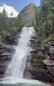
Bridal Veil Creek (Lower)
| Rating: | |||||||||||||||||||||||||||||||
|---|---|---|---|---|---|---|---|---|---|---|---|---|---|---|---|---|---|---|---|---|---|---|---|---|---|---|---|---|---|---|---|
| | Raps:3, max ↨165ft
Red Tape:No permit required Shuttle:Optional 5min Vehicle:Passenger Rock type:Cutler Sandstone, Conglomerate | ||||||||||||||||||||||||||||||
| Start: | |||||||||||||||||||||||||||||||
| Parking: | |||||||||||||||||||||||||||||||
| Condition Reports: | 7 Jul 2021
"R3 seemed doable due to broad watercourse but it spooked my partner so we skipped it. Returned to vehicle via the established hiking trail north of th |
||||||||||||||||||||||||||||||
| Best season: | June-July, BEST Aug-Oct
|
||||||||||||||||||||||||||||||
| Regions: | |||||||||||||||||||||||||||||||
Introduction[edit]
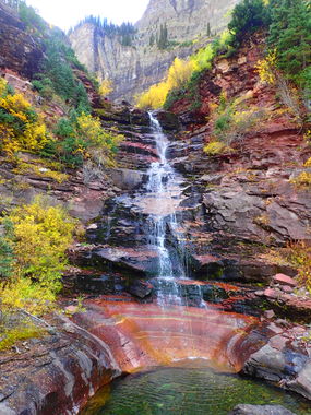
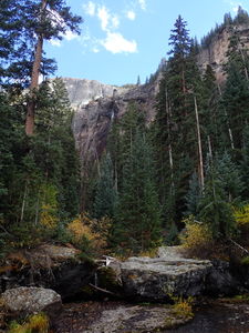
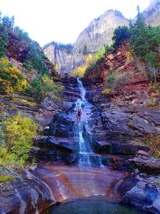
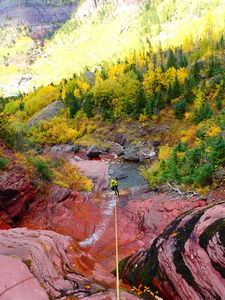
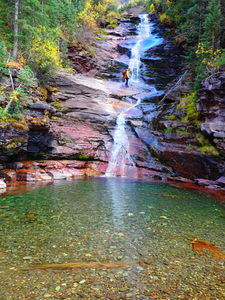
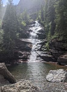
Three gorgeous rappels in the Telluride basin below Bridal Veil Falls opposite the Via Ferrata. Short approach, nice descent, trail access.
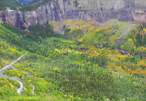
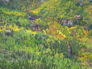
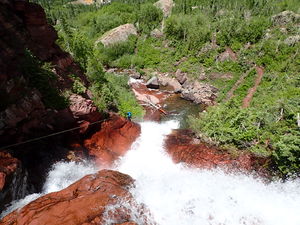
As all snowmelt-charged drainages, this canyon has two personalities depending on water flow. Lower Bridal Veil can be seen from the road driving to the trailhead and from the approach trail if starting from the bottom. If the water level is too big, be patient for another day.
Low Flow: August-September easy, beginner friendly. In low to moderate flow during later summer, R2 and R3 are easy lower angle rappels for beginners. R1 is better accomplished for beginners (or high flow) with an anchor from a tree on Canyon Right.
High Flow: June-July more likely requiring a rappelling path to avoid the flow.
Approach[edit]
From Telluride, drive east out of town toward Black Bear Pass.
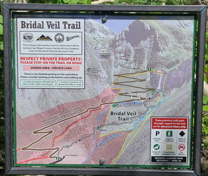
Option 1 (2WD) Preferred: Park at the bottom of the Bridal Veil Trail, which starts at 9000' elevation before the 4WD HC set of switchbacks. Hike 0.8 miles +654' elevation most of the way up the Bridal Veil Trail. Monitor a gps to find a subtle, unmarked trail intersection with a 250 foot path to enter the creek above R1. Hiking up from the bottom, while longer allows for the steep uphill hike with lighter, dry ropes and wetsuits.
Option 2 (4WD HC): Drive and up several switchbacks toward the base of Bridal Veil Falls and Black Bear Pass. Park at a switchback ending in a large boulder and a set of old iron steps. This is a full switchback below the base of Bridal Veil Falls. There is only room for two moderately-sized vehicles at most. Tuck vehicles in as much as possible to give space for others to drive the switchback. Find a trail to the right of the large boulder at the switchback. Follow this 250ft to the intersection with the Bridal Veil Trail. Continue beyond the trail on a subtle, faint trail to enter Lower Bridal Veil Creek in another 250ft. This trail continues beyond the creek, but the canyon descent begins here.
Descent[edit]
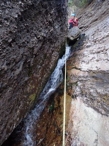
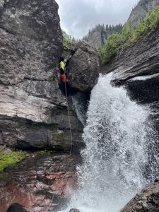
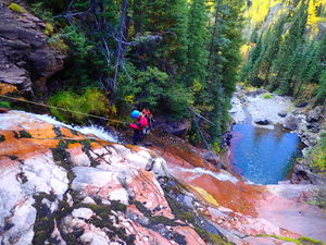
R1: 50ft Low water: from a rock pinch by a conglomerate boulder on Canyon Left. This rappel is a bit tricky in that it will want to pull toward a left pendulum.
R1: 65ft High water: from a tree on Canyon Right, outside the watercourse skirting the power of the falls.
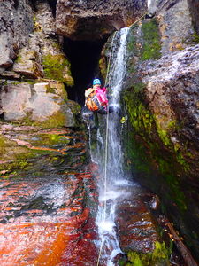
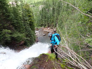
R2: 120ft Low flow: slinging a large boulder in canyon center, puts the rappel line directly in the flow.
R2: 120ft High flow: a large willow is slung at the base higher on a rock more on Canyon Left. This allows for a rappel on Rappeller's Right that can accomplished mostly out of the flow all the way down with a bit of tension to avoid a pendulum into the flow.
Exit: The Bridal Veil Trail has a spur connecting to the bottom of R2. Depart the stream course if necessary.
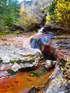
Low flow: Just before R3, set a hand line or carefully downclimb LDC. Try the 2 meter toboggan.
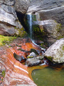
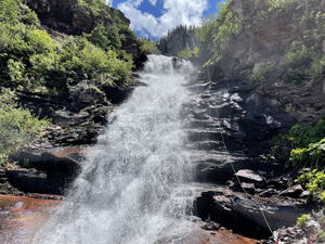
R3: 165ft Low water: from a larger pine tree on Canyon Left
R3: 165ft High water: skirt the "toboggan" entirely (in high flow, this is hardly recognizable) and climb through the forest upstream above a giant boulder on Canyon Right to get closer to the edge of the falls. Rappel from a large tree on Canyon Right to stay on Rappeller's Left of the flow all the way down.
Exit[edit]
After R3, exit Canyon Right immediately. A large flat dirt viewing platform at the bottom of the falls indicates a short spur trail from the Bridal Veil Trail. Hike up or down the Bridal Veil Trail depending on the parking location.
Down stream of the exit, the creek disappears below the ground level. All that remains down stream are more down climbs and private land owned by Idarado, the mining company. While Bridal Veil Falls is ice climbed in winter, no anchor is possible to rappel Bridal Veil Falls in summer months due to the private property owned at the power house above.
Red tape[edit]
There is a lot of private land in this area of the Telluride box canyon. The US Forest Service and San Miguel County own the land encompassing these three rappels. Using the Bridal Veil Trail makes it easy to stay on public land. In fact, the local mining company, Idarado, helped construct this trail.
Beta sites[edit]
- Mountain Project regarding ice climbing Bridal Veil Falls: https://www.mountainproject.com/route/105917751/bridalveil-falls
Trip reports and media[edit]
Sept 2018: first known descent, no other anchors found. Lisa Purdy and Ira Lewis.
