Brown Gulch
| Rating: | |||||||||||||||||||||||||||||||
|---|---|---|---|---|---|---|---|---|---|---|---|---|---|---|---|---|---|---|---|---|---|---|---|---|---|---|---|---|---|---|---|
| | Raps:2, max ↨100ft
Red Tape:No permit required Shuttle:None Vehicle:Passenger | ||||||||||||||||||||||||||||||
| Start: | |||||||||||||||||||||||||||||||
| Parking: | |||||||||||||||||||||||||||||||
| Condition Reports: | 22 Aug 2025
"For all the times Ive driven I-70 and looked up at Silver Plume Falls (R2) in Brown Gulch, Im glad to have finally hiked up and rappelled these two |
||||||||||||||||||||||||||||||
| Best season: | June-August
|
||||||||||||||||||||||||||||||
| Regions: | |||||||||||||||||||||||||||||||
Introduction[edit]
Brown Gulch is a short canyon located in Silver Plume, a small former silver mining town along Clear Creek in the Front Range of the Rocky Mountains.
This canyon runs over dozens of old mining claims which the City of Silver Plume purchased on January 31, 2023 and now owns. At the time of this writing, a commission is being formed to determine the future use of the area, preemptively being called “Silver Plume Mountain Park”. Access to this canyon may change as future land use continues to develop. More information may be available at www.silverplumetown.com
The Griffin monument sits atop the large cliff face seen on the approach to the canyon. The monument is the gravesite Clifford Griffin, a heartbroken miner who lost his fiancée to an untimely death, known for playing the violin for the townspeople below from his cabin above.
Approach[edit]
Driving: From Denver, drive west along I-70. Continue till you reach Exit 226 for Silver Plume. At the highway exit stop sign, Continue straight on Water St. for about ¾ mile. Prior to the road going under the highway, A large abandoned mine and large pull off will appear on the north shoulder. Park here.
Hiking:
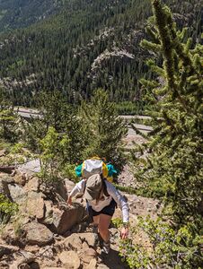
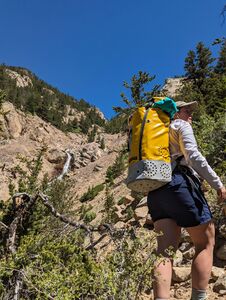
Once parked, follow the old road around the old mine. Take caution and avoid trespassing on the property. A faint mining road appears to the north. Take this road up until it begins to form game trails. Continue working your way up loose scree and mining tailing. Eventually these trails bring you to the large Dunderberg Mine. Avoid the mine as best as possible. Old mining structures and tunnels create a unique hazard. They are unstable, and can give way at any time.
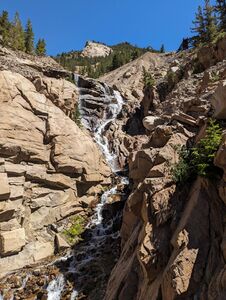
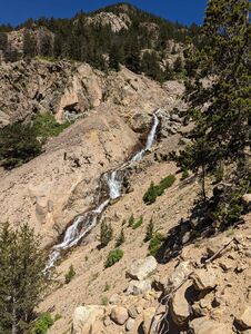
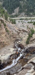
By this point, you can see the whole technical portion of the canyon and assess the flow. The goal is to gain elevation to above the upper waterfall, and contour around to access the top. Take caution as contouring around to the top of the falls crosses over steep, loose scree fields. Once across, work your way down to the top of the first falls.
Descent[edit]
R1: 65' from bolts DCR out the flow or 75' from bolts DCL slightly higher upstream to rappel in the flow.
DC: Immediately below R1, a few short but steep drops block passage down canyon, but are easily bypassed DCL. Constructing a natural anchor would create another short rappel in the flow.
Continue down canyon, bypassing smaller obstacles until R2 is reached.
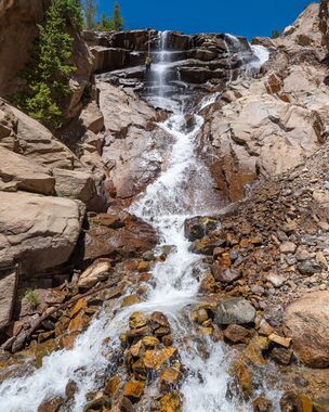
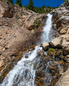
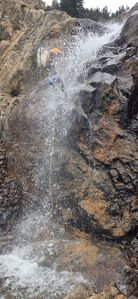
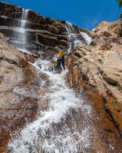
R2: 100' from the furthest of two sets of bolts DCR to rappel out of the main flow down the steeper cliff face or 95' in the slanted chute in the flow from bolts DCL.
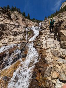
2 sets of ice-climbing bolts exist at the top. The bolts furthest DCR puts you in some light flow of the furthest right fall. R2 drops into a wide, steep amphitheater, where the water splits into 3 separate waterfalls, eventually merging back together on a ledge near the bottom.
Exit[edit]
After the second rappel, the technical portion of the canyon is over. The stream can be followed back to the dirt road and eventually the car. Alternatively, the canyon wall lowers briefly, allowing exit and access to the approach trail, avoiding much of the slippery downclimbs of continuing through the watercourse.
Red tape[edit]
Beta sites[edit]
Mountain Project: Silver Plume Falls (Ice Climb)
Trip reports and media[edit]
- July 16 2023: First known aquatic descent by Andrew Tanasescu, Kati Wright.
- mid-August 2025: photos added for alternate bolt stations. Ira Lewis, Kyle Preiss
- Drone footage showing Medium-High flows on June, 12 2022
