Buckwater Draw
| Rating: | |||||||||||||||||||||||||||||||
|---|---|---|---|---|---|---|---|---|---|---|---|---|---|---|---|---|---|---|---|---|---|---|---|---|---|---|---|---|---|---|---|
| | Difficulty:3A III (v3a1 III) Raps:3-7, max ↨55ft
Red Tape:No permit required Shuttle:Optional 5min Vehicle:Passenger Rock type:Sandstone | ||||||||||||||||||||||||||||||
| Start: | |||||||||||||||||||||||||||||||
| Parking: | |||||||||||||||||||||||||||||||
| Shuttle: | |||||||||||||||||||||||||||||||
| Condition Reports: | 9 Dec 2017
"See the full condition report at Candition.com. Submitted by [http://www.candition.com/profile/stud |
||||||||||||||||||||||||||||||
| Best season: | May, Sep-Oct
|
||||||||||||||||||||||||||||||
| Regions: | |||||||||||||||||||||||||||||||
Introduction[edit]
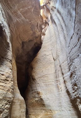
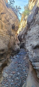
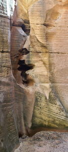
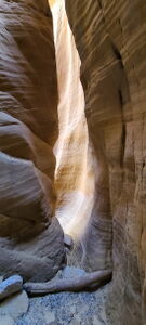
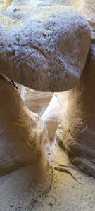
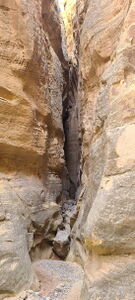
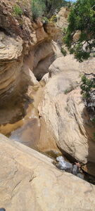
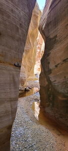
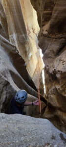
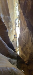
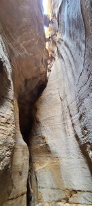
While short, The Buckwater Draw Forks provide good downclimbs and several good rappels resembling popular Utah sandstone slot canyons. Looking at the rating, the canyons are probably better and the score is likely reduced for the effort to get there and back.
South Fork Buckwater Draw (a.k.a. Cliff Creek, Lower Buckwater Draw) is the better fork with more downclimbs and a longer slot section.
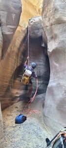
Main Fork Buckwater Draw provides a rappel through the Magic Chamber at the confluence of the forks.
USGS maps call this Buckwater Draw.
June starts to get rather warm. No swims, but feet might get wet.
This describes the Grand Tour as written up in the SummitPost beta, which does not require a car shuttle.
- Note: The metrics for this adventure are also based on the Grand Tour: Parking -> South Fork -> Main Fork -> Parking, where the approach is a sum of all the approaches and the descent metrics are added together.
Approach[edit]
Buckwater Grand Tour:
DRIVE: Just east of Dinosaur, Colorado turn north on Harper's Corner Road for 4.3 miles and park at the Plug Hat Butte Parking area.
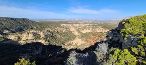
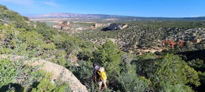
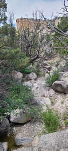
APPROACH SOUTH FORK BUCKWATER FROM PLUG HAT BUTTE: Walk north on the Bull Canyon Rim Trail for 1.0 mile, noting a junction fork in the trail to the right. Depart the trail down a steep vegetation-filled gully and access South Fork Buckwater Draw at the drop-in point. SummitPost beta indicates features are not worthwhile upstream.
DESCEND SOUTH FORK BUCKWATER (see below)
Descent[edit]
DESCEND SOUTH FORK BUCKWATER:
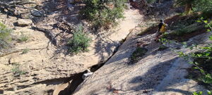
DC: 25' reasonable downclimb
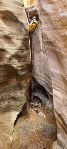
R1: 20' from a deadman anchor
DC: (3) downclimbs (optional rappel)
DC: under the large final Large Chockstone (optional rappel)
Arrive at the confluence. The Magic Chamber is just upstream in the North Fork.
Final Downstream Slot Section:
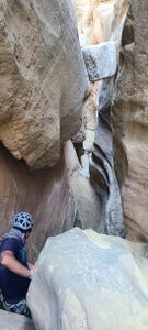
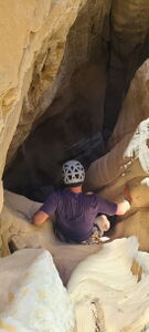
DC: Two Wide Chockstones - the walls are just wide and tricky enough. Use a rope and partner assist as required.
APPROACH MAIN FORK BUCKWATER FROM BOTTOM OF SOUTH FORK BUCKWATER (see below)
*Note the Main Fork could also be accessed from the alternate parking along Harper's Corner Road
DESCEND MAIN FORK BUCKWATER:
DC: 25' (optional rappel off rock jumble)
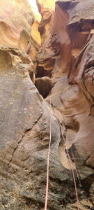
R1: 30' from a chockstone pinch
DC into small pool and slot opens
The Magic Chamber rappel down to the confluence can be broken up into two separate drops to improve rope pull.
DC: 35' into Magic Chamber (optional rappel)
R2: 55' rappel from the bottom of downclimb rigged off a large chockstone
Arrive at the confluence. The final Large Chockstone drop is just upstream in the South Fork.
Final Downstream Slot Section:
DC: Two Wide Chockstones - the walls are just wide and tricky enough. Use a rope and partner assist as required.
Exit[edit]
APPROACH MAIN FORK BUCKWATER FROM BOTTOM OF SOUTH FORK BUCKWATER:
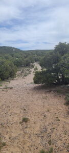
After the confluence and Two Wide Chockstone obstacle, hike Buckwater Draw (a.k.a. Cliff Creek) downstream 1.1 miles, eventually veering right to intersect the Old Jeep Trail, which runs north of Cliff Creek / Buckwater Draws.
Hike the Old Jeep Trail 1.4 miles uphill and drop into the Main Fork for another 0.25 miles down a more vegitated boulder downclimb than the South Fork.
RETURN TO PLUG HAT BUTTE:
Following SummitPost beta, we found an exit that 'goes,' but it was a sandy, loose rock uphill scramble south out of the drainage to the rim of the mesa ridge. The path to gain the rim in the gps track on this page is OK, but not recommended highly, and doesn't sound like it followed the same exact path of the SummitPost write up. From the rim, head east and uphill to the rim of Bull Canyon above, then follow the trail back to the parking lot.
An easier, but longer exit would be to hike downstream to the Old Jeep Road again, which is 5.25 miles to a car shuttle along Harper's Corner Road.
Red tape[edit]
Beta sites[edit]
 Super Amazing Map : Buckwater Draw
 AmericanSouthwest.net : Buckwater Draw; Colorado
 SummitPost.org : Buckwater Draw-South Fork
 SummitPost.org : Buckwater Draw
Trip reports and media[edit]
- http://www.13ergirl.com/buckwater/buckwater.html
 Candition.com : Buckwater Draw
p26 Kelsey's 2nd Edition Technical Slot Canyon Guide to the Colorado Plateau
