Bull Draw (Dinosaur)
| Rating: | |||||||||||||||||||||||||||||||
|---|---|---|---|---|---|---|---|---|---|---|---|---|---|---|---|---|---|---|---|---|---|---|---|---|---|---|---|---|---|---|---|
| | Difficulty:3A III (v3a1 IV) Raps:1-2, max ↨95ft
Red Tape:No permit required Shuttle:Optional 25min Vehicle:High Clearance Rock type:Sandstone | ||||||||||||||||||||||||||||||
| Start: | |||||||||||||||||||||||||||||||
| Parking: | |||||||||||||||||||||||||||||||
| Shuttle: | |||||||||||||||||||||||||||||||
| Condition Reports: | |||||||||||||||||||||||||||||||
| Best season: | May-Jun, Sep-Oct
|
||||||||||||||||||||||||||||||
| Regions: | |||||||||||||||||||||||||||||||
Introduction[edit]
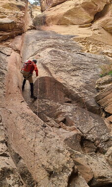
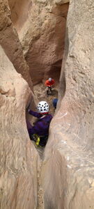
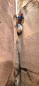
Bull Draw is the drainage west of Bearwater, Kingsnake, and Snake Drop. It contains one really great downclimb and rappel combo, but that's the highlight. While pretty, the pay-to-play ratio is high.
The exit of Bull Draw is the only drainage in this area that crosses Colorado State Trust Land managed by the BLM. A Hunting or Fishing license is required to hike in Colorado State Trust Land (details in the Red Tape section).
Approach[edit]
Set an optional shuttle vehicle along Highway 40 avoiding the private land.
Drive north on Harper's Corner Rd for 5.9 miles, just beyond Plug Hat Mesa. Turn right off pavement down Echo Park Rd into BLM land and a bumpy dirt two-track heading East. Reconsider this dirt road in rainy conditions or after recent precipitation. Park in an open field by a cattle pond.
Hike southwest on cattle trails on top of the mesa, avoiding private land and aiming for the start of the target drainage with GPS.
Descent[edit]
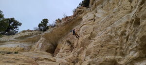
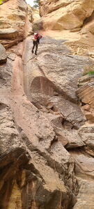
R1: 95' from a tree. (40.29324, -108.89793) The first rappel can be bypassed on Canyon Right. Another entrance option exists with a taller headwall just to the west. (40.29318, -108.89888)
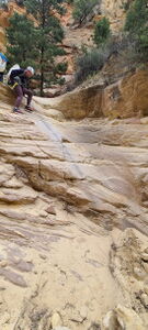
Three downclimbs 10' or less
25' DC in a nice chute followed immediately by
R2: 65' from a deadman anchor
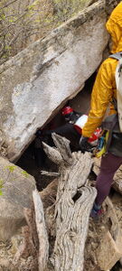
A rabbit hole downclimb in a large boulder field concludes the canyon maneuvers.
Exit[edit]
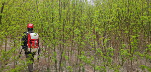
Continue in the canyon bottom battling some vegetation, avoiding minimal poison ivy and early season ticks. The landscape opens to easier terrain.
Avoid private property noted on the attached kml map to return to a shuttle vehicle parked on Hwy 40. An upclimb to the start vehicle has not been verified.
Red tape[edit]
Bull Draw below R2 crosses Colorado State Trust Land actively managed by the Bureau of Land Management (BLM). 2.8 million acres of trust land in Colorado earns revenue for public schools and is leased for agriculture and recreation through the Colorado Parks and Wildlife (CPW) Hunting and Fishing Access Program (HFAP). Colorado State Trust Land receives funding from active Hunting or Fishing licenses.
Activity on the Colorado State Trust Land should be done with an active Hunting or Fishing License to be compliant.
References:
- https://cpw.state.co.us/placestogo/Pages/StateTrustLands.aspx
- https://slb.colorado.gov/public-access
Purchase a Hunting or Fishing License (even if not hunting or fishing) online at: CPWShop https://www.cpwshop.com/purchaseprivilege.page or by phone (1-800-244-5613).
- Colorado Resident 1 day hunting or fishing licenses are $15.55 (2023 price)
- "State Wilderness Area (SWA) passes may not be used to access State Trust Lands (STLs) leased by the Division, due to current leasing agreements between CPW and the State Land Board."(https://cpw.state.co.us/Documents/LandWater/SWA/License-Requirements-SWA-STL-Access-FAQ.pdf)
Beta sites[edit]
Trip reports and media[edit]
3May2024: explored by Ira Lewis, Wayne Herrick, Cassie Taylor, Sean Yarborough, Rob Demis, Mark Grammer, Tim Heaton
