Butte Creek
| Rating: | |||||||||||||||||||||||||||||||
|---|---|---|---|---|---|---|---|---|---|---|---|---|---|---|---|---|---|---|---|---|---|---|---|---|---|---|---|---|---|---|---|
| | Raps:3, max ↨120ft
Red Tape:No permit required Shuttle:None Vehicle:Passenger | ||||||||||||||||||||||||||||||
| Start: | |||||||||||||||||||||||||||||||
| Parking: | |||||||||||||||||||||||||||||||
| Condition Reports: | 15 Sep 2025
"Super fun day. Zero people. Nice to have great trails for approach and exit, with zero bushwhacking. R1 was easy, fun to check out the cave behind the |
||||||||||||||||||||||||||||||
| Best season: | June-Sept
|
||||||||||||||||||||||||||||||
| Regions: | |||||||||||||||||||||||||||||||
Introduction[edit]
Butte Creek is a short and scenic canyon in Santiam State Forest. Although it can be easily run in an hour, the ease and fun of repeating obstacles will make you want to stay longer. Be aware: Butte Creek sees a large number of non-canyoning visitors during the summer months (often lounging and swimming in the pools below the falls), so use caution when deploying ropes. Please avoid using fixed anchors in areas accessible by the general public. Ghosting may be appropriate, or simply hike back to the top of the falls afterwards and remove your anchors.
- Use care when visiting as the canyon is extremely slippery.
- Butte Creek might be combined with nearby Shotgun Creek for a longer day of canyoning. It's about 40min away.
Approach[edit]
Driving[edit]
The Butte Creek Trailhead was formerly accessed via Crooked Finger Road (near Abiqua Falls), but as of July 2018 Weyerhaeuser closed the road to all motorized vehicles. (Per a ranger in July 2024, there are no plans to reopen this road in the near future.) The new approach is via Family Camp Road on the east side of Butte Creek above the Molalla River. As of 2024, Google Maps provided the correct directions for reaching the trailhead. There is parking at the trailhead for several vehicles and a restroom.
- You could also park at the campground further upstream and hike to the falls from there.
Hiking In[edit]
From Butte Creek trailhead and follow the maintained trail right ~0.25mi to the bottom of Upper Butte Creek Falls. From here you can gauge the waterflow on the first rappel and/or pool depth. Once assessed, hike back up the trail until you reach the point where you're just a bit upstream of the upper falls. Follow an obvious use-trail down to the top of R1.
Descent[edit]
All jumps should be scouted in advance. Jumping is a leading cause of canyon injuries (i.e. broken legs and ankles).
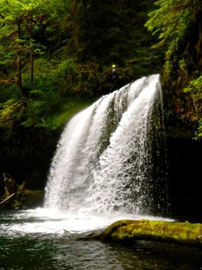
- R1: Upper Butte Falls. 25' + additional rope depending on what anchor you use. A large log DCL may lend itself to ghosting. If conditions are good, this falls can be jumped. There is a cave behind the waterfall you can walk into. Beware hitting anyone in the landing zone when deploying your rope.
- A short walk downstream, the creek funnels into a tight slot-like feature. Options: downclimb (or rappel) into the slot and swim out through the falls, or bypass DCL. Further along the slot it's possible to jump (~8ft) into a pool, but check the depth first. Use caution in high flow, as strong current could sweep you over R2. In lower flow, the slot and pool below is safe to swim in.
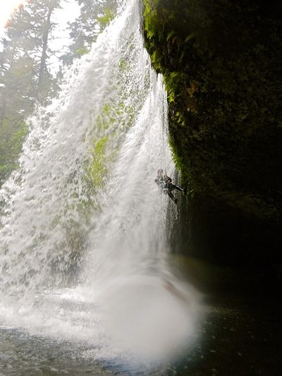
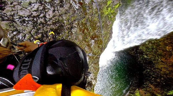
- R2: Middle Butte Falls. 120ft from tree DCL. This puts you right in the flow at the top of the falls which can be pushy even at low volume. It's possible to use a rock knob DCR at the brink as a natural redirect to keep you out of the torrent. Be aware: water at the bottom is shallow! This waterfall is erroneously referred to as Lower Butte Falls on the map. Use caution moving around on slippery rock above the falls; this area has been the site of at least one accident.
- High flow: use a different anchor. An anchor DCR might provide a dry line down the pitch.
- 10ft drop into a pool, easily downclimbed with plenty of holds. Some jump potential here, but beware underwater ledges. R3 is the exit from this pool.
- R3: Lower Butte Falls. 30' down a narrow chute. Rappelling the chute could be dangerous in high flow. Currently, there is no good anchor for this rappel. Here are some options:
- Rappel the chute from a tree high DCL above the aforementioned pool. Requires about 80ft of rope. (A dry line DCL of the watercourse could also be rappelled from the same anchor.)
- Rappel ~30ft from a tree DCR of the chute. Dry rappel that lands immediately adjacent to the boil.
- Rappel ~15 from tree DCR onto spacious ledge then jump ~15 into pool
- Jump ~30 from tree DCR
- Possible 25-30ft technical jump down a dry chute DCL of the tower. Need to get far enough out to clear two logs.
- For the daring, possible jump 45ft from the "tower" immediately DCL of the chute.
Exit[edit]
About 70ft downstream of the final pool, locate a faint climber's trail DCL in the vegetation. The trail ascends steeply and cuts back climber's left along the cliff wall to reach the top of R3. There is some slight exposure; not recommended in the wet.
Continue to follow cliff wall to find a well-worn user trail climbing up out of the canyon from the bottom of R2. There's one class 3-4 scramble section with plenty of holds. Once atop the ridge, meet the official maintained trail. Follow the trail back upstream, bearing right at the first junction and continue until you're back at the parking lot (~5-10min).
Red tape[edit]
Be aware: unlike other parts of the country, canyoning is not widely known or recognized in the Pacific NW. Individuals climbing, rappelling, or slack-lining around such "show waterfalls" are far more likely to garner negative reactions from the general public at large. Negative reactions can lead to complaints and more rules by the local authorities. Locals suggest descending Butte Creek when the number of hikers will be low - e.g. early in the morning or on weekdays. Please be scrupulous about following a Leave-No-Trace ethic. Leaving brightly colored anchors can annoy waterfall photographers, irk land managers, and may encourage the inexperienced / unprepared to attempt to follow you. An easy option at Butte Creek is to hike back up to the top of the falls at the end of the day and remove your anchors.
Beta sites[edit]
 CanyoneeringNorthwest.com (archive.org) : Butte Creek
 Link to USGS gauge for Butte Creek at Monitor - this gauge may be decommissioned after Oct 2024 per lack of funding.
- Recreation Report: Santiam State Forest
Trip reports and media[edit]
Background[edit]
A cave (a tree mold made from balsatic lava flow) is nearby the middle falls (44°55'39.21", -122°30'57.02")


