Cañon del Infiernillo
| Rating: | |||||||||||||||||||||||||||||||
|---|---|---|---|---|---|---|---|---|---|---|---|---|---|---|---|---|---|---|---|---|---|---|---|---|---|---|---|---|---|---|---|
| | Raps:13, max ↨89ft
Red Tape:No permit required Shuttle:Required 12mi Vehicle:High Clearance | ||||||||||||||||||||||||||||||
| Start: | |||||||||||||||||||||||||||||||
| Parking: | |||||||||||||||||||||||||||||||
| Shuttle: | |||||||||||||||||||||||||||||||
| Condition Reports: | |||||||||||||||||||||||||||||||
| Best season: | Nov-Jun, COLD Jan-Feb
|
||||||||||||||||||||||||||||||
| Regions: | |||||||||||||||||||||||||||||||
Introduction[edit]
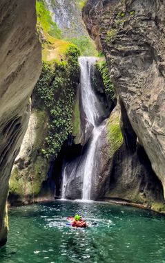
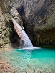
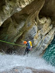
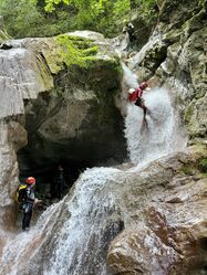
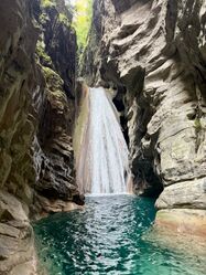
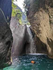
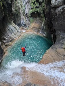
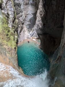
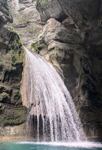
A spectacular limestone canyon in a beautiful highland area. This canyon is deep, often dark, with long sculpted travertine passages filled with emerald to aquamarine water and lots of swimming. You will rappel down steep conic travertine accretions covered with moss into grand cathedral-like grottos. Slides that shoot you out into open space 12 feet above the water. You'll want to do this canyon more than once.
This is a popular a canyon with local canyoneers, and commercially guided from the midpoint down.
Be sure to read the Queretaro region notes for more information on the area.
Logistics[edit]
Setting up the shuttle can be a little complex and time consuming. The campground at the midpoint (Cañon EL INFIERNILLO-Pinal de Amoles on Google Maps) can help with logistics. They also have meals, wifi, snacks, beer, basic cabins, bathrooms, etc - all around very helpful, albeit they charge a dubious "entry fee" for the canyon (80MX per person).
People have also stayed at rooms below one of the roadside shops near the end of the canyon. Contact Ruben Espinoza Olvera on 4411051540
Approach[edit]
The KML map is accurate as on Nov 2024.
Upper Section[edit]
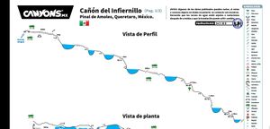
The upper section is approached via a down-hill trail starting at the end of the road. Once you reach the river bed and large bridge, follow the river downstream. There's a short section of down-climbing through a boulder field. Depending on water levels you may or may not encounter water until R1 (where the canyons slots up).
Lower Section[edit]
The midpoint is approached from a trail starting at the campground. It's short enough to justify hiking down in bottom-half wet suits.
Descent[edit]
The exact nature of your descent will depend on water levels. It's important to depth-check, communicate hazards, and know how to correctly shallow-jump.
Upper Section[edit]
After the open-air approach, R1 (which can be done as a short-roped toboggan) marks the start of a series of beautiful caverns.
Quick-fire features take you downstream until the canyon opens up again and you regain the sun.
Lower Section[edit]
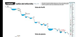
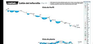
After the midpoint trail joins DCR, the lower section starts with a series of features in quick succession, dropping you back into deep caverns.
- R1 (immediately after the midpoint trail) can be jumped once depth checked.
- R2 can also be jumped (or rappelled DCL to a shorter jump).
- Around the corner is a ramp which should be tackled carefully as mis-jumping here has broken at least one leg.
- R3 is a very large ramp into a cavern which can be short-roped as a toboggan into a spectacular cathedral-like grotto.
- R4 is a short DCR to bypass a sketchy slide.
- Leading you to an large toboggan (or DCL jump/rap).
... keep going downstream depth-checking jumps along the way.
Exit[edit]
The only practical exits along the canyon are the midpoint and final exit.
Exiting at the midpoint requires a 40 minute hike up to the campground. Exiting at the end requires a 1 minute hike up to the road.
Red tape[edit]
Beta sites[edit]
 Wikiloc.com : Barranco El Infiernillo
 Cañonismo.com : El Infiernillo
