Capulla
| Rating: | ||||||||||||||||
|---|---|---|---|---|---|---|---|---|---|---|---|---|---|---|---|---|
| | Raps:13, max ↨364ft
Red Tape:No permit required Shuttle:Optional 4.0km Vehicle:Passenger | |||||||||||||||
| Location: | ||||||||||||||||
| Condition Reports: | ||||||||||||||||
| Best season: | ||||||||||||||||
| Regions: | ||||||||||||||||
Introduction[edit]
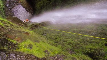
A great canyon that deserves more travel. It’s character is very different from others in Madeira - in a coastal hardwood forest. Despite the good amount of creek walking, the rappels are very pretty. You feel like you’re in a magical fairy waterfall land. The 110m rappel is delightfully straight forward, though a legitimately technical multi-pitch.
Approach[edit]
A 4WD high clearance is definitely needed for the switchback road. However, a regular street car can park at the base of the 4x4 road, and the hike up the road isn’t so bad. It adds about an hour to the approach to hike the road. (Thus the approach time is 45m with a 4WD shuttle, or 1h45m without the shuttle)
The approach involves multiple foot tunnels following the levada - some of which are 1/4-1/2 mile long. Bring headlamps!
Descent[edit]
The precise top of the canyon is a fairly unpleasant place to suit up - in the direct spray from the falls above. It’s recommended to continue another 50m or so on the trail for a drier suit-up experience.
Go to the camadeira link below for a quality canyon topo. This has all of the information you need. The anchors in this canyon can be a bit tricky to spot, but as of 2022, the beta in the canyon topo is accurate. This canyon is best done with a party of competent riggers. There are several hanging belays accessed from an access rappel/traverse line (marked “MC” on the topo) that are easy to find but involve a spicy move or two to reach.
Exit[edit]
The exit is at the levada. Prepare yourself for more tunnel walking. Although the exit is unpleasantly long, it’s mercifully flat along the levada, and towards the end there are lovely views down towards São Vicente. At the end of the levada, you’ll have another 1/2 kilometer or so to walk down the dirt road, back to your car.
Red tape[edit]
Beta sites[edit]
 CaMadeira.com : Canyon Capulla
 Descente-Canyon.com : Capulla
Trip reports and media[edit]
 Wikiloc.com : Barranco Capulla - Madeira
 Wikiloc.com : Barranco capullla Madeira
