Cascade Creek (Indian Peaks)
| Rating: | |||||||||||||||||||||||||||||||
|---|---|---|---|---|---|---|---|---|---|---|---|---|---|---|---|---|---|---|---|---|---|---|---|---|---|---|---|---|---|---|---|
| | Raps:0-8, max ↨75ft
Red Tape:No permit required Shuttle:None Vehicle:Passenger Rock type:Granite | ||||||||||||||||||||||||||||||
| Start: | |||||||||||||||||||||||||||||||
| Parking: | |||||||||||||||||||||||||||||||
| Condition Reports: | |||||||||||||||||||||||||||||||
| Best season: | Aug-Sept
|
||||||||||||||||||||||||||||||
| Regions: | |||||||||||||||||||||||||||||||
Introduction[edit]
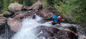
Experienced canyoners will want to skip this canyon. While Cascade Creek, which flows into Lake Granby on the West side of the continental divide, looked like it might mirror https://ropewiki.com/East_Inlet_Narrows_(RMNP) cutting through several granite rock bands, it never forms substantial narrow committing gorges or many vertical rappels. Every rappel can be bypassed. The higher volume water levels funneled in the few narrow chutes don't match well with the slippery conditions and the feeling that the rappels are more contrived. Throw in a poor pay-to-play with the long hike and this didn't come together for a recommendable descent.
However, this is a great trail. Enjoy hiking the Cascade Creek Trail with less weight in the pack and seeing the majority of the waterfalls from the trail or with a few short diversions on social trails.
Approach[edit]
Drive West on Monarch Lake Road / CR 6 off of Highway 34 on the Southwest corner of Lake Granby. After 9.6 miles, Park at the Monarch Lake Trailhead.
All visitors to the Arapaho National Recreation Area are required to pay a recreation fee. Pay online at https:/www.recreation.gov/activitypass/anra
Hike the Cascade Creek Trail 5.23 miles following signs to Crater Lake, which sits at the bottom of Lone Eagle Peak. Depart the trail when it levels out above R1, which can be seen from the trail.
Descent[edit]
Cascade Creek is mostly an open creek, separated here by the 4 sections where Cascade Creek cuts through glacier-carved granite bands.
1st Descent Section
A short narrows ends in a 12' bypassable falls just before R1.
R1: 45' from a tree DCR or other natural anchors
After a few downclimbs and stream walking
R2: 25' from a tree DCL into a small pool under a rock overhang
Bypass a narrow chute on either side
R3: 75' from a tree DCL in line with a chute to a short more vertical falls. Bypass DCR and strike through the meadow back to the trail, log bridge and top of R4.
2nd Descent Section
R4: 35' from trees DCL or DCR. Easily bypassable DCL on old trails. Reenter the creek for R5 or continue the bypass.
R5: 12' from trees DCL or DCR
3rd Descent Section
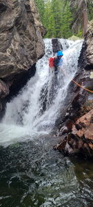
R6: 140'-150' from trees above through a chute and down Cascade Creek Falls
Alternatively,
R6b: 65' from a tree DCR if the water volume in the chute is too high next to the falls into the pool below. Exit at the trail or continue downstream and downclimb the small waterfall below, then regain the trail.
4th Descent Section
R7: ~120' from a tree or boulder down this longer, low angle stepped cascade
R8: 40' at the end of a final narrows for a two stage waterfall
Exit[edit]
Hike 4.65 miles back to the Monarch Lake Trailhead from Cascade Creek Falls or 3.65 miles from the bottom of R8.
Red tape[edit]
Beta sites[edit]
Trip reports and media[edit]
2024-08-25 First known descent. Ira Lewis, Sean Yarborough


