Cataract Creek (Silverton)
| Rating: | |||||||||||||||||||||||||||||||
|---|---|---|---|---|---|---|---|---|---|---|---|---|---|---|---|---|---|---|---|---|---|---|---|---|---|---|---|---|---|---|---|
| | Raps:3-5, max ↨110ft
Red Tape:No permit required Shuttle:Optional 45 min Vehicle:4WD - High Clearance Rock type:Sandstone | ||||||||||||||||||||||||||||||
| Location: | |||||||||||||||||||||||||||||||
| Condition Reports: | |||||||||||||||||||||||||||||||
| Best season: | BEST Jul-Sep
|
||||||||||||||||||||||||||||||
| Regions: | |||||||||||||||||||||||||||||||
Introduction[edit]
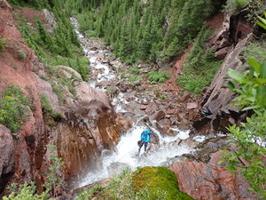
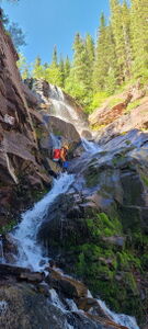
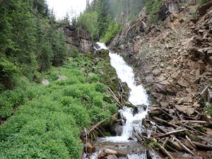
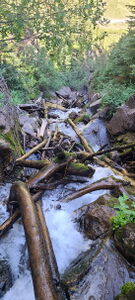
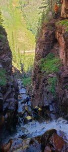
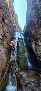
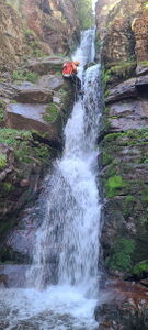
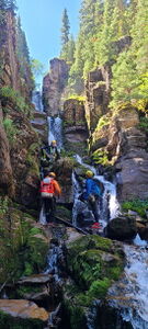
Cataract Creek cuts a deep narrow watercourse close to the road with interesting rappels in a quick sequence. An ice climber trail on the East side of the drainage provides easy access from the bottom. In the canyon, the few downclimbs and obstacle course of rocks and avalanche logs is slippery but manageable between rappels. While 5 rappels are possible, R3-R5 provide the best section.
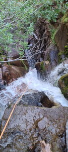
Because Cataract is a narrow slot, enter it when water levels are appropriately low. Cataract's water volume can be viewed roadside from County Road 7 below. Because of possible foot entrapment in a v-slot, this canyon had been given an R risk rating, however in lower flow, this risk is PG.
This waterfall is a confirmed nesting site for the Black Swift, listed as a Species of Special Concern by the U.S. Forest Service and U.S. Fish and Wildlife Service. The swifts migrate from Brazil annually to occupy this site from late May until late September, raising a single chick. The swifts are susceptible to disturbance from human activities near their nests, including noise and movement, direct disturbance or destruction of their nests, and trampling of vegetation. Canyoneering/climbing at this waterfall during the Black Swift nesting season (late May - late September/first frost) is likely to cause direct damage to nests, eggs, and young, and disturb adult swifts enough to cause them to abandon their nest and offspring. Click here for more information on the Black Swift.
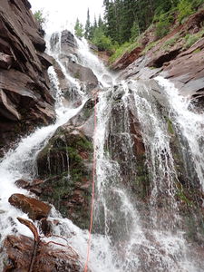
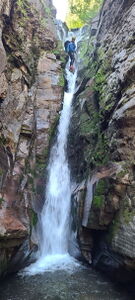
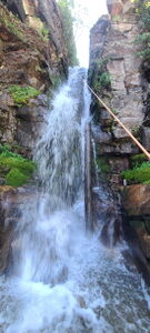
The first descent approached from the top of the catchment, well above the technical section. "For one of the most breathtaking views anywhere, do the long route that takes you up to 12,200 feet in elevation and [drops] in as the headwaters are forming in a massive horseshoe shaped valley reminiscent of the opening scene in Jurassic Park. At this point, when Alden, who had just come back from Hawaii and has done hundreds of canyons in the big western canyoning states, said this may be the most beautiful canyon he's ever seen, it made me realize how spoiled we are in the San Juan Mountains. For having only [a few] rappels it's hard to rate any canyon very high. The 3rd rappel, a narrow slot with the full force of the water pouring on you, I felt was one of the best rappels I have ever done, out of thousands of rappels. The "R" rating is due to the V slot with overhang on the 3rd rappel. Similar to Shaver Cut [in California], it could be potentially fatal if someone were to get a foot caught in the V. There was no way to inspect inside the V as all of the water is flowing down in a powerful flow at this point."
Approach[edit]
Drive: just Northwest of Silverton, head East on County Road 7 for 3.5 miles toward the South Mineral Campground.
Park: at one of a few pullouts, which can be dispersed camping spots.
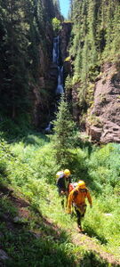
Hike: across South Fork Mineral Creek and toward the base of the canyon. Seek a close view point of the final waterfall and follow a worn network of trails up the slope on rappeller's left of the drainage.
Advised: The best part of the canyon are rappels R3-R5. The approach and descent distance and elevation gain are based on this recommendation.
Optional Shuttle: continue on CR7 past South Fork Mineral Campground for another 2.75 miles. Beyond the campground, high-clearance 4WD is required. Drive an additional 1.9 miles on CR7 and park at a small turn-out with room for one car. Hike: following a faint use-trail heading down to the creek. A muddy trail leading up the other side is the Hardrock 100 Trail, which is barely visible unless you happen to come soon after the race itself. After crossing South Fork rapidly gain elevation for about one mile. Crest the pass between Porcupine Creek Basin and Cataract Creek Basin at 12,282 feet elevation. Continue east on the trail to a gulley heading north, down into the massive valley below. Downclimb to the valley floor going through a boulder strewn hillside. Follow the creek north and across the valley, dropping 1600' to the technical section at the end, closer to the road. The shuttle route will take 7-9 hours. The approach is approximately 4.75 miles +1900' -1820'.
Descent[edit]
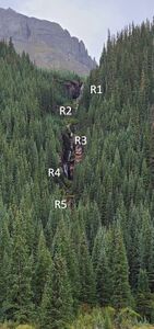
R1: 90' from a tree slightly uphill on Canyon Left
R2: 80' from a tree on Canyon Left, or
R2: 25' skirting the falls on Canyon Right from a tree
In low water this can probably be downclimbed if the rocks aren't slippery.
Downclimb slippery logs and rocks to the top of R3
R3: 80' from a rock or log in the stream course
Beware foot entrapment. Avoid foot placements on rappel in the back of the V slots formed in this canyon to mitigate possible entrapment.
Note: a ledge on Canyon Right after R3 and before R4 could provide an emergency exit
R4: 60' from a rock or log in the stream course for a low angle rappel. The path on Rappeller's Left provides a series of steps for good footing
R5: 110' 2 stage rappel from a tree on Canyon Right or Canyon Left.
The second stage could be rappelled dry on Rappeller's Left.
Downclimb three final short drops to the end of the canyon
Exit[edit]
Hike downstream in Cataract Creek a hundred feet and up a short bank on Canyon Right to regain the trail down to cross South Fork of Mineral Creek to the vehicle.
Red tape[edit]
Beta sites[edit]
Ice Climbing Route: https://www.mountainproject.com/route/106067379/cataract-creek
Trip reports and media[edit]
First canyoneering descent 8/20/2015 Logan DeGrand and Alden Anderson
2022-06-25 Ira Lewis and Ryan Humphries approached from the bottom. Photos and kml added for approach from bottom. R3-R5 skipped for higher water after recent rains.
2024-07-28 beta updated. Ira Lewis, Dan Kinler, Andrew Tanasescu, Ben Smith. Low, post-snowmelt, very manageable water level.

