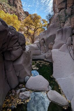
Chalk Creek Canyon
| Rating: | |||||||||||||||||||||||||||||||
|---|---|---|---|---|---|---|---|---|---|---|---|---|---|---|---|---|---|---|---|---|---|---|---|---|---|---|---|---|---|---|---|
| | Difficulty:3B III (v3a2 III) Raps:1, max ↨50ft
Red Tape:No permit required Shuttle:Optional 30min Vehicle:4WD - High Clearance | ||||||||||||||||||||||||||||||
| Start: | |||||||||||||||||||||||||||||||
| Parking: | |||||||||||||||||||||||||||||||
| Condition Reports: | 30 Dec 2023
"Descended Chalk Creek to the river and packrafted about 7.5 miles to the 288 bridge. Enough water for packrafts at 135 CFS and a few sections of mello |
||||||||||||||||||||||||||||||
| Best season: | Spring, Fall
|
||||||||||||||||||||||||||||||
| Regions: | |||||||||||||||||||||||||||||||
Introduction[edit]
A canyon in the Salt River Canyon Wilderness with a short section of narrows and one rappel that takes you to the Upper Salt River.
Most will chose to ascend the one rappel back up to exit through the canyon instead of route-finding and bushwacking the steep slopes surrounding the canyon. However, staging a shuttle vehicle and packrafting to the 288 makes for a much higher value day with some Class II whitewater and excellent scenery.
Approach[edit]
Turn off Cherry Creek Rd to FR 1075 which requires high clearance (and perhaps 4x4 under some conditions).
Descent[edit]
Follow the drainage. Some minor downclimbs and bypasses take you to the one rappel, which may require some anchor creativity. Shortly after the rappel the canyon opens to the Salt River; the easiest way to access the river is to hike through the trees and brush following the canyon slope on canyon right until it opens up, then heading southeast to reach the river.
Exit[edit]
The most enjoyable way to exit the canyon is to packraft several miles along the Salt River to the 288 bridge takeout.
Alternatively, go back the way you came, ascending the one rappel.
Red tape[edit]
Beta sites[edit]
 Super Amazing Map : Chalk Creek Canyon
