Chorreadero
| Rating: | |||||||||||||||||||||||||||||||
|---|---|---|---|---|---|---|---|---|---|---|---|---|---|---|---|---|---|---|---|---|---|---|---|---|---|---|---|---|---|---|---|
| | Raps:8-22, max ↨60ft
Red Tape: Shuttle:Required 20 min Vehicle:Passenger | ||||||||||||||||||||||||||||||
| Location: | |||||||||||||||||||||||||||||||
| Condition Reports: | 17 Dec 2021
"Long route (Full route). Perfect flow. Some small debris inside, but no major blockages. Anchors are good enough, but some rapides are rusted, and a f |
||||||||||||||||||||||||||||||
| Best season: | Nov-May, BEST Dec-Mar
|
||||||||||||||||||||||||||||||
| Regions: | |||||||||||||||||||||||||||||||
Introduction[edit]
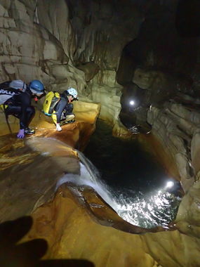
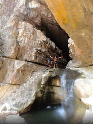
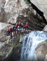
Chorreadero is THE reason for canyoneers to come to Chiapas. It is one of the most fun caves in the world and ranks as one of Mexico's most sporting trips. With about a dozen jumps to 25 feet, more than 20 rappels to 50 feet, and several slides to 15 feet, along with long swims through narrow hallways -- all in a cave -- it is truly a unique outing. The cave ceiling is predominantly 30 to 100 feet high and walls are 10 to 30 feet wide, making it easy to travel through. In addition there are two massive rooms.
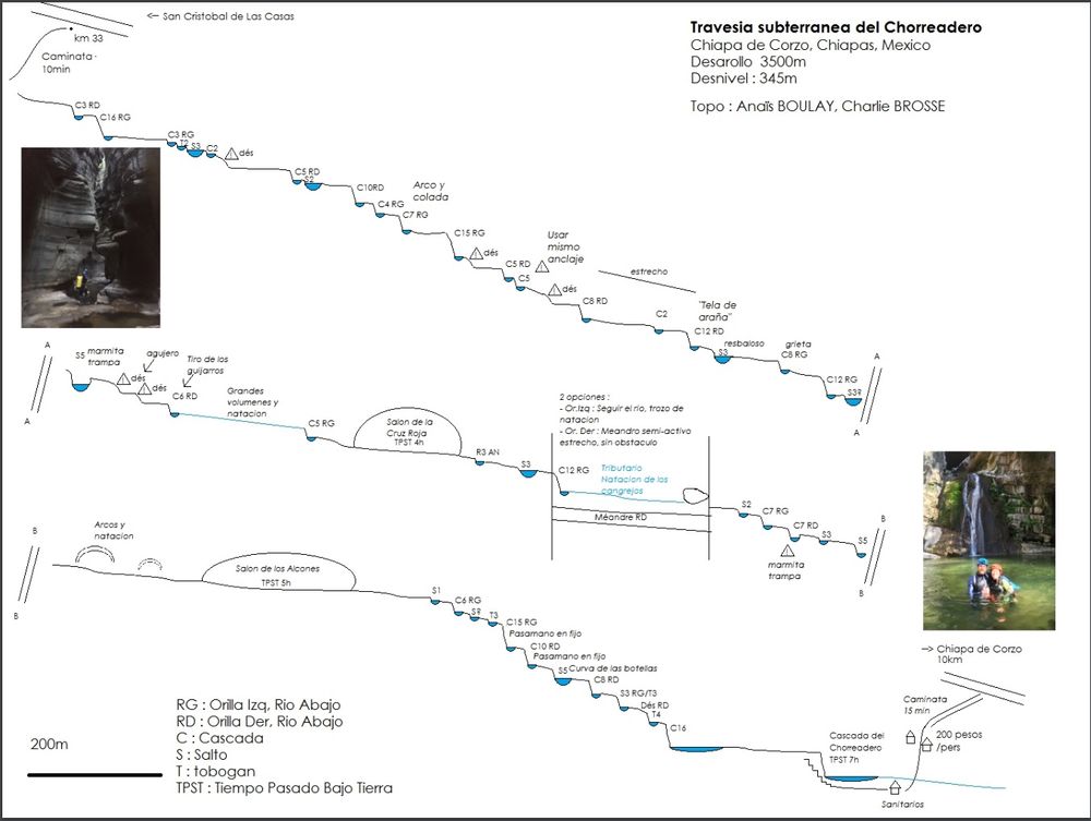
Chorreadero itself is an underground canyon/cave that runs about 3.5km (2 miles) and drops 330 vertical meters (1000ft). Officially there are 26 rappels, 14 jumps, and 3 toboggans. However some people do quite a few more jumps with as few as 6 rappels. There are many stories of broken legs in this cave, so it is best to be cautious and to check out the jumps first by lowering someone. Most jumps are between 10'-15', with the highest about 30'. The cave itself mostly lacks beautiful features like soda straws, bacon rind, stalagmites and stalactites, although there is one exception with a massive ice cream cone formation in the first giant room.
The best time to go is between December and April. The earlier months will be more exciting with the water still flowing, whereas later the stream is quite small and the pools can become stagnant. December levels are usually sporting, but not unreasonably high – even at places where you are directly in the water, it’s not generally forceful enough to be a problem. The checkpoint is at the resurgence, and usually there is a small stream and you can see the steps leading up to the bottom cave entrance. If there's so much water that you cannot see the steps DON'T DO IT. If it rained recently water will be high, but the canyon drains quickly, so you can go back after one or two days and try again. However after the monsoon season starts in June (sometimes in May) the cave is too dangerous to do until the next dry season.
The full descent is done as a through trip with a shuttle. The last quarter of the cave can be done as a loop from the bottom and does not require a shuttle. This section of the cave is run by several commercial companies and it usually has fixed ropes, but don't count on it. Fixed ropes get blown out (or badly damaged) after every flood.
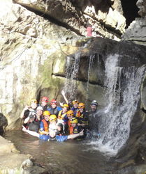
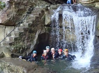
Several commercial companies offer guided trips down the cave. Xaman Expediciones and Petra Vertical have particularly good reviews on TripAdvisor and can provide English speaking guides. You may want to hire them if you want to save time checking each drop for jumping/sliding potential. This could save you 2 to 3 hours. Guides typically go through the cave each November and clean out debris and fix up anchors.
The 'long' route should take an experienced team around seven hours. Carry extra webbing and rapides in case of poor anchors. Always ask the staff at the entrance the current conditions. According to them, only about one group per year does the full route independently, and fewer than half a dozen other guided groups go through.
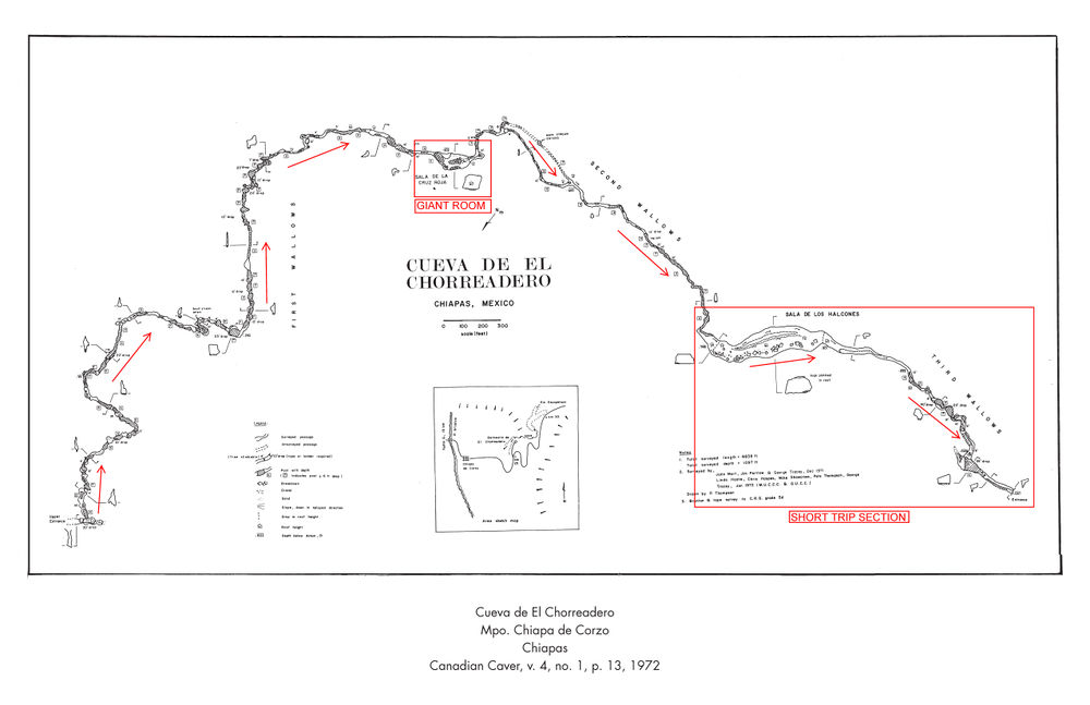
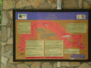
As a second trip in the area, you may consider Jaguar Canyon which is the above-ground canyon that runs from Chorreadero's start to exit, although the two follow very different paths -- the caving route is much longer as it snakes its way under the mountain in a different direction than the canyon above (see the map above for the exact route, which was traced from the cave survey map).
The other reason to come to Chiapas is the Rio La Venta river expedition.
Approach[edit]
If coming from Tuxtla, it is possible to come via a taxi hired on the street in Tuxtla. You should tell them you'd like to go to Chorreadero (taxi drivers will only know about the lower entrance) and negotiate them down to 500 pesos. At the entrance, ask your taxi driver to wait for the whole day, pay the admission fee (200 pesos as of December 2021) and ask the staff current conditions and anchors. If doing the long route, you should be able to convince the taxi driver to drive you up to the top for 200 pesos more.
Exit Parking[edit]
The cave is located half an hour east of Tuxtla Guitterez, the capital of Chiapas. The resurgence is a commercially developed swimming area surrounded by jungle vegetation with a cascade. Take the old hwy 190 from Tuxla to San Cristobal de las Casas, on the way toward San Cristobal there is a sign (Balneario de el Chorreadero). IMPORTANT: Do not take the new autopista between Tuxtla and San Cristobal, the new road does not provide access to Chorreadero.
They open at 8am and close at 6pm. If you are still in the cave at 6pm, they will wait for you, but please start early to avoid this from happening.
Full trip[edit]
The full trip has a 12-minute car shuttle to the top. It is not recommended to leave a car there due to the possibility of break-in, so you can hire someone working at the swimming area to come up with you and drive your car back down. Or if you came by taxi, ask your driver to take you (~200 pesos for the entire car).
The classic start adds about a mile of easy pleasant sandy creek walking, which builds your anticipation before arriving at the cave itself. The drop off spot for this is near a white fence. Note that the landowner there might charge money for accessing his land if he sees you. Pack up quickly, drop into the sandy creek bed, and follow it downstream.
For an alternate approach that is only a 5 min walk to the cave entrance, although it involves climbing through a garbage pile, there is a tiny roadside pullout without any signs and the taxi driver will tell you you are incorrect (just double-check the coordinate). It is just below kilometer marker 33. If you see marker 33, you've passed it. Due to the garbage is called the Trash Wall approach. From this tiny pullover, walk down the road barely 10 meters and you will see a trail steeply descend into the forest and a faint sign telling you not to access Chorreadero here (because you should go back to the white gate and pay the private property owner even though he doesn't own the cave -- scam!). Follow this trail down for barely five minutes, and then you will be at the stream that immediately enters the cave.
Short trip[edit]
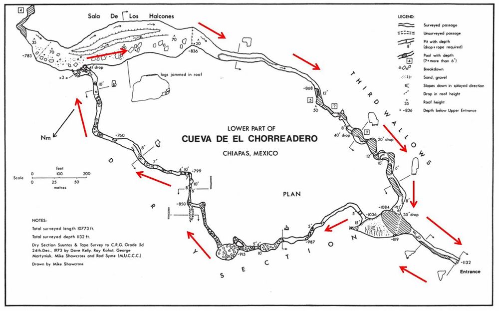
For the short trip, you will enter the cave via the exit, at the swimming area. In the first room where the darkness starts, observe the waterfall inside the cave LDC -- this is the last rappel. Proceed left (RDC) up canyon, crossing the pool and scrambling up scree and muddy formations. At the top of this scramble, there is a hallway. Do not follow this hallway, but instead look up to the right (LDC) before entering the hallway. There should be fixed, knotted handline that may be used to climb up approximately 15'. At the top of this climb, a passage begins that should generally be easy to follow. At a T, go straight -- the right junction reconnects per the map, but this reconnection point was not obvious. In the large room, scramble up the scree and climb out on the right (LDC) side of the room. A good rest spot appears to be at the T with unsurveyed passage on the map. Continue up a number of tricky upclimbs that are made substantially easier by fixed ropes with loops made in just the right places. Eventually arrive at a rappel into the giant room. Look around this area carefully as there should be more than one window to rappel from.
None of this approach contains particularly squeezy portions, so consider your route carefully if you encounter any. The correct route is almost always covered in well-trodden mud, though it can occasionally be tricky to figure out where this is. The upclimbs are especially difficult with muddy shoes (which negates most of the stickiness of the Five Ten soles), but using the fixed ropes in the right way makes them all fairly easy. Passing packs at the climbs is advised.
This approach is approximately 350ft of elevation gain and can be very strenuous without rest breaks. At a nominal pace, expect somewhat over an hour from the cave mouth.
Descent[edit]
Make sure to bring plenty of waterproof light. Cheap headlamps that claim to be waterproof are generally not anything of the sort; your headlamp must be IPX7 or better. The Nitecore HC30 and Zebra Lights have been shown to work well in these conditions. Test your battery life by actually running your headlamp at the intended brightness for the full duration beforehand. Bring twice the battery power you anticipate needing, and at least three separate sources of light per person.
There are single bolt anchors installed at most of the drops. As of January 2018 the anchors were mostly in good shape. Some anchors may be "pin" bolts that require hooks or other special techniques to be used safely. You may encounter drops that do not have bolts -- these places are possible jumps (scout first!), or people set anchors using rock horns, simul-rap, or use bottom anchor techniques. Also, please remember to NEVER blindly trust single bolt anchors, ALWAYS back them up for all but the last person down (usually the lightest).
Full trip from top to bottom (6hr-12hr)[edit]
The longer, more arduous full through trip is only suited for experienced cavers. In order to attempt this trip, your team MUST be prepared to self rescue from deep underground. There is no cave rescue in the area, so if someone gets injured you may need to hold out for days before authorities can send any help. Chorreadero is a very fun cave/canyon, but it also has a long story of broken ribs, broken ankles and broken legs. It is advisable to have a call-out contact, you can use one of the local guide companies.
There are multiple anchors at every drop but some get blown out every season, so a bolt kit is essential unless you have confirmation from a local guide company that the route is good.
Short trip from the bottom up (4h-6h)[edit]
This is the route usually run by commercial companies, and covers the best part of the descent. It involves scrambling up a dry side passage to get back in the river cave (see Approach) and descending it from there with rappels, jumps and slides. The Lower Section features are: 15 foot slide, swim through underwater bridge, 8 foot slide, 40 foot rappel, 30 foot jump, 15 foot jump, downclimb, 8 foot slide, downclimb, 40 foot rappel or 25 foot possible jump.
Exit[edit]
Walk out the steps of the commercial cave entrance and back to your car.
Red tape[edit]
Negotiation is required when running the shorter bottom up trip or full-length trip. As of the end of 2015, entrance fees for both the short or full-length trip ranged from 330-350 pesos per person (~$20 US per person). Initially the locals wanted 3000 pesos per person (~$175 US), and be ready to walk away if they try to rip you off. For the full-length trip, it is possible to pay an additional 100 pesos for one of the locals to drop everyone off at the drop-in point and have the local drive the car pack to the exit. In 2012, the fee was $100 pesos per person for either the short or full-length trip. In 2018 we paid 200 pesos for the full length and we tipped 100 pesos to the driver to bring back at the exit the car.
Beta sites[edit]
- Cave Map of last section (commercial companies route)
- Cave Map for full through trip (hardcore cavers route)
- Trip Advisor
- Turismo Chiapas
Trip reports and media[edit]
Chorreadero descent in March of 2021
Background[edit]
Original information provided by Matt Oliphant, Nancy Pistole, Jef Levin and Xaman Expediciones.
The name Chorreadero in Spanish comes from the verb chorrear, and the suffix -dero which means "something that does". Chorrear has several meanings depending on context, with the most common being to gush, to drip, or to soak. Because the cave has been named for many decades, its name likely means "The Gusher" in reference to the tremendous outflow of water from its mouth during the rainy season.
