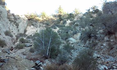
Cloudburst Canyon
| Rating: | |||||||||||||||||||||||||||||||
|---|---|---|---|---|---|---|---|---|---|---|---|---|---|---|---|---|---|---|---|---|---|---|---|---|---|---|---|---|---|---|---|
| | Difficulty:3A II (v3a1 II) Raps:1 - 4, max ↨120ft
Red Tape:No permit required Shuttle:None Vehicle:Passenger | ||||||||||||||||||||||||||||||
| Location: | |||||||||||||||||||||||||||||||
| Condition Reports: | |||||||||||||||||||||||||||||||
| Best season: | Anytime
|
||||||||||||||||||||||||||||||
| Regions: | |||||||||||||||||||||||||||||||
Introduction[edit]
A short can with a single entrance drop of 120 feet, or an alternative entrance series of 4 drops up to 60 ft.
Approach[edit]
Park at the first side road (34.2545, -118.1021) off of Mount Wilson road. Hike up the side road to the canyon entrance (34.2545, -118.1095). For the alternative entrance, continue up the road and take the trail to Supercloud canyon. Enter the obvious drainage at 34.2498, -118.1124.
Descent[edit]
The main route has the single entrance drop of 120 feet. This is followed by a half-mile hike to the bottom of the canyon. The alternative entrance has a series of approximately 4 rappels of up to 60 feet. However, there are several ways you can do this series which may change the actual number of rappels, but shouldn't increase the highest rappel. If doing the normal entrance with a shuttle, the total distance is 1.5 miles, with a loop it becomes 3.2 miles. If doing the alternative entrance with a shuttle, the distance is 2.9 miles, looping back to the start gives a distance of 4.6 miles.
Exit[edit]
If doing a shuttle, you should have parked at 34.2619, -118.1179. To get to the shuttle, continue past the first trail you encounter and turn right on the second trail. When you hit the road, turn left to get to your car. If doing a loop, turn right onto the first trail you encounter and hike back up to Mount Wilson Road and turn right to get back to your car. The hike back to the car adds 2.1 miles and 1 to 1.5 hours.
Red tape[edit]
Beta sites[edit]
 Chris Brennen's Adventure Hikes (St Gabriels) : Cloudburst Canyon
