Colby Canyon
| Rating: | |||||||||||||||||||||||||||||||
|---|---|---|---|---|---|---|---|---|---|---|---|---|---|---|---|---|---|---|---|---|---|---|---|---|---|---|---|---|---|---|---|
| | Difficulty:3A I (v2a1 I) Raps:2-3, max ↨15ft
Red Tape:No permit required Shuttle:None Vehicle:Passenger | ||||||||||||||||||||||||||||||
| Location: | |||||||||||||||||||||||||||||||
| Condition Reports: | 11 Dec 2024
"Spent 3 more hours cutting logs, trimming trees, etc. Getting better, but a LOT more work is needed to open it up properly. To be continued in January |
||||||||||||||||||||||||||||||
| Best season: | Year round. Beware of high water in Winter
|
||||||||||||||||||||||||||||||
| Regions: | |||||||||||||||||||||||||||||||
Introduction[edit]
> Please carry your favorite Gardening tools to every canyon (Folding Saw, Pruners, Loppers, Machete). We all need to help with trail and canyon maintenance on every trip.
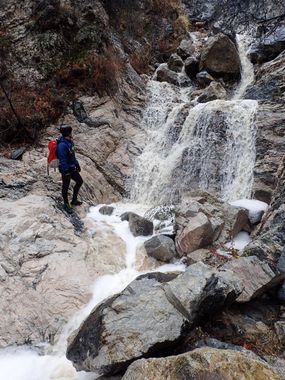
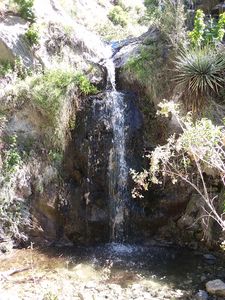
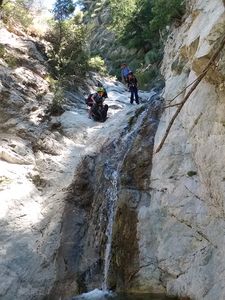
Colby Canyon is very pretty small canyon that seems to have water most of the year. It is a great canyon for beginners, with some down-climbs, several nice pools and 2 or 3 small rappels.
An easy and straightforward hike that is best done during a rainstorm for a true canyoneering experience.
Approach[edit]
Getting There: From the 210 Freeway take exit 20 for “CA-2/Angeles Crest Hwy” toward La Cañada, Flintridge. Drive 10 miles on the Angeles Crest Hwy to the trailhead and parking lot on the left (north) side of the road. Entering “Colby Canyon Trailhead” on Google maps will take you right to the parking, or enter: 34.269683, -118.140695
Approach: Follow the well maintained Colby Canyon Trail from the parking lot down into the canyon. The trail will go up stream and then cut right and climb the South-East side on the canyon. You will cross Daisy Canyon Creek (0.427 miles) and then the trail will meet Colby Canyon Creek. This is your drop-in point. (0.875 miles 34.2742780,-118.1324250 3907ft)
Descent[edit]
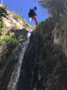
The Canyon: The first waterfall right at the drop-in is a 15’ rappel. After that you’ll pass a few more drops that you can down-climb or bypass and 1 more 10’ rappel.
Waterfalls:
| Number | Tiers | Total height | Anchor (looking down stream) | Anchor Gear | Rope* |
|---|---|---|---|---|---|
| 1 | 1 | 15' | L - Several bushed looped together | 10-15’ Webbing or rope | 40’ |
| 2 | 3 | 30' | N/A - Bypass on Right | N/A | N/A |
| 3 | 1 | 6' | N/A - Bypass on Left | N/A | N/A |
| 4 | 1 | 4' | N/A - Bypass on Left | N/A | N/A |
| 5 | 1 | 10' | R - Tree high on the wall | 5’ Webbing or rope | 30’ |
| 6 | 1 | 10' | Down climb on Left or Rappel off high tree on Right | N/A or 5-10’ Webbing or rope | N/A or 30’ |
- Rope - Recommended length based on rappel height and distance between tiers (when applicable) and to anchors x 2
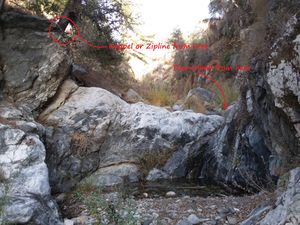
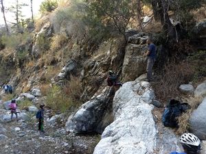
Waterfall notes: 2. Bypass is a sketchy traverse on the right wall. Some may want to rappel. 6. Using the tree on the right side and a boulder at the bottom, you can either do a nice mini zipline or use or to practice guided rappel
Exit[edit]
From the bottom of the last drop you will join back with the Colby Canyon Trail and it’s a short walk back to the car, the same way you came.
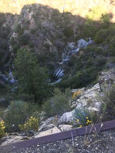
Instead of heading back the trail and to add some fun, I like to stay and follow the canyon towards the tunnel under the road and right before the tunnel, climb the gully on the right. An easy fifth class scramble back to the car.
Red tape[edit]
Nothing known to me...
Beta sites[edit]
 Chris Brennen's Adventure Hikes (St Gabriels) : Colby Canyon
 Chris Brennen's Adventure Hikes (St Gabriels) : Strawberry Peak
 SummitPost.org : Colby Canyon
Trip reports and media[edit]
June 6, 2019 - Plenty water to enjoy (or bypass)...
