Conditions:Shop Creek-20241009142136
Latest: |
21 Sep 2024 (1 yr ago) |
|---|
| Reported by: | Sedona Jay (1 reports) | |
|---|---|---|
| Quality: | Amazing |
|
| Waterflow: | Very Low |
|
| Wetsuit: | None |
|
| Water temperature: | ||
| Difficulty: | Normal |
|
| Time: |
Team: 2 people with experience level Brand new to Intermediate
Trip report URL:
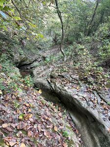
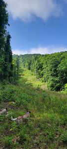
Comments: All of the reports before are accurate on the approach. You basically follow the BRT until you get to the powerlines and follow that up the mountain. Its true that it skirts private property so definitely be aware and respectful as you make your way to the top. GPS Coord for the top/drop in are: N 36.045835 W 93.258119. Once there, traverse west and you will see the first anchor/drop in down the canyon.
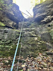
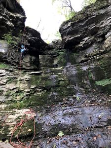
Rap 1 (Fixed anchor) is a little slippery if wet conditions. There are two places to drop in, the one on the right looks like it would eat your rope on the rope pull and get stuck. Choose the one on the left and drop straight.
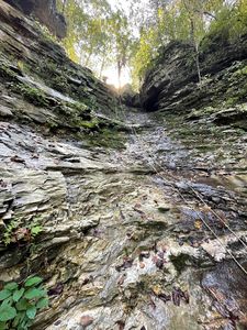
SLIPPERY! They are not kidding about how slippery the conditions are, even in low water. Always wear your helmet through the whole canyon!
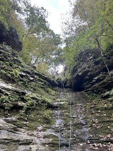
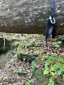
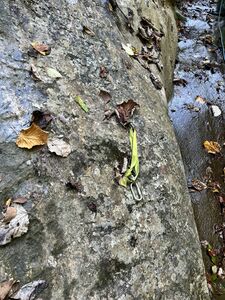
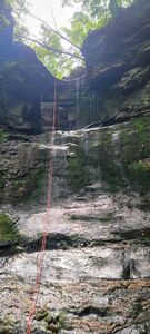
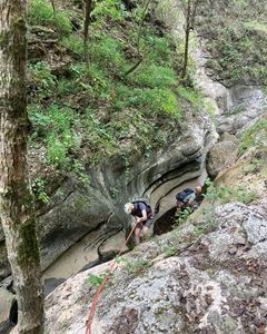
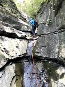
Rap 2 (Fixed Anchor) is easy to navigate. Once you get to the fallen tree that has a webbing wrap and link to anchor... This is where the fun begins!!! It was awesome. I can't wait to come back in the spring in full water!! But as it was, even low water was rad. From this point, you have fixed anchors about every 100 ft down the canyon to pull and reset. Space is limited in the canyon to be aware of your footing and clip in safety lines as needed as you reset. Rope pulls are pretty easy and only once did we get caught on a piece of slag that we needed to whip it... whip it good, to free the rope.
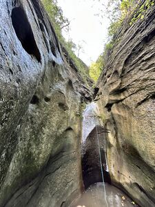
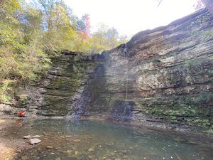
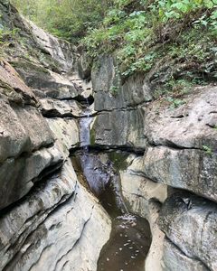
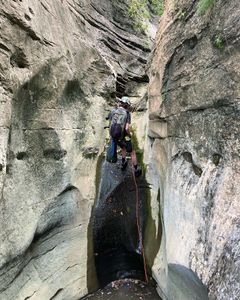
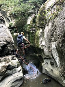
Last rappel is the funnest through the slot and ends in a 10 foot drop into a pool. I can imagine in high water this part is insane and fun!
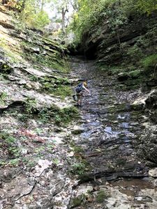
From here you can stow your rope but keep your helmet on as you navigate the slippery canyon/creek all the way to Twin Falls.
You can rappel Twin Falls but no anchors are setup so you will need to ensure you have enough webbing and rigging to setup up a safe rappel. Otherwise BRT down to the parking lot and success!
All condition reports
| Date | Quality | Waterflow | Wetsuit | Difficulty | Time | Team | Reported by |
|---|---|---|---|---|---|---|---|
| Amazing | Very Low | None | Normal | | 2 people Brand new to Intermediate | Sedona Jay (1 reports) | |
Comment: All of the reports before are accurate on the approach. You basically follow the BRT until you get to the powerlines and follow that up the mountain. Its true that it skirts private property so definitely be aware and respectful as you make your way to the top. GPS Coord for the top/drop in are: N 36.045835 W 93.258119. Once there, traverse west and you will see the first anchor/drop in down the canyon.
Rap 1 (Fixed anchor) is a little slippery if wet conditions. There are two places to drop in, the one on the right looks like it would eat your rope on the rope pull and get stuck. Choose the one on the left and drop straight. SLIPPERY! They are not kidding about how slippery the conditions are, even in low water. Always wear your helmet through the whole canyon! Rap 2 (Fixed Anchor) is easy to navigate. Once you get to the fallen tree that has a webbing wrap and link to anchor... This is where the fun begins!!! It was awesome. I can't wait to come back in the spring in full water!! But as it was, even low water was rad. From this point, you have fixed anchors about every 100 ft down the canyon to pull and reset. Space is limited in the canyon to be aware of your footing and clip in safety lines as needed as you reset. Rope pulls are pretty easy and only once did we get caught on a piece of slag that we needed to whip it... whip it good, to free the rope. Last rappel is the funnest through the slot and ends in a 10 foot drop into a pool. I can imagine in high water this part is insane and fun! From here you can stow your rope but keep your helmet on as you navigate the slippery canyon/creek all the way to Twin Falls. You can rappel Twin Falls but no anchors are setup so you will need to ensure you have enough webbing and rigging to setup up a safe rappel. Otherwise BRT down to the parking lot and success! | |||||||
| Great | Low | None | Special challenges | | 2 people Beginner to Intermediate | Human Chockstone (1 reports) | |
Comment: 5 for being in Arkansas, 3 if it were in a canyoneering area. It was a good time. Approach is a little heinous, a lot of trail blazing up a powerline clearing. WAYFINDING SKILLS ARE A MUST. Unfortunately, I did not get good GPS coordinates to assist. Definitely would try a different approach next time around.
Anchors were good. Webbing relatively new. Replaced one draw. Access: wasn't difficult. Camp Orr road is a little steep, but just kept traction and speed and the Prius did fine. Approach: started on BRT trail where it crosses Camp Orr Road. Followed BRT to the powerline clearing, and bushwhacked uphill, trying to stay as near to the clearing as possible to avoid private property (although the lines probably go straight through some). Drop into canyon wasn't intuitive, but at the same time, I think it would be difficult to miss. Canyon: First of all, it is SUPER slippery, an not only in obvious places. Highly recommend a helmet, even when just walking in the river. Most all rappels would be downclimbable, if not for the silt / moss / slime on the bedrock. Tossed several handlines just to stay safe. It wasn't apparent at first, but each drop seemed to have it's own anchors, so it's safe to pull rope between drops. As much as we wanted to, didn't rappel off of Twin Falls. | |||||||
| Great | Moderate Low | None | Normal | | 3 people Brand new to Advanced | Jamceld (1 reports) | |
Comment: Warm day in high 70’s. Water cold, but you can easily tolerate it and climb out of the pools. Great bolt anchors.
| |||||||
| Amazing | Low | None | Normal | | 2 people Intermediate to Expert | Caboalta (13 reports) | |
Comment: Great flow, easy for a class C canyon with relatively small raps and low flow. Floated Buffalo River in pack rafts from Steal Creek with low flow (around 80 cfs) and did canyons along the way. Great trip, beautiful scenery and very few people since Buffalo River was so low companies were not running it.
| |||||||
| Great | Moderate Low | Full wetsuit | Advanced | | 5 people Beginner to Advanced | Hillbelfi (33 reports) | |
Comment: Shop Creek in flow is an amazing canyon, and definitely a class C even though it’s short. Marked advanced because the slot section of the canyon requires swiftwater skills such as sliding, rappelling in flow, and communication - It also can’t be escaped once you start.
When the water is up, we dropped into the canyon off a fallen log (left the webbing) and used about 135 ft of rope to get all the way to the sling anchor. Could do it in 100 ft if you stopped early and did a slide into the pool to climb up to the sling anchor. Short 20-30 ft rappel from the sling anchor DCL to a pool where bolts have been placed DCR (note: bolts aren’t allowed in this area and we didn’t place them, but they make the next rappel much better and safer). Fun, splashy rap about 100 ft off the bolts into a swimming pool. Downclimb and finish with 2 slides that are bumpy and technically but fun if the water is up. Creek hike out to the Buffalo river trail. | |||||||
| Good | Very Low | None | Normal | | 3 people Intermediate to Advanced | Hillbelfi (33 reports) | |
Comment: Awesome time in Shop Creek!
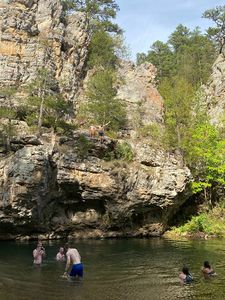
Hike up from Kyle's Landing and dropped in at the pipe that runs under Camp Orr road. Creek started out totally dry and gradually we ended up in more water until we were splashing through a few pools at the slot section near the end. All rappel beta is based off Sgaloob previous condition report. R1 - replaced the anchor (webbing was fraying) on a tree DCR, 80 ft. R2 - used a ghost anchor around a large boulder in the center of the canyon, approx. 20 feet, didn't need it for the ramp section as the creek was very dry. This is where our experience deviates from Sgaloob's a bit. R3 - used an existing sling anchor in good condition on a tree DCL, approx. 30 ft. R4 - did the whole slot section in one long rappel, replaced the anchor around a rock chockstone DCL, used 75 ft. of rope, make sure to set up the pull thoughtfully as the rope winds through the slot by the time you get to the bottom. trickle of water through the slot, definitely the most beautiful part of the creek. Next section is the reason behind the 7.5 hour timeline! We chose continued to creek down to Twin Falls which was running at just a trickle, but it's a beautiful 80 ft rappel into a pool deep enough to splash into. Anchor is a tree DCR set back from the lip, so used 200 ft. rope all in all, but there is a clear trail up to the top of the falls so you do not have to pull and people can rappel multiple times. We took our anchor down since it is a popular hiking trail. We continued following Shop Creek all the way to the Buffalo River instead of hiking out on the BRT, then hiked/swam our way up the Buffalo River back to our campsite at Kyle's Landing. Really fun way to end the canyon IF the river is low and you're camping at Kyle's Landing - it's a bit of a haul. Some fun jumps and swims but the main draw is just being in the water. POINT OF INTEREST though is downstream from Kyle's Landing there are some really fun and beautiful 25-30 ft. jumping points on the cliff off of river left. Some webbing and ropes were strung up to mark the scramble up. | |||||||
| Good | Very Low | None | Special challenges | | 3 people Intermediate to Advanced | Sgaloob (2 reports) | |
Comment: Rick provided plenty of beta to successfully complete this canyon here and on his Canyon Collective tr, but I thought I'd flesh it out a bit more, as I think this canyon will be seeing, and is worthy of, more traffic.
First, I'd like to speak to the quality. While I rated this canyon 3/5 relative to all canyons, this is certainly a 5/5 adventure for Arkansas, especially if you're already in the area to float the Buffalo or climb at HCR or Sam's Throne. It is a true slot canyon, which is rare for the region, and incredibly scenic. Here are some notes: Access: Note that PRIVATE PROPERTY abounds around this canyon, and the boundaries aren't obvious While driving down the road you will see about 50 "No Trespassing" signs. It's not clear, but likely, that the canyon itself runs through private property. The Buffalo River Trail is NPS, but above and below the canyon are easements of private property. Not to perpetuate stereotypes or anything, but if the numerous confederate flags in the area are any indication, Arkansas is not a place you want to get caught trespassing. Proceed at your own risk. There are several options for accessing this canyon. A) You can park at the trailhead for Twin Falls (i.e. Triple Falls in Tim Ernst's book) outside Camp Orr. There is supposedly a trail from the top of Twin Falls that connects to the Buffalo River Trail, but it isn't obvious and I don't think it's commonly used. One could use that trail to proceed past the falls up to the BRT, east on the BRT to the road, then up the road to where the watercourse crosses under the road. Note that climbing is among the prohibited activities on the Camp Orr signage, so it's possible to have a a "hey whatcha doin" encounter if you're flaking out ropes, etc. at your car. This option is probably good for when the road is muddy. This option adds time/distance to the canyon, but also adds the worthwhile Twin Falls. B) You can pull off the road where the BRT crosses the road, walk up the road to the watercourse, do the canyon, and hike out the BRT. This is probably the least conspicuous and shortest. C) The blasphemous option: Just take the BRT to Shop Creek and hike up from the bottom. The bottom of the canyon is the most scenic part, and is easily accessible from the bottom. The 15' falls looks very difficult to climb up, but might have the geometry to get up with a pack toss. You could then slither up the slot to see the coolest parts.
Canyon: As mentioned by Rick's report, I can't emphasize enough how slippery this canyon is. Even in effectively "dry" conditions, this was the most slippery canyon I had ever been in, and it's not just in obvious spots like mossy/wet rocks. Many surfaces have a lime/clay coating that make it simply impossible to stand. At one point in the canyon my wife ate shit and smacked her (helmeted) head basically just standing there (she was fine). Also this canyon is spring fed, and I don't think it ever goes completely dry. There was a small flow, about 1 CFS, and it was pretty much impossible to stand. I can't imagine doing this canyon in full Class C conditions. While probably 95% of this canyon could in theory be downclimbed, we often found ourselves rapping or handlining down the low angle slots for security. From where the watercourse crosses the road, proceed down canyon 30-45 mins to a small ledge. This ledge can easily be downclimbed / partner assisted, but you may want a handline for security, as approaching the lip can be very slippery. The canyon will deepen, and you will quickly arrive at R1. R1: Rap from the tree DCR ~80', or ~35' to the ledge and slippery 5.9 downclimb, or bypass DCL. R2: 15' from a boulder pinch to long low angle (very) slippery ramp, or downclimb DCR, or bypass DCL. We stayed on rappel down the whole ramp (~80'). R3: Handline down the low angle slippery slot to the ~8' drop from a tree on the right. R4: Handline or rap down the low angle slippery slot to the ~10' drop from a tree on the left. R5: Handline or rap ~6' from a chockstone into the twisty left-turning slot. The drop at the end of the slot is the falls and pool that you can access from the bottom. Rap another 15' into the pool below. We used the chockstone anchor up around the corner, and the pull was fine. This used pretty much all 100' of rope to get a good angle on the pull. If one was concerned about the pull or rope grooving, there is an option for a good knot chock near the top of the twisty slot on the right. | |||||||
| | | | | Sgaloob (2 reports) | |||
| Great | Very Low | None | Normal | | 2 people Advanced | Metaconid (6 reports) | |
Comment: Leaving this trip report in 2024, though I completed the loop the first time 12 years ago. I decided to leave this report after reading of the more recent descents. I do not understand elements of the recent reports that suggest there are up 7 rappels to 100'. I do not consider myself an excellent climber and we completed the entire hollow rappelling only three times, including the final drop out of the slot, and the longest rappel we completed was about 50'.
I also don't understand why multiple sets of bolts have been placed before and in the slot. My group safely descended without using fixed anchors and many people did before and after us as well. In fact, we found webbing and a rap ring above the slot that a previous group had used to anchor the rappel over the final fall. The legality of placing bolts along the Buffalo is unclear to me but it seems to unnecessarily draw attention to our activities, especially when safe natural anchor opportunities abound.
| |||||||
