Conditions:Stone Plus One-20250209225831
Latest: |
8 Feb 2025 (11 mos ago) |
|---|
| Reported by: | Jcsjcs (141 reports) | |
|---|---|---|
| Quality: | Great |
|
| Waterflow: | Very Low |
|
| Wetsuit: | Rain jacket |
|
| Water temperature: | ||
| Difficulty: | Normal |
|
| Time: |
Team: 2 people
Trip report URL:
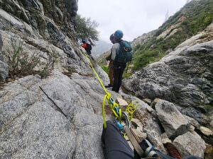
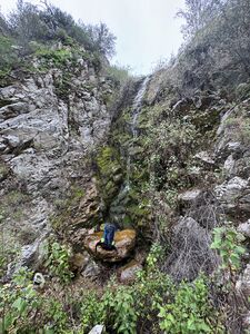
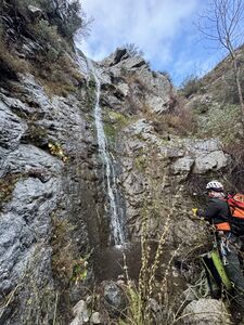
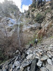
Comments: Decent amount of waterflow due to recent rains. Rain jacket was sufficient protection and didn't see any sustained water exposure. Serviced a couple of anchors. Bushwhacking wasn't too bad and was more on the fun obstacle course end of the spectrum rather than being heinous.
All condition reports
| Date | Quality | Waterflow | Wetsuit | Difficulty | Time | Team | Reported by |
|---|---|---|---|---|---|---|---|
| Great | Very Low | None | Normal | | 2 people Beginner | Zlabry (2 reports) | |
Comment: Great canyon although there is prolific poison oak. Added webbing around a solid downed log and small bush with an easy pull for R4 for ~20' rappel (could not find previous webbing and 40' seems like it would be in a thicket of brush). Replaced the sun-crusted webbing at R14.
There are a few spots that want to snag a rope, and R12 seems very inadvisable as a single rappel due to the pull. The first part (from 12a) was dry and downclimbable, but anchor options in the middle seemed quite sparse and we could not spot 12b until we were at the right-hand bend on rope. Very fun little sequence though. Biggest challenge was finding an appropriate climb back up to the trail after R17 to avoid the canyon walk. We tried shimmying up the large downed logs just down canyon of R17 and scrambling over the ridge. It was not great. I don't have a lot of advice on this part.
| |||||||
| Ok | Very Low | None | Normal | | 5 people Beginner to Advanced | Eshi-1 (38 reports) | |
Comment: Replaced webbing to All rappels but 2 (R3 & 14 need replacement soon).
Removed some unnecessary webbing from wrong/bad anchors. Tightened some loose bolts and reoriented some hangers that were twisted in the wrong direction. As the previous report said: The anchor for R16 is no more. Use the R15 bolted anchor and combine with 16. Easy pull and takes 2x100'. | |||||||
| Great | Very Low | None | Normal | | 3 people Intermediate | ADubs (15 reports) | |
Comment: Really lovely canyon, very green and mossy, lots of fun walls. We used the drop-in a little further up the trail that Willie notes. Super easy little gully, sounds way better than the one noted in the beta. The anchor for R16 seems to have been removed... we couldn't find it and there was no adequate tree as stated. Plenty of rock to build a cairn, but it's much easier to just use the bolted R15 anchor and combo with 16. The combo was about 90' of rope. SO much poison oak... holy baloney. Silkwood showers for all.
| |||||||
| Good | Very Low | None | Normal | | 2 people Intermediate to Expert | Canyondozer (8 reports) | |
Comment: Couldn't ask for a better apporach. We took our time through and attended to some of the overgrowth. Replaced webbing in several places and uncovered anchors at R9.
| |||||||
| Good | Very Low | Rain jacket | | | 4 people Intermediate to Expert | Eshi-1 (38 reports) | |
Comment: 4 of us started. Tightened loose bolts on R1.
R2 - Removed unnecessary Cairn and used a bush LDC. Replaced Webbing on several rappels. Cleared a lot of brush along the way. 3 of us had to bail at R8 due to other commitments. Willie kept going alone.
| |||||||
| Good | Very Low | Rain jacket | Special challenges | | 1 people | Willie92708 (1017 reports) | |
Comment: The canyon (in stretches) is heavily overgrown by canyon kelp, sticker vines, and other water plants.
The poison oak is totally avoidable, but do be careful because it is super thick in a couple spots; go around these spots! Eshed & Co had to bail at R8, but I continued down canyon trimming some plants and rebuilding some anchors. Much of the webbing is getting old as it is significantly Sun bleached. We replaced some of it from R1-R8 and I changed out 2 anchors from R8 to R17. I ghosted some anchors that either did not have webbing, or the webbing was unsafe to use (webbing removed). A bit of a flash flood has cleared the canyon floor somewhat after the last rappel; this makes it much easier to avoid the poison oak "forest" on the shelf DCR, because you can stay in the creek bed and avoid it. Water flow is nice (see pic). Even with "special challenges" it was still only 7.0 hours car to car. | |||||||
| Great | Very Low | Rain jacket | Normal | | 2 people | Jcsjcs (141 reports) | |
Comment: Decent amount of waterflow due to recent rains. Rain jacket was sufficient protection and didn't see any sustained water exposure. Serviced a couple of anchors. Bushwhacking wasn't too bad and was more on the fun obstacle course end of the spectrum rather than being heinous.
| |||||||
| Good | Very Low | None | Normal | | 4 people Intermediate | Anhad (2 reports) | |
Comment: The main thing to note is that this canyon has become *extremely* overgrown from R6 all the way down to the first part of the exit walk. Wherever the canyon becomes less steep allowing for plants to take hold, you will have to make your way through waist-height bushes or try to avoid them by creeping along the sloped gravel walls. Many of these bushes have thorns so long pants are required and long sleeves are also recommended. Expect to see lots of funnel-shaped grass spider webs, and harvestmen spiders. We saw hummingbirds and a rattlesnake on the approach also (be careful).
Add 1-2 hrs to your expected time for this canyon due to the thick bushes, or bring tools to clear vegetation. The approach was nice and some occasional small trees or shrubs provide shade on the way up. All of the rappels were excellent and a small trickle of water throughout kept it nice and refreshing. No problems with vegetation blocking the raps. There is no clear drop-in point/trail, you just have to make your way down the slope to the water trying to dislodge as little as possible. Webbing is overall in good condition (no fuzziness) but very faded on anchors where there is no shade. We did not feel the need to replace but in the future, it may be necessary. R5 is at the bottom of a huge rock slide. This rock slide felt extremely unstable. Even nudging the bottom few with my feet caused them to tumble, which loosened up the ones above etc. etc. Best to let sleeping dogs lie. We did not trust the rocks. Luckily another group had the same idea so there is an anchor around a bush LDC (see picture) that allows you to rappel off to the side of the entire rock situation. R9 is difficult to spot. The area does not look very similar to the picture (unfortunately we failed to get a better one) and the bolts were mostly covered with dirt. Another group rigged a webbing anchor on a nearby bush which we found and used before we spotted the bolts, so either is fine. We downclimbed the first part of R12, and then discovered the cairn anchor was gone. So we built a new one. Overall a great experience to do once, but would probably not repeat it unless it becomes less overgrown. | |||||||
| Great | Low | Rain jacket | Special challenges | | 3 people | Willie92708 (1017 reports) | |
Comment: Since the Wildwood picnic area is closed, we parked near the North East end (down canyon) of Stonyvale Road. Two of the older pull-offs have been blocked off and "no parking" signs installed. The very end is also "no parking", but there seems to be some legal parking on the creek side just before the end. From there, we hiked toward Wildwood until the trails dumped us into the creek. We crossed over and within a minute or 2 we were on the Stone Canyon (Forest Service trail 13W07). The trail has been well maintained and so it's just hiking up for an hour to the drop-in. We hiked about 80 feet further up than the RopeWiki drop-in as there was a nice gully to descend here, and we were quickly at R1, where we layered up and got on harnesses. We did not bring wetsuits, but I did bring 2 layers of tights (outer thick and "wind proof"), a warm top, a rain jacket, and neoprene gloves and socks. That was sufficiently warm for the cool day with on/off light drizzle. Once in the canyon we came across our "Special Challenges"; the canyon kelp is super thick over much of the canyon, the long stringy sticker vines sometimes are mixed is with the kelp, and some plants have clogged up passage. However, with significant trimming and crushing down the kelp, travel is now easy through the canyon. All the webbing anchors we used were "OK", meaning that the webbing was still sufficiently strong, but much of it needs to be replaced. Since it was all soaking wet, it was hard to judge the Sun bleaching effect. We removed some old webbing and super rusty quick-links, and we ghosted some drops with a Fiddlestick. The R2 rock cairn is still in place, the R5 boulder anchor seems to be gone (we used a bush with purple webbing LDC), And the R12 split rock cairn is gone (we combined off R12 bolts). Some of the RW anchors don't exist anymore, so we ghosted or downclimbed some drops. There is some poison oak vines (no leaves) in places throughout the canyon. Some of our rappel lines took us through a few PO vines, still just barely brushing them. However, after the final rappel, the exit path on the shelf RDC is covered in PO bushes. I washed off in Big Tujunga Creek before heading back to the parking area, and I suffered no ill effects of the PO. But at least one member got hit with the rash (2 days later). For the exit hike we stayed DCL on Big Tujunga Creek until we were past the private property, then crossed over and back to the parking spot. Looking at the land parcels, it's not practical to stay totally off private property for the exit hike, but since Big Tujunga Creek is a Federal "navigable waterway", technically the property owners cannot keep you out of the waterway itself. Still it's best to stay far away and be quiet on the exit hike. | |||||||
| Ok | Very Low | None | Normal | | 2 people | Rapbear (80 reports) | |
Comment: Don't do this canyon on a hot day. The hike up is brutal with very little shade. Go early to avoid the sun.
The full canyon drop in is very loose and slippery. Take your time on this. The rappels are OK. Some are nice with moss covered walls that remind you of the wetter seasons. Most of the rappels are dry but a few have a trickle of water with tons of bees. The anchors were mostly in good shape. Some rapides are getting rusty and should be replaced soon. There was newer black webbing on many of the anchors. We replaced the webbing on R1 and rebuilt the rock cairn anchor at R2. Please inspect the rock cairn before using it. I thought we avoided the bugs but they came for us towards the end of the canyon. They are relentless. Overall, the hacking through the overgrowth and following the faint path down the canyon tired us out and made it a long day. Listen to the past reviewer, bring a machete.
| |||||||
| Good | Dry | | | | 10 people Intermediate to Advanced | RFontaine (341 reports) | |
Comment: Approach hike was a breeze! It's an easy well maintained trail. Easy to miss the drop in if not watching map. Dropping down to the 1st rap is an extremely slippery loose slope, use caution!!
Rappels were nice enough. Big ones were decent but not amazing by any stretch. Canyon gets very dense and "jungley" in the middle, very over grown but paths are developing that are easy enough to follow. Lots of poison oak but mostly easily avoidable. The various stretches of jungle are broken up by open sections that give you a chance to breathe and admire the view of.... the highway... and some "meh" mountains. Definitely some small neat features throughout like springs flowing down mossy rock faces and interesting greenery. A few pretty spots and lots of variety, which was nice, however I was definitely far from impressed. The flies however, while not biting, were obnoxious and were mostly ever present, only disappearing on occasion in certain sections. Once to the exit, the path was fairly obvious and scenery grew a bit more interesting. However, this was short lived as the bush grew denser and denser and got quite obnoxious. A sharp machete proved to be a useful tool here. We hacked our way through, stumbling and cursing. The flies wouldnt let up and we were covered in debris. Lots of deep brush holes to fall into and while staying up on the left bank worked a bit, that was was also tough due to the angle and loose soil. Frustrating, but we finally got out, following the GPS file to the river; we were happy to take a swim. After all that bush whacking there should be a much more obvious exit path left in our wake. All in all, it was a long day with a big group. Lots and lots of waiting for slower members throughout. It was good to have something to do on a Sunday and definitely glad I did it. The canyon over all was okay and for the area pretty decent; worth checking out for sure! Definitely bring a machete and long sleeves/pants. You wont regret it!
| |||||||
| Ok | Dry | None | Normal | | 1 people | Activedad29 (19 reports) | |
Comment: Hike up was great. I took the shortcut drop in after reading the prior review. I replaced the orange webbing and rusted mallion on rap 8 with fresh black webbing and a stainless mallion. The canyon is overgrown and I unfortunately forgot my garden hedge shears. Lots of greenery on the trail to include P.O. but nothing unusual. Weather was ideal.
| |||||||
| Ok | Very Low | None | Special challenges | | 3 people Intermediate | RavKhadge (5 reports) | |
Comment: Dropped into upper canyon. Encountered thick jungly brush that from R5 onwards slowed our progress substantially. We decided to bail using the lower drop in point just before R8. The brush is filled with thorny vines and poison oak that make bushwhacking very unpleasant and slow. The upper drop in is very loose, difficult, and slow. The lower drop in might be a little better. Webbing is faded on some anchors but trustworthy enough. Replaced cairn anchor on R2 (damaged webbing) with a tree anchor about 20 ft further back
| |||||||
| Good | Very Low | Rain jacket | Special challenges | | 2 people | Willie92708 (1017 reports) | |
Comment: Since my partner did not bring rain pants (just cotton pants), his legs were cold as there was significant water spray from the falls and the high temp was maybe 60F (special challenges). But thanks to running the canyon recently and working paths through the brush, the trip through went quickly, and the exit without navigation issues. It was certainly nicer with higher flow on this trip than last (see pic). And treating all outer shell and shoes as "hazmat" after wading through poison oak at the exit, I avoided any PO rash later.
| |||||||
| Good | Very Low | Rain jacket | Special challenges | | 6 people | Willie92708 (1017 reports) | |
Comment: Since we spent the time to prune our way through the dense brush in the canyon (special challenges), the flowing water really added to the overall experience, and the winter rains have brought out the hillside grass, I gave it an overall "good" rating. The canyon kelp in some parts of the canyon is so thick, you walk on top of it, as your feet do not ever reach the ground. The other brush is also super thick in these areas. So trimming a path through it, made it pleasant overall, instead of a nasty bushwhack.
The approach trail is mostly great (recently trimmed in stretches), but it does need more trimming work and I found a bit of poison oak just after the scree field, nearly at the drop-in point. In the canyon there are a few patches of poison oak (PO), which are all avoidable with care. The first bit of PO grows out of a down-climb, which can be rappelled to avoid it. After the last rappel, where the canyon gets wide and there is a trail DCR high on the bank, there are many PO bushes which are much harder to walk through carefully. It may be better just to stay in the drainage and spent the extra time on the exit The anchors in the canyon are a hodgepodge of everything. Up top, some relatively new webbing was cut from bolts or around bushes, and just left; certainly a bit odd. We rebuilt all the rock cairn anchors, as we had no way to know the webbing condition under the rock pile. A couple anchors directly in the water course were extremely scummy, with excessively rusted quick-links. We bypassed these water course anchors by combining rappels. We replaced the oldest webbing, and any that was clearly damaged. We did use plenty of older webbing that was significantly Sun bleach as it was either redundant rigging (2 bolts or 2 pieces) or we backed it up with meat anchors. Certainly it would be reasonable to replace most all this older webbing. Since the picnic area is still closed for construction until Feb 2020, we parked under the big oak tree near the end of the neighborhood street. We found a rock wall across Big Tujunga Creek, so we kept our feet dry on the approach. In the canyon, the pools were easily avoidable. However, near the bottom in a thicket of canyon kelp, I fell into the water below the plants and that was the last of dry feet for the trip. We skirted along the other side of the river bed for the exit and cross Big Tujunga Creek very close to where we parked. Overall the navigation, approach, descent and exit were straight-forward. | |||||||


