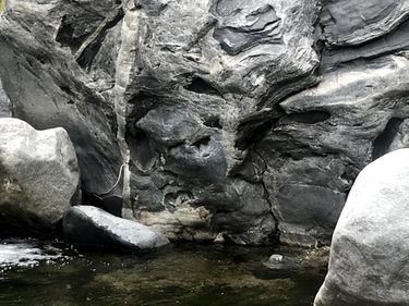
Corona Gulch
| Rating: | |||||||||||||||||||||||||||||||
|---|---|---|---|---|---|---|---|---|---|---|---|---|---|---|---|---|---|---|---|---|---|---|---|---|---|---|---|---|---|---|---|
| | Difficulty:3A III R (v5a1 III) Raps:1-5, max ↨60ft
Red Tape:No permit required Shuttle:None | ||||||||||||||||||||||||||||||
| Location: | |||||||||||||||||||||||||||||||
| Condition Reports: | 5 Mar 2025
"After viewing the ratings of Corona Gulch (this "canyon") and Sativa Sunrise Gulch (adjacent "canyon"), I think the rating where swapped. Corona Gulc |
||||||||||||||||||||||||||||||
| Best season: | Anytime
|
||||||||||||||||||||||||||||||
| Regions: | |||||||||||||||||||||||||||||||
Introduction[edit]
One of the true hidden gems of the Tujunga region, and sporting some of the best views and most inspiring scenery available, Corona Gulch evokes feelings of quarantine. The first known descent was on 2020-10-25 by Alex Reeves, Brit Wylie, and Galilea von Ruden.
This canyon is designated R because of the required natural anchors (e.g. fiddlestick).
Approach[edit]
Park at the same trailhead as for Fall Creek or GFOTF: 34.29725,-118.16994. Walk down the fire road, continue past the Fall Creek drop-in, and enter the obvious drainage on your left when you reach the power lines.
Descent[edit]
The canyon starts off relatively flat and gets steadily steeper as it progresses. Expect downclimbs increasing in difficulty and length; some party members may require a belay or rappel.
Eventually the canyon cliffs out at its one mandatory rappel. There are a couple natural anchor options at the top, but you will need expertise in setting and evaluating natural anchors to proceed.
After this, continue down much as before to the bottom of Big Tujunga. Alternatively, shortly after the mandatory rappel you can angle up and to the right to gain a large flat area with a number of good rappel lines on its face (approx 150 feet). If you take this route be careful to avoid sticking your rope on the abundant vegetation growing on the face.
Exit[edit]
Either walk upstream to the fire road, or downstream to the exit of Josephine Creek.
