DECAF BAG Canyon
| Rating: | |||||||||||||||||||||||||||||||
|---|---|---|---|---|---|---|---|---|---|---|---|---|---|---|---|---|---|---|---|---|---|---|---|---|---|---|---|---|---|---|---|
| | Difficulty:3A I (v3a1 I) Raps:1, max ↨85ft
Red Tape:No permit required Shuttle:None Vehicle:Passenger Rock type:Sandstone Conglomerate | ||||||||||||||||||||||||||||||
| Start: | |||||||||||||||||||||||||||||||
| Parking: | |||||||||||||||||||||||||||||||
| Condition Reports: | 14 Dec 2025
"JUST SAY NO! One rappel that has a ton of rockfall. Yes, its short, but still . . . dont do it. |
||||||||||||||||||||||||||||||
| Best season: | Oct-Apr
|
||||||||||||||||||||||||||||||
| Regions: | |||||||||||||||||||||||||||||||
Introduction[edit]
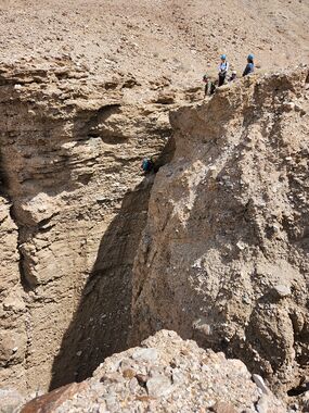
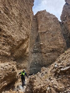
1 Rappel wonder. Should be combined with it’s neighbor Cavern Slot. Same parking, trailhead and approach for both canyons. Go up and do one, then go up again and do the other. All together should take you 1-3 hours depends on group size & speed. The name: The evening after running this and Cavern Slot, we were sitting around the fire at the Trona (Great Falls Basin) campground. After playing around with the first letter of everyone’s name, I ended up with DECAF BAG. Now you try it...
Approach[edit]
Driving: From Ridgecrest, CA take the 178 East driving to Searles Valley and through the little town of Trona about 45 miles (45-60 min) from the center of Ridgecrest (178/ S Lake China Blvd). Leave the paved road at 36.03366, -117.28157. From here you will drive 9.75 miles on dirt roads. In May 2023 was done by a minivan and several sedans. No 4x4 or AWD needed. Drive 3.7 miles to the Ballarat Ghost Town. At 36.04636, -117.22284 turn Right (south) onto Wingate Road. Drive for 5.9 miles until the turn-off and turn Left (no signs or other land marks). Drive another 0.15 miles to the parking & trailhead.
Hiking: From the parking area walk South. You will pass the canyon’s exit and imminently turn Left following a trail up a little ridge line. Keep left above the canyon till the trail drops right into the watercourse. Bam! You made it! R1 is right there.
Descent[edit]
| Number | Tiers | Total height | Anchor (looking down stream) | Anchor Gear | Rope* |
|---|---|---|---|---|---|
| R1 | 1 | 85' | Cairn Center | 10-15’ Webbing or rope | 200’ |
Exit[edit]
From the bottom of the R1 it’s a short walk back to the car.
Red tape[edit]
None
Beta sites[edit]
Trip reports and media[edit]
Background[edit]
First Known Descent: 5/6/2023
First Known Descent Members: Eshed Bootel, Dean, Cameron, Amanda, Fred, Ana, Brian, Geraldine

