Damnation Creek
| Rating: | |||||||||||||||||||||||||||||||
|---|---|---|---|---|---|---|---|---|---|---|---|---|---|---|---|---|---|---|---|---|---|---|---|---|---|---|---|---|---|---|---|
| | Raps:8+, max ↨130ft
Red Tape:No permit required Shuttle:Required 30mins Vehicle:Passenger Rock type:Granite | ||||||||||||||||||||||||||||||
| Start: | |||||||||||||||||||||||||||||||
| Parking: | |||||||||||||||||||||||||||||||
| Shuttle: | |||||||||||||||||||||||||||||||
| Condition Reports: | |||||||||||||||||||||||||||||||
| Best season: | Aug-Oct
|
||||||||||||||||||||||||||||||
| Regions: | |||||||||||||||||||||||||||||||
Introduction[edit]
Damnation Creek, aka Purgatory Falls, is a lush old-growth gem tucked deep in the North Cascades. This remote drainage offers a blend of mossy forest approach, cascading creek walking, and a string of rappels that plunge through sculpted bedrock. Massive fallen cedars and Douglas firs span the canyon, giving the descent a primeval feel.
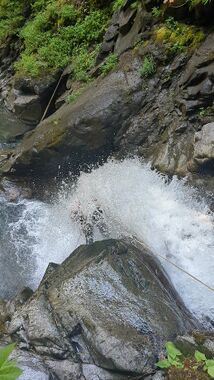
Expect lots of downclimbs, a few jumps, and scary but 'easy' rappels — several of which take you straight through full force of the creek. With alternative anchor choice, most can be bypassed if the flow is too high. While the canyon is slippery in places, it also has handhold and footholds wherever one needs them to be for both the downclimbs and the rappels.
It is easy to check the flow of this canyon, drive to the exit shuttle point and walk for a minute to the creek.
Approach[edit]
First Descent Approach[edit]
The first descent took a conservative approach to dropping into the canyon, picking a route with mild steepness, but more creek walking. However the forest was so easy going, a steeper approach may be feasible in future.
Leave vehicles just before the Thornton Creek trailhead road, where an old FSR splits off but is now blocked off by boulders.
Follow a quiet, abandoned Forest Service road that is beautiful, has a viewpoint along the way and is just very serene.
When the road peters out, descend steeply down through lush forest to meet the creek. Footing can be slick and soft; expect ferns, nurse logs, and a soft duffy slope all the way to water level.
The approach feels more like a nature walk than a slog, with filtered sunlight, huckleberries galore, and the occasional giant treefall.
Potential Future Approach[edit]
The first descent found their approach surprisingly easy, so future parties might want to try a more direct entrance to the technical section.
A short-cut approach is marked on the ropewiki map. This should cut-out a lot of creek walking.
Descent[edit]
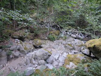
The canyon begins with a stretch of creek walking before the drops stack up. Enjoy the fact you are not doing Thornton again and admire all of the pretty pools along the creek walk. Many of the rappels concentrate all of the water in the stream but anchor opportunities are plentiful to take dry lines if needed. Having at least one person with good downclimbing skills will help the team move through the canyon quickly, otherwise bring lots of webbing and anchor building material. Some of the fallen trees in the canyon are 15' in diameter.
Jump 1 / Downclimb DCR (~15ft) — Either leap into a deep pool or scramble down canyon right.
R1 (15ft', webbing pinch DCL) — Short rappel off a natural pinch point.
R2 (50' DCC) - Low angle from log.
R3 (40' DCC) - another low angle from log branch attached to massive old growth.
R4 (35' DCL) — Drop into a small chamber, flow can be taken directly or skirted.
R5 (50' DCL ) — A very solid rooster tail rappel. Current anchor setup allows for dry line or wet line.
R6 (130', DCR) — Three distinct steps with options to break up. Full length is 130ft, though the final stage can be downclimbed DCL to shorten rope use.
R7 (40' DCL) — this pool looks jumpable but is not.
R8 (45' DCL) - you and all of the water go down a open crack, looks much scarier than it actually is.
A lot of these drops were estimated, r6 should be fairly accurate.
Exit[edit]
From the base of the final rappel, continue creek walking downstream until terrain eases and a trail appears DCR. Scramble back up through forest to reconnect with the abandoned road. Follow the mellow grade back to the parking pullout.
Red tape[edit]
Beta sites[edit]
Trip reports and media[edit]
Background[edit]
Descended August 24th 2025 by Adam Bercaw & Hereward Cooper, taking 5.5hrs. There was no signs of previous descents, however it's feasible the canyon could have been ghosted.

