Devil Canyon (East Fork)
| Rating: | |||||||||||||||||||||||||||||||
|---|---|---|---|---|---|---|---|---|---|---|---|---|---|---|---|---|---|---|---|---|---|---|---|---|---|---|---|---|---|---|---|
| | Difficulty:3A IV (v3a1 IV) Raps:10, max ↨160ft
Red Tape:No permit required Shuttle:None Vehicle:High Clearance Rock type:Granite | ||||||||||||||||||||||||||||||
| Location: | |||||||||||||||||||||||||||||||
| Condition Reports: | 2 Mar 2020
"First descent? No prior anchors found, even in the main Devil drainage.. Great weather, partly cloudy. Tiny trickle of water on many of the rappel |
||||||||||||||||||||||||||||||
| Best season: | Nov-Mar
|
||||||||||||||||||||||||||||||
| Regions: | |||||||||||||||||||||||||||||||
Introduction[edit]
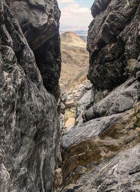
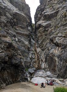
A fun full-day canyon with several rappels, many downclimbs, and a short but interesting narrow sequence in the middle of the technical portion. There may be a trickle of water on many of the rappels in spring or immediately following rainfall. Descending this canyon shortly after rainfall also makes for more pleasant walking conditions in the approach/exit wash section, as the sand is packed down.
All anchors are natural and may not be present as described following rockfall or flash flooding. Comfort with inspection and construction of natural/marginal anchors is mandatory.
The canyon shares its exit hike with Guadalupe Creek.
Approach[edit]
Park at the Guadalupe Creek trailhead and hike up the prominent wash for approximately one mile. Keep right at the fork (the left fork here is Guadalupe). The 25’ dry fall a few hundred feet later is the (optional) final rappel of Devil Canyon. Look for a use trail to your left and follow it out of the wash.
The trail becomes increasingly faint, but can be followed to about 33.59360, -116.31886 before abandoning it to bear right up the obvious ridge via path of least resistance. Travel cross-country to the East Fork drop-in at approximately 33.59473, -116.32893.
Descent[edit]
(All rappel lengths are approximate.)
- R1 50’ from a pinch canyon left
- R2 90’ from a pinch canyon left
- R3 120’ from a pinch canyon right
- R4 110’ from a pinch canyon left
At approximately 33.60139, -116.32060, the east fork joins the main Devil Canyon drainage.
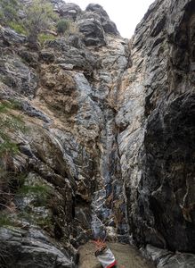
- R5 90’ from a pinch canyon left. (NOTE: as of March 2, 2020, anchor options at the bottom of this rappel are extremely limited. Verify before descending R5 that the smoke tree used as an anchor for R6 (canyon right, slightly above the watercourse) is still in place. If flooding or erosion remove this tree, you will need to farm rocks from above the R5 anchor to build a cairn anchor for R6.)
- R6 160’ from a tree canyon right. This narrow slot is perhaps the most interesting feature in the canyon, and ends with a short but steep drop.
- R7 80’ from a pinch canyon center.
- R8 (optional) 100’ from a pinch in the watercourse, or scramble down canyon left to bypass.
- R9 25’ from a tree canyon left. This rappel appears larger initially, but much of it can be downclimbed canyon left. Below this rappel you will begin to see evidence of foot traffic in the canyon.
- R10 (optional) 25’ from a knot chock canyon left. Can be bypassed via a use trail that departs the wash canyon right a few hundred feet before the dry fall.
Exit[edit]
Walk back down the Guadalupe Creek wash to the parking area.
Red tape[edit]
Beta sites[edit]
Trip reports and media[edit]
Background[edit]
First documented descent by Morgan Diefenbach on March 2, 2020. No anchors or evidence of human presence in the technical portion of the canyon were observed.


