Diablo Canyon
| Rating: | |||||||||||||||||||||||||||||||
|---|---|---|---|---|---|---|---|---|---|---|---|---|---|---|---|---|---|---|---|---|---|---|---|---|---|---|---|---|---|---|---|
| | Difficulty:3A IV (v3a1 IV) Raps:13-27, max ↨160ft
Red Tape:No permit required Shuttle:None Vehicle:4WD - High Clearance Rock type:Limestone | ||||||||||||||||||||||||||||||
| Location: | |||||||||||||||||||||||||||||||
| Condition Reports: | 21 Apr 2024
"We approached between Zombie and Diablo, and it wasnt a good route. Lots of sections of steep rock slabs with loose rocks on it.. Canyon was bette |
||||||||||||||||||||||||||||||
| Best season: | Oct-Apr
|
||||||||||||||||||||||||||||||
| Regions: | |||||||||||||||||||||||||||||||
Introduction[edit]
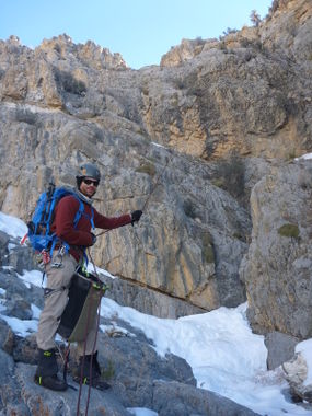
The hike and canyon are at 5,200-7,800', so this area will be cooler than most Death Valley canyons. There may be snow in the winter. It is viable to do this canyon later in the spring than most canyons in the park.
13-27 rappels? What kind of description is that, you might wonder. Canyoneers may rappel 27 times, if they wish. 'Rim-ineers' can bypasss 14 of those drops, which speeds up the day.
Approach[edit]
The GPS track in the beta shows a route just to the left (north) of the canyon. However, we went up to the right of the canyon, starting far right of it. Our route was not good. Hopefully the GPS track is better.
Descent[edit]
Optional R1 40 feet from knot chock, can be downclimbed.
R2 25 feet, retrievable anchor from a tree.
Optional R3, we downclimbed.
R4 150 feet from a pinch. Rappel looks really big from the top.
Long downclimb.
R5 160-foot two-stage, anchored from slung big rock.
R6 35 feet from small rock rock on canyon right. R7 40 feet, releasable anchor (which didn't want to release) on small arch on canyon right.
Option R8 or bypass right on limestone slabs.
Downclimbs.
Long nearly level section ending at 6,350' elevation.
R9 35 feet from small rock chock on canyon right.
Optional R10 (could be combined with R11) or bypass right.
Optional R11 about 40 feet down slope, or continue bypassing on ledge on canyon right.
R12 95 feet from slung large rock in watercourse.
Optional R13 about 60 feet, two-stage with impressive overhanging keeper pothole in the middle. Or bypass right.
R14 20 feet from fist-sized rock chock in floor.
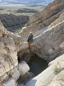
Cool, shallow section of canyon with patios and small dry potholes due to bedding of limestone.
R16 20 feet from small bush.
R17 30 feet from single knot chock on right wall of a pothole at the top of the rappel.
Optional R18 two-stage, or bypass left on ledge.
Optional R19 20 feet, or bypass left.
Optional R20 20 feet. We used meat anchor and last person bypassed.
Optional R21 30 feet. Meat anchor, or bypass left.
Optional R22 20 feet, or bypass left.
Junction with south fork.
Several more bypasses.
Optional R23 20 feet into pothole with steps out on left, or bypass drop on right.
R24 30 feet, we used meat anchor then counter-anchored rope from bottom through a hole in the false floor.
R25 80-100 feet from small bush. About 80 feet for first stage, 100 feet if combined with a second stage that can be bypassed on right.
R26 80 feet from a bush.
R27 20 feet from a knot chock in left wall of a stinky pothole. A little challenging to get over the overhanging lip of the pothole to start the rappel. Flinging pack over the endge and using webbing attached as a counterweight helped.
Scrambles, pothole bypasses.
Exit[edit]
Red tape[edit]
Dispersed roadside camping is allowed at the trailhead. It is allowed at least one mile from Ubehebe Crater Road to just before Teakettle Junction. [1] shows where roadside camping is allowed.
Beta sites[edit]
 Super Amazing Map : Diablo Track
Trip reports and media[edit]
FIRST DESCENT TRIP 12-14-13:
Background[edit]
Originally explored by Scott Swaney & Jared Plummer on 12-12-14

