Diabolic Passage
| Rating: | |||||||||||||||||||||||||||||||
|---|---|---|---|---|---|---|---|---|---|---|---|---|---|---|---|---|---|---|---|---|---|---|---|---|---|---|---|---|---|---|---|
| | Difficulty:3A III (v3a1 III) Raps:11, max ↨130ft
Red Tape:No permit required Shuttle:None Vehicle:Passenger | ||||||||||||||||||||||||||||||
| Location: | |||||||||||||||||||||||||||||||
| Condition Reports: | 10 Feb 2024
"The climb up was fun . . . but some might be scared by exposure. The descent from ridge to the first rappel was mellow. It would be great if someone c |
||||||||||||||||||||||||||||||
| Best season: | Nov-Mar (avg for this region)
|
||||||||||||||||||||||||||||||
| Regions: | |||||||||||||||||||||||||||||||
Introduction[edit]
The last 5 rappels are nice, and are back-to-back. The upper part was less exciting, and had tedious rocks and boulders. People who are not unduly bothered by heights will find the climb up fun and sporty.
It would be a great canyon if someone finds a sneak route to drop in for just the final five rappels.
Approach[edit]
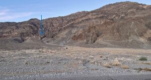
Park on shoulder of North Highway (aka Scotty's Castle Road), about 12.5 miles north of CA-190. Hike up alluvial fan to ridge just south of Diabolic Canyon's exit. The ridge has a good amount of solid rock, although you need to use your hands to scramble up in places. There is some exposure that might scare some people. But many experienced Death Valley canyoneers will find the approach more fun (and less loose) than others, like Deimos or Helios.
Once to the ridge starts leveling off, go all the way to the bottom of the steep headwall, then go down into the canyon on a gentle slope contouring to the head of the canyon. We did the south fork, but the Scott Swaney's track went a little farther to the north fork. They join up not far down canyon.
Descent[edit]
R1 (40 feet from pinch point) is right as you get to the canyon drainage.
Rocky gully.
Confluence with the north fork (which is the track's route).
Long downclimb immediately before R2.
R2 (25 feet from cairn) down a slope. Could be a hard downclimb, down dark gray limestone.
Canyon turns into smooth light gray, almost white, rock. Feels like a nice canyon starting here.
R3 (80 feet from pinch point), down vertical wall.
Short distance
R4 ( 100 feet from pinch point) over multi-stage rappel. Could probably be climbed but is crumbly.
Bypass/downclimb LDC
R5 (30 feet from pinch point), appears to be multi-stage but isn't. There is also a rock at edge that could work for retrievable counter-balance rappel.
R6 (50 feet from pinch point).
Canyon gets wide, walk for a long time through boulder field.
If there's a way to do a sneak route in after the boulder field, the next part of the canyon would be popular if could be a short day.
R7 (20 feet from big rock)
Downclimb
R8 (50 feet from chockstone - 20 feet to edge, then 30 feet vertical). Next rappel is immediate.
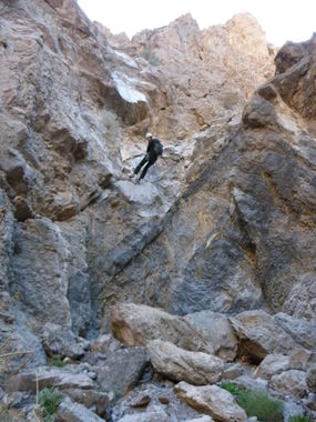
R9 (130 feet from pinch point). Two-stage. Rapel could easily be broken into two rappels of 50-60 feet each by building a cairn for second stage. There are plenty of good-sized rocks for a cairn. Next rappel is immediately after.
R10 (90 feet from pinch point). Two stages, each about 25 feet. Next rappel is immediate.
R11 (30 feet from cairn).
Canyon opens up into a wash.
Exit[edit]
Walk down wash then bump up onto the alluvial fan to the south (left). Easy walk to your car.
Red tape[edit]
Beta sites[edit]
 Super Amazing Map : Diabolic Passage
Trip reports and media[edit]
FIRST DESCENT TRIP 12-25-11:
Background[edit]
Originally explored by Scott Swaney on 12-25-11 & team, SEE REPORT ABOVE

