10 Nov 2024 "P4 wet line bolts on RL were bent close to flat against the rock. Trip continued down Margaret Falls, which was awesome exposure and a good technical
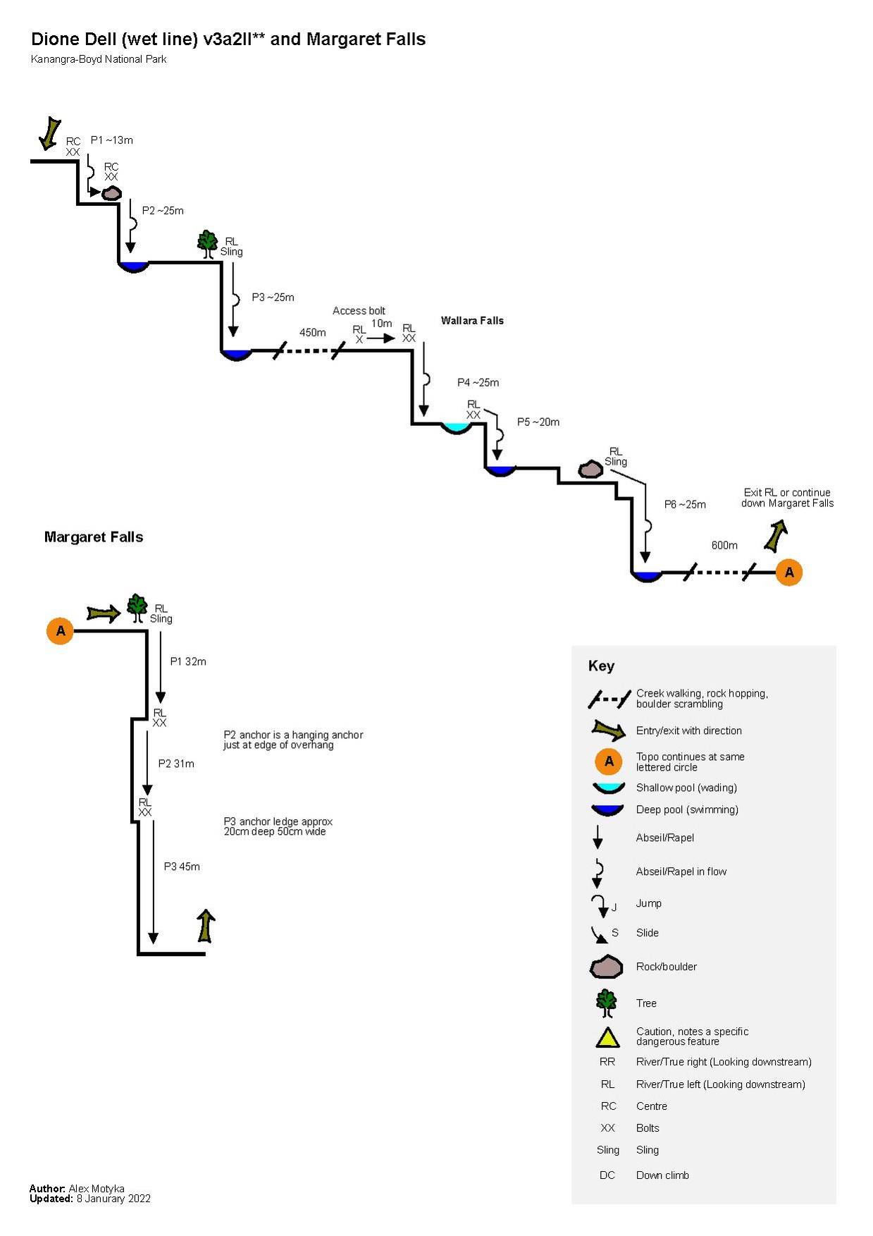
These notes cover the "wet line" through Dione Dell. This line increases the technical difficultly and aquatic novelty. Water levels can range from gentle to high flow depending on seasonal rain. Dry line options can be taken for any abseil deemed too risky depending on water level. For the classic dry line track notes please see OZultimate's Dione Dell track notes.
Dione Dell is a great second day option after doing one of the bigger canyons in Kanangra Boyd National Park.
Proceed along the Dione Dell entry/exit route (also known as the Margaret Falls entry route) until -33.99787, 150.09710
Proceeding along the defined path at this point will take you to Margaret Falls... however veering right and following the GPX entry route provided (click on map above or download from Gaia) will take you to the junction of Dione Dell Creek and Christies Creek.
The entry route has been marked with orange tape (do not remove). If you find yourself bush bashing you're off the route.
This new entry route saves a lot of time and can be completed in approximately 30 minutes
Canyon starts at approximately -34.00272, 150.09092
Descent
The canyon starts in the "river centre" of the waterfall fed by Christies Creek
Proceed down canyon referring to the Dione Dell v3a2II** canyon topo for details on "problems" you will encounter along the canyon
The canyon ends at Margaret Falls (-34.00831, 150.09522) which is considered its own adventure but is descendable. You will need appropriate technical skills to deal with hanging anchors.
Exit
Exit river left along the ridge via the Margret Falls entry track/Dione Dell exit track
Track is relatively well defined "goat track" however regrowth can result in loosing the track
The track will take you to the junction at -33.99787, 150.09710 where you veered off to enter the canyon. Proceed back to car.