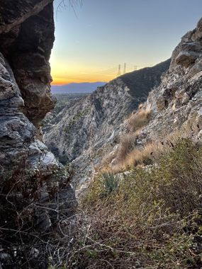
Dry Taco Ravine
| Rating: | ||||
|---|---|---|---|---|
| | Difficulty:3A II PG (v4a1 II) Raps:6, max ↨200ft
Red Tape: Shuttle:None Vehicle:Passenger Rock type:Granite | |||
| Start: | ||||
| Parking: | ||||
| Condition Reports: | 21 Apr 2024
"Who wants to run Dry Taco when there is Eaton Canyon right next door? Decided to scope out Dry Taco again after a year and Im reminded why I dont d |
|||
| Best season: | ||||
| Regions: | ||||
Introduction[edit]
If you are looking for big vertical (1500 feet) with minimal horizontal (from the approach road to Eaton wash mega trail), ZERO poison oak, and a few yuccas to dodge, Dry Taco Ravine is made for you! Note that the first 2 rappels have lots of loose rocks, thus the PG rating.
Approach[edit]
Parking near Pinecrest Dr and Crescent Dr in Altadena (same as for Eaton Canyon), head toward the gate at 34.19163, -118.10545 (note: the gate is timed entry during daylight hours), down across the bridge and hike up the Wilson Toll road past Henninger Flats to the T junction at 34.19722, -118.08614. Head West (downhill) toward Telephone trail (Eaton approach), but take the first left branch on the road and continue to the very West end at 34.19498, -118.09557 (slightly West of the Helipad). Head North off the road at 34.195083, -118.095388 where it makes a gully, but head a bit right and follow the cut path on the ridge through dense brush about 150 feet. The path angles hard left for 50 feet to a large bush The path then angles hard right dropping significantly and quickly there after dropping very steeply down earthen terrain to the first rappel at 34.19541, -118.09637.
Descent[edit]
R1 120' off a stout bush around a few yuccas, DCL over a crumbling rock ridge (PG)
R2 150' off a descent bush around more yuccas
Head down the main drainage past a few short sketchy downclimbs. 24NOV2022 there is webbing anchor under a boulder canyon center for the 3 short downclimbs at (34.19483, -118.09761).
A few minutes hike leads to the "main event" at 34.19477, -118.09806:
R3 100' off big bush on the ridge DCR above the drop
R4 75' off a BFR center drainage
Continue down scree and talus to the BIG :) rappel:
R5 180' off a eyebolt and 2.5" bush growing out of the rock high DCL. There are 3 stages, so keep going until you are getting close to the end of 200 foot rope.
Continue down to the last rappel:
R6 40' off a BFR center drainage
From the bottom of R6 (note the graffiti) it's a few minutes hike to the main Eaton drainage.
Exit[edit]
Head down the Eaton wash to the Wilson Toll Road bridge, climb up on either side, head up to the gate and back to your car.
Red tape[edit]
Beta sites[edit]
Trip reports and media[edit]
Background[edit]
No clue why anyone would want to explore this ravine!
