Eaton (East Branch)
| Rating: | |||||||||||||||||||||||||||||||
|---|---|---|---|---|---|---|---|---|---|---|---|---|---|---|---|---|---|---|---|---|---|---|---|---|---|---|---|---|---|---|---|
| | Difficulty:3B III PG (v4a2 III) Raps:4, max ↨110ft
Red Tape:No permit required Shuttle:None Vehicle:Passenger Rock type:Granite | ||||||||||||||||||||||||||||||
| Location: | |||||||||||||||||||||||||||||||
| Condition Reports: | 31 Oct 2021
"Will skip everything in Eaton. The only real thing to report is that there is A LOT of poison oak. Harder to spot out this time of year as it was most |
||||||||||||||||||||||||||||||
| Best season: | Dec-May
|
||||||||||||||||||||||||||||||
| Regions: | |||||||||||||||||||||||||||||||
Introduction[edit]
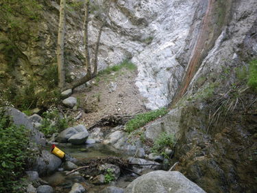
This canyon would normally be done as a front end bonus canyon on an Eaton trip, adding an additional 2 to 3 hours. Most of it is heavily covered in a tree canopy with trickle water flow down through many small pools over slippery bare rock. Using a long walking stick helps getting down the many slick rocks. It's mostly clear of any brush, and just a few spots where careful movement is required to avoid touching poison oak. The final 110' rappel drops you nearly into the main Eaton Creek, just 100 yards upstream of the normal drop-in approach point.
Approach[edit]
Follow any of the normal Eaton Canyon approaches to the high point (34.197117, -118.086281) where the Wilson Road goes right, and the Eaton approach goes left. Follow the Wilson Road for another 0.6 miles to the Idlehour trail (34.199327, -118.079883). There is a trail to water capture infrastructure about 0.3 miles from the junction, but it dead ends, not connecting to the Idlehour trail, unless you enjoy climbing extremely steep earthen slopes to make the short cross country connection. Instead go the full 0.6 miles and take the Idlehour trail through a saddle at 3400 feet, and continue downhill to the drop in point (34.204425, -118.079322) where the trail crosses a rock wall with culvert. Beware of the excessive poison oak growing heavily on both sides of the Idlehour trail!
Descent[edit]
There are 2 optional rappels 30 and 25 feet (ghosted off of a big tree and a marginal bush), two mandatory rappels 25 and 110 feet (webbing anchors). Note that the 2 bush stocks for the final rappel are not that solid, so as of April 2018 they are backed up with a rope tied to a wedged log in the creek 20 feet upstream. Also there is much loose rock on the 110 foot rappel! Thus, warranting the PG rating.
Exit[edit]
Walk 100 yards downstream to the normal drop-in approach point for Eaton Canyon (lower). One could hike back up the Eaton approach trail, just doing this canyon, but obviously once here, you might as well do Eaton (lower)!
Red tape[edit]
Beta sites[edit]
Trip reports and media[edit]
A video summary of a trip in June of 2012 can be seen here.
Approaching the final 110' rappel: https://drive.google.com/file/d/0BwrjU22tpdjYajRfb21zSlVuYjg/view
Doing the final 110' rappel with a 200 foot rope (doubled over): https://drive.google.com/file/d/0BwrjU22tpdjYOHRoMzdVZ0o1dUU/view
Background[edit]
Christian Lupercio explored this back in 2012. Christian heard voices downstream in the main Eaton creek but never caught the party. He found out later that Chris Brennen and company were doing Eaton (lower) that very same day. As of the creation of this Ropewiki page (April 2018) the original webbing and rusty quick-links are still in place, although one of the final rappel bush stocks died, so the webbing was moved to another live stock.


