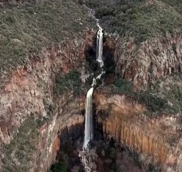
Encinoso Falls
| Rating: | |||||||||||||||||||||||||||||||
|---|---|---|---|---|---|---|---|---|---|---|---|---|---|---|---|---|---|---|---|---|---|---|---|---|---|---|---|---|---|---|---|
| | Difficulty:3A II (v3a1 II) Raps:2, max ↨215ft
Red Tape:No permit required Shuttle:Required 1- 1.5 hrs Vehicle:High Clearance Rock type:Basalt & Ssndstone | ||||||||||||||||||||||||||||||
| Location: | |||||||||||||||||||||||||||||||
| Shuttle: | |||||||||||||||||||||||||||||||
| Condition Reports: | 5 Oct 2024
"I went late afternoon to bounce the drops, caver style. Rigged both, rappelled and ascended.. The hike to and from R1 took me 1hr each way. Once i |
||||||||||||||||||||||||||||||
| Best season: | Oct-May (avg for this region)
|
||||||||||||||||||||||||||||||
| Regions: | |||||||||||||||||||||||||||||||
Introduction[edit]
Encinoso Falls in Oak Creek Canyon is a roadside waterfall that flows during snow melt in the spring and monsoons in the summer. Access to the top requires a car shuttle, and the roads are typically closed during winter months. The shuttle will require a high clearance vehicle. During dry conditions this makes for a casual 6-8 hour day, with 3-4 hours of canyon time. The swimming hole at the bottom of the route will be hard to resist.
Approach[edit]
Hike a short distance northwest across the flat rim toward the main drainage. The drainage is best accessed at the head, where you will be greeted by up to 3 moderate downclimbs that can be rappelled if needed.
Descent[edit]
The first mandatory rappel is 140' from a bolted anchor LDC. Soon after, rappel number 2 is 215' from a bolted anchor RDC.
Use extra caution when deploying the ropes, alerting potential hikers and climbers below.
Exit[edit]
Continue down the main drainage and eventually locate a climber's trail on the RDC side that leads down to the creek. A couple hundred feet downstream is a really nice spot to swim and enjoy the shade.
Red tape[edit]
Beta sites[edit]
Trip reports and media[edit]
Background[edit]
"The Waterfall" has been a popular Hard-Trad Climbing crag since the 1980's.
The top down canyoneering route was first explored and established by Eric Moorcroft, Jason First, and Justin Weih July 29, 2024.
