Escape Creek
| Rating: | |||||||||||||||||||||||||||||||
|---|---|---|---|---|---|---|---|---|---|---|---|---|---|---|---|---|---|---|---|---|---|---|---|---|---|---|---|---|---|---|---|
| | Difficulty:3A II (v3a1 II) Raps:5-7, max ↨55ft
Red Tape:No permit required Shuttle:None Vehicle:Passenger Rock type:Gneiss | ||||||||||||||||||||||||||||||
| Start: | |||||||||||||||||||||||||||||||
| Parking: | |||||||||||||||||||||||||||||||
| Condition Reports: | 18 Jun 2023
"Plenty of recent rain caused the canyon to be flowing and quite a bit of fun. There is no clear trail on the hike up; just try to vaguely follow the r |
||||||||||||||||||||||||||||||
| Best season: | Apr-Oct
|
||||||||||||||||||||||||||||||
| Regions: | |||||||||||||||||||||||||||||||
Introduction[edit]
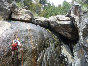
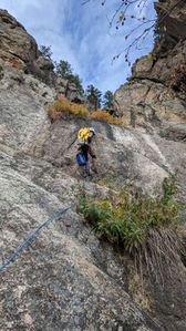
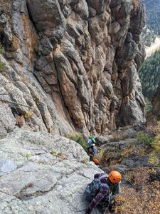
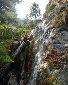
Escape Creek Canyon drains a short gulch near the town of Waltonia, east of Estes Park. The upper gulch is tame - relatively open and forested. But the short last stretch breaks through a large pegmatite crag, forming a number of dry falls. These dry falls are the technical section of this canyon. This technical section is one of the best dry foothills canyons on the Front Range.
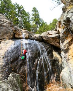
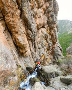
For most of summer and autumn, the canyon is dry. If you descend it during this time, the route is little more than a sport rappelling route, though it is pretty. During winter small ice flows form, which makes the canyon potentially dangerous to descend. Spring is the best time to go. Usually around late April into early May, or after several days of a continuous rain, the water flows through the canyon and creates a number of photogenic waterfalls. The current never becomes strong enough to cause difficulties (aside for slick rocks), though you will get wet sliding down parts of the canyon. This is by far the best time to descend this route.
The descent takes half a day. The longest rappel reaches 60 feet or so, but a 50 meter rope is recommended, as a number of rappels can be combined. The hike to the top is very steep, and is exposed to the full sun, so bring plenty of water. There are no water sources along the route.
Escape Creek makes for a quick half day, good for early season, potentially wet, training canyon without a long approach.
Approach[edit]
From the town of Drake on Highway 34 (Big Thompson Canyon, west of Loveland and east of Estes Park), drive roughly 2.6 miles up Highway 34 to True Gulch, past the pulloff to Waltonia. At Waltonia, a passing lane appears. When the passing lane ends, the road curves to the west. On this curve is where True Gulch crosses in a tunnel under the highway. There is a large pile of dirt here, in a pulloff. Park here.
Looking up the Big Thompson canyon, you'll see the large crag known locally as Mary's Bust. It has several unfinished bolted routes on it. The canyon drains to the right (north) of Mary's Bust. The crags to the right of the canyon are more broken.
The canyon appears as an unnamed temporary drainage on the maps. It is the next one up the road from True Gulch (0.15 miles).
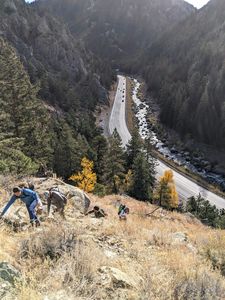
Climb the steep slopes to the west of True Gulch. The steepest section is by the road. Don't hike along the rim of the technical section, rather the slopes to the north (right) of the rim. After gaining over some larger cliff bands at the bottom, slowly work your way up and towards the top of the technical section, following various game trails along the way. The top point is pretty obvious when you get there - above, the stream winds through forest, then plunges 50 feet or so down a cliff. The hike to the top will take around 30 minutes, or longer if you take plenty of rests.
Descent[edit]
Near the first rappel, a small creek bed appears from a wooded area. Occasionally in the spring or after large rains, the creek runs, but the canyon remains dry for most of the year. Small, ankle deep pools may exist throughout the canyon, particularly at the bottom of R2 and R3/Downclimb, but they're typically very easy to avoid.
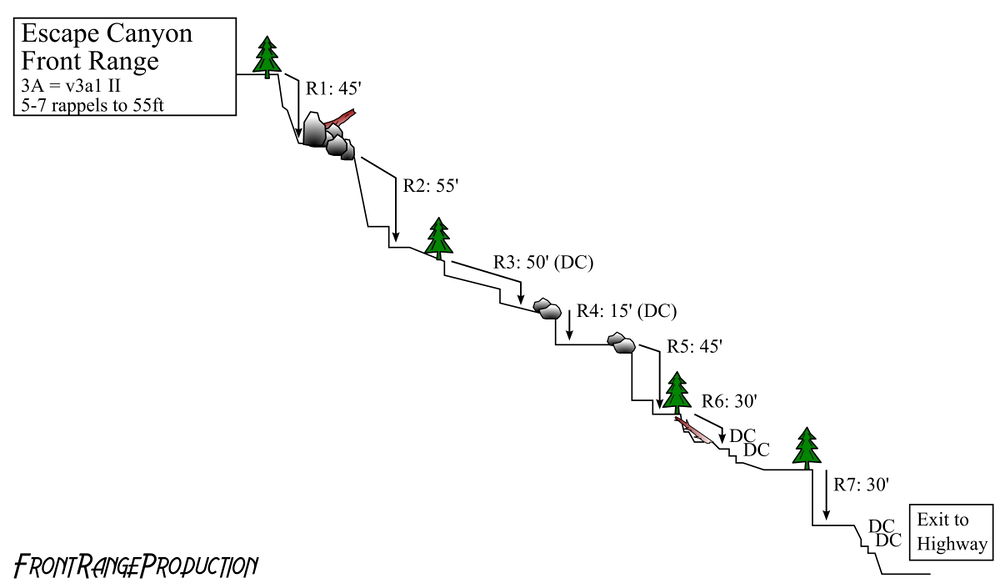
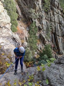
R1: 45' from a tree DCR
R2: 55' from a boulder
R3: Downclimb or 50' rappel from tree in watercourse. Typically this is a fairly easy downclimb, but flowing water can obscure the rock below and make the downclimb tricky
R4: 15' from a boulder or a downclimb. This is a relatively small drop that can be easily completed with a partner assist or handline.
R5: 40' from of a large boulder DCR. This rappel ends on the next shelf down. Look for a large log leaning against a wall which indicates the start of R6.
R6: 30' from a tree DCL.
R7: 30' from a tree in the watercourse or bypassed on either side.
Exit[edit]
Eventually you'll reach the road. Walk along the road for 0.15 miles back to True Gulch and your car.
