Falls Creek (Pagosa Springs)
| Rating: | |||||||||||||||||||||||||||||||
|---|---|---|---|---|---|---|---|---|---|---|---|---|---|---|---|---|---|---|---|---|---|---|---|---|---|---|---|---|---|---|---|
| | Difficulty:4B III R (v5a2 V) Raps:3, max ↨405ft
Red Tape:No permit required Shuttle:None Vehicle:Passenger Rock type:Volcanic Conglomerates, Sandstone and Mudflow Breccia | ||||||||||||||||||||||||||||||
| Location: | |||||||||||||||||||||||||||||||
| Condition Reports: | |||||||||||||||||||||||||||||||
| Best season: | July-Sep
|
||||||||||||||||||||||||||||||
| Regions: | |||||||||||||||||||||||||||||||
Introduction[edit]
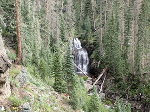
Hiking to Fourmile Creek Falls (275') and Falls Creek Falls (405') is a popular 3 mile out and back summer hike from the trailhead near Pagosa Springs.
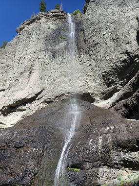
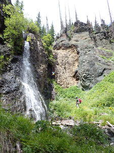
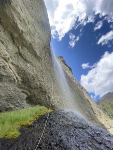
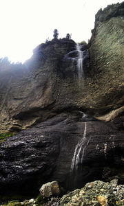
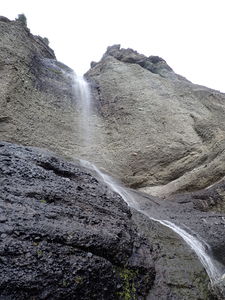
Falls Creek Falls is the larger of the two waterfalls, but requires a longer hike and a tougher off trail uphill approach to get into the canyon. Falls Creek Falls has a walk off at 310', but requires the full height of 405' for the pull.
Once complete, the return is easy on the same approach trail, or a short hike on trail reaches the top of Fourmile Creek Falls (275').
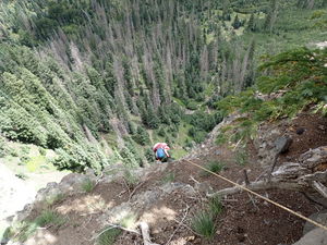
Many challenges come with big rappels such as this including not being able to see the rappeler from above and rigging appropriate friction for a smooth descent.
This waterfall is a confirmed nesting site for the Black Swift, listed as a Species of Special Concern by the U.S. Forest Service and U.S. Fish and Wildlife Service. The swifts migrate from Brazil annually to occupy this site from late May until late September, raising a single chick. The swifts are susceptible to disturbance from human activities near their nests, including noise and movement, direct disturbance or destruction of their nests, and trampling of vegetation. Canyoneering/climbing at this waterfall during the Black Swift nesting season (late May - late September/first frost) is likely to cause direct damage to nests, eggs, and young, and disturb adult swifts enough to cause them to abandon their nest and offspring. Click here for more information on the Black Swift.
Approach[edit]
Hike the Fourmile Creek trail from the parking lot for 3.4 miles to the remaining foundation of The Steel Bridge, as marked on the USGS map layer. Continue on the left side of Fourmile Creek (looking upstream) until Upper Fourmile Falls comes into view.
For another 0.65 miles, head steeply uphill following game trails when possible and target the saddle due west of remaining foundation of The Steel Bridge. Drop down the opposite side into Falls Creek and follow Falls Creek downstream to R1.
Descent[edit]
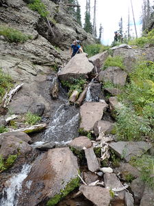
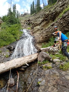
R1: 130' from a pine tree on Canyon Right to protect several shorter cascades
R2: 75' from a tree in Canyon Center
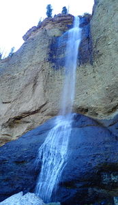
Falls Creek Falls
R3: 405' from a tree on Canyon Right, a walk off is possible at 310', but requires the full height of 405' for the pull
Beware hikers at the base of Falls Creek Falls below
Exit[edit]
Once on the ground after Falls Creek Falls, hike back to the parking lot via the same approach trail or hike to the top of Fourmile Falls if adding another waterfall descent to the day.
Red tape[edit]
Beta sites[edit]
Trip reports and media[edit]
June 2018: visited by Ira Lewis and Lisa Purdy Lewis
Aug 2021: descended by Ira Lewis, Chris D'Amico and Mike Gulsvig
