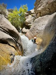
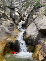
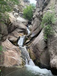
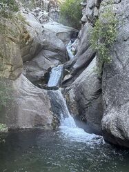
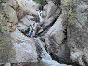
Fort Creek (Three Falls)
| Rating: | |||||||||||||||||||||||||||||||
|---|---|---|---|---|---|---|---|---|---|---|---|---|---|---|---|---|---|---|---|---|---|---|---|---|---|---|---|---|---|---|---|
| | Raps:2-7, max ↨145ft
Red Tape:No permit required Shuttle:None Vehicle:Passenger Rock type:Granite | ||||||||||||||||||||||||||||||
| Start: | |||||||||||||||||||||||||||||||
| Parking: | |||||||||||||||||||||||||||||||
| Condition Reports: | 13 Jul 2025
"Did the canyon as a group of 3, took 4 hours car to car. All anchors are in good condition and in the locations described on ropewiki. |
||||||||||||||||||||||||||||||
| Best season: | June-November
|
||||||||||||||||||||||||||||||
| Regions: | |||||||||||||||||||||||||||||||
Introduction[edit]
Canyons like Three Falls are unique in Northern Utah. It offers sections of committed slot and deep pools unseen in most nearby canyons and features considerable bushwhacking, logjams, slippery downclimbing and water features. That being said, it wouldn't hold up against other class C canyons in the West; but, is one of the best local canyons for those living in the SLC/Utah County area.
Note: This page contains information for the Lower Fort Creek (aka Three Falls) route, which is the only track recorded on the map above. The full route is a combination of Upper and Lower Fort Creek routes and starts at 40°30'04.6"N 111°45'52.3"W. Upper Fort Creek contains three low-angle rappels that can be avoided by downclimbing; but, won't be worth it for most since Lower Fort Creek contains all of the goods. You can view the details for the full route by checking out the Upper Fort Creek ropeWiki page at:
Approach[edit]
The best place to start is at the trailhead where the Three Falls hiking/biking trail crosses North Three Falls Drive. Park on the side of the road here. After a few switchbacks and about 5 minutes of hiking--but before reaching the bridge that crosses Fort Creek--you will leave the maintained trail and follow a ridge upward to the north, northeast. There is a very obvious social trail all the way up this ridge, but there are also a few intersecting trails where you can tell people have gotten off route in the past and, which could do the same to you, so keep you eyes open. Following the GPX track posted on this page will pretty much keep you spot-on target the whole way. Continue on foot up the ridge. There will be over 900 feet of elevation gain before you top out and drop into the drainage. Expect some bushwhacking, but good paths can be found through the scrub oak. Just before you top out there is an option to take the alternate, West Ridge Approach which is detailed bellow, otherwise stay on the social path to descend the standard, Erosion Gully route.
Standard Approach aka the Erosion Gully[edit]
Follow the main social trail as it tops out and starts to descend down to the drainage. The route down the gully gets loose and step in some places. Footing is bad and you will slip and slide; but, this section of the approach is short and not too terrible. Still, exercise caution and use tree branches as hand holds as you descend. Despite being fairly well worn and obvious, by now, it is still easy to get off the main track here and have to bushwhack.
The Erosion Gully approach will drop you into the drainage at 40.49535, -111.76994. You will encounter a handful of fun waterslides and the impressive Wall of Springs (RDC at 40.495978, -111.769808) as you descend the drainage to the point where the West Ridge Approach meets the drainage and to where the technical descent begins. The spring can double the flow to the the creek at certain times of the year, FYI!
West Ridge Approach[edit]
Before reaching the top of the hill cut to the left to GPS way point 40.49535,-111.76994. This point will lead you out a ridge that runs towards the west and to a sloping hillside that ends in a cliff. This cliff is 120 feet tall. Put on your wet suits here before the rappel into the canyon. The approach rappel (aka rappel 0) is anchored via some [yellow] webbing around the bottom of a fir tree on the right side of the ridge 3/4 the way out the ridge. This rappel will drop you into the drainage right at the waters edge in a location right before the wall of springs that come out of the right side of the canyon.
This approach will skip a few fun water slides and the Wall of Springs as you enter the drainage below them.
Descent[edit]
West Ridge Approach Rappels[edit]
- Rappel 0 (Approach Rappel) (120 feet) This rappel is NOT in the watercourse and will ONLY be encountered if doing the ridge approach. This will drop you into the drainage and place you at the water's edge. Yellow webbing to a tree on the right side of the ridge 3/4 the way out the ridge.
Main Descent Rappels[edit]
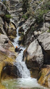
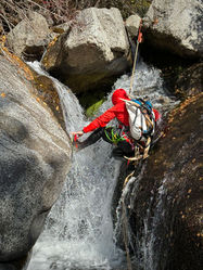
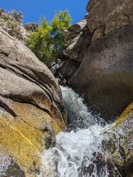
- Rappel 1 (60 feet)
- Option 1: Two-bolt, Unlinked Anchor DCR---these 2 bolts are designed to not need webbing and to be used with some type of blocking device (totem, figure 8, biner, etc.) Please don't put webbing on them
- Option 2: Webbing on tree roots DCL.
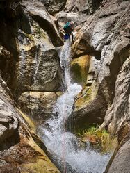
- Rappel 2 (95 feet)
- Option 1: 2 Bolts DCL---these 2 bolts are designed to not need webbing and to be used with some type of blocking device (totem, figure 8, biner, etc.) Please don't put webbing on them.
- Option 2: Tree DCL (this requires a semi-exposed climb up an eroded slope to get to. Provides a better anchor for rappelling in higher flow, no line of sight.
- Option 3: 2 bolts on DCR (better option for high flow) on an outcropping just left of the furthest right channel. Easily accessible in low flow. In higher flow you can rig a traverse line by using the enormous pine tree nearby---these 2 bolts are designed to not need webbing and to be used with some type of blocking device (totem, figure 8, biner, etc.) Please don't put webbing on them.
- Rappel 3 (55 feet)
- Option 1: V-thread Anchor DCL in granite rock (rappel directly in flow). Note the anchor may or may not be threaded. If un threaded, use the holes in the rock to thread a new anchor.
- Option 2: Single Bolt DCR (dry rappel)
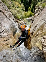
- Rappel 4 Two-Stage (10+ feet into a pool and then 20+ feet down a slab [50' Total]) Bolts DCL on other side of boulder. To access bolts, downclimb first ledge far DCL. Bolts are just to the right.
- Rappel 5 Single Bolt DCL. It is on the back side of the rock in the stream flow
- Rappel 6 (30 foot) Bolt DCR
- Rappel 7 Two-Stage (20 feet to a flat walk-off and then 20 feet to a pool) Tree Sling DCL - Note, this can be set up as two separate rappels using another tree sling DCL. Doing this as two raps does make the pull less likely to get hung up.
It's recommended to rappel all of it rather than down climbing because slipping would send you down the slide and over the cliff. Moderate-High water levels will make many down climbs very dangerous/impossible.
Keep going till your reach the bridge. Walk DCL down the trail back to your car approx 5 minutes away.
The popular "Natural Waterslide" frequented by locals is below the trail and past the canyon's end.
Exit[edit]
After exiting the creek at the bridge, follow the trail back to your vehicle.
If you stay in the drainage after passing the bridge, there is a 30-foot natural waterslide. However, it is on private property and is now sometimes patrolled by a security guard.
Red tape[edit]
North Three Falls Drive is currently a public road, so you can legally park there. However, the city plans on putting no parking signs near where the trail crosses the road. This will likely push back parking on the road by a few hundred feet to up to 1000 feet away from the trail. The developers/HOA in the area is attempting to have the city privatize the road so that the public are no longer allowed to park on North Three Falls Drive. If the road is privatized this will mean that the public will need park miles down the trail at the Three Falls Trailhead. This would make the route much longer for canyoneers unless you have a mountain bike, and even then it would be a full day. The developers don't currently have the votes on city council to get the road privatized, but that could easily change at the next election cycle. If you want public access to continue at the upper trailhead along North Three Falls Drive, let the city know.
Beta sites[edit]
Trip reports and media[edit]
 YouTube.com : What Some Guy Does, Canyoneering Three Falls (Fort Creek)
