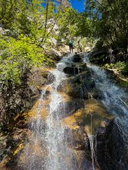
Fort Creek (Upper)
| Rating: | |||||||||||||||||||||||||||||||
|---|---|---|---|---|---|---|---|---|---|---|---|---|---|---|---|---|---|---|---|---|---|---|---|---|---|---|---|---|---|---|---|
| | Raps:6-13, max ↨145ft
Red Tape:No permit required Shuttle:Optional Vehicle:Passenger Rock type:Granite | ||||||||||||||||||||||||||||||
| Start: | |||||||||||||||||||||||||||||||
| Parking: | |||||||||||||||||||||||||||||||
| Shuttle: | |||||||||||||||||||||||||||||||
| Condition Reports: | 14 Sep 2024
"Canyon took 6 hours car to car. Replaced almost every anchor station. The canyon description doesn’t seem entirely accurate, there were more section |
||||||||||||||||||||||||||||||
| Best season: | May-Oct
|
||||||||||||||||||||||||||||||
| Regions: | |||||||||||||||||||||||||||||||
Introduction[edit]
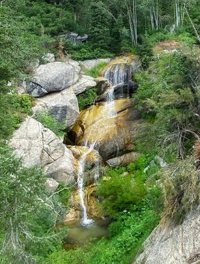
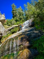
Everyone in the Wasatch has loved the quick pay-to-play of Fort Creek (Three Falls), but that's only a taste. If you want a full day of fun with more waterfalls, the Upper Section adds six more rappels of up to 100' and is the perfect addition for a full day of effort. Other options abound with a link-up of Second Hamongog (Upper East Fort Creek) if you're feeling adventurous.
Approach[edit]
Hike the ridge between Fort Creek and Fortknocker Falls to the top and descend above rappel one in Fort Creek (Upper). The approach hike is steep, and you'll gain 1,700 in elevation in only 1.3 miles. There is a primitive/game trail and many open areas that make hiking easier. Some creative route finding and bushwacking may be required.
Optional Approach (Shuttle):
We started at Schoolhouse Springs for the first exploration, requiring a car shuttle. The main road is North Three Falls Way, and the turn-off to the trailhead has a "No Trespassing" sign (North Aspen Drive). Driving this dirt road takes you to the trailhead parking, which appears to be legal by all the locals. This is where we parked. From the SHS approach, it is 4.3 miles and 2700' of gain to get to the drainage, hiking up to the First Hamongog and then continuing west to the Second Hamongog. From the Second Hamongog, you will hike west at the split (right goes up to Lake Hardy). Once you get to your drainage, drop in and continue downstream until you reach the first rappel. Review the beta for Second Hamongog/Upper East Fork Creek for more information: https://ropewiki.com/Second_Hamongog
Descent[edit]
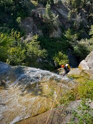
Rappel 1 (90 feet) – DCR red webbing on a pine tree.
Rappel 2 (100 feet) – DCL red webbing on a tree. (If needed, it can be broken into two 50-foot rappels or bypassed by downclimbing DCR.)
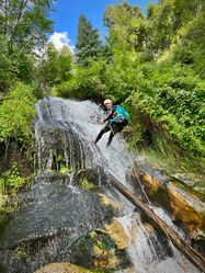
Rappel 3 (70 feet) – DCR used a fiddle stick off a large pine. (Also possible to downclimb or walk down the log, followed by a 5' shower (handline) or downclimb left (bypass), then a larger downclimb right.)
Rappel 4 (50 feet) - DCR black wedding off small willows.
Rappel 5 (50 feet) - DCR red webbing off small willows. (Also may be downclimbed DCL through thick vegetation.)
Rappel 6 (50 feet)
From the confluence, most will want to continue down Fort Creek (Three Falls) for the lower section of the canyon. However, there is an option for a heinous scramble/climb out to return to your approach trail (NOT recommended). Plan on a full day and descend the complete drainage.
Exit[edit]
After exiting Fort Creek (Three Falls) at the bridge, follow the trail back to your vehicle.
If you stay in the drainage after passing the bridge, there is a 30-foot natural waterslide. However, it is on private property and is now sometimes patrolled by a security guard.
