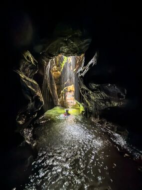
Geronimo
Jump to navigation
Jump to search
| Rating: | |||||||||||||||||||||||||||||||
|---|---|---|---|---|---|---|---|---|---|---|---|---|---|---|---|---|---|---|---|---|---|---|---|---|---|---|---|---|---|---|---|
| | Difficulty:3B III (v3a2 III) Raps:4-5, max ↨49ft
Red Tape:No permit required Shuttle:None Vehicle:Passenger Rock type:Sandstone | ||||||||||||||||||||||||||||||
| Start: | |||||||||||||||||||||||||||||||
| Parking: | |||||||||||||||||||||||||||||||
| Condition Reports: | |||||||||||||||||||||||||||||||
| Best season: | Oct-Apr (avg for this region)
|
||||||||||||||||||||||||||||||
| Regions: | |||||||||||||||||||||||||||||||
Introduction[edit]
A nice simple canyon. Worth doing once. Even better if paired with Horseshoe canyon next door which is the more impressive of the two canyons.
Approach[edit]
- Download the GPX or work out your own route
- Follow the Wollangambie One entry track down to the river at -33.48765, 150.35578
- Cross the river (normally low water and you'll only get your feet wet)
- Ascending from Wollangambie up involves a few scrambles and not a really well defined path, find your way to the top, you can see where others have been before you
- Once on top and you should see a faintly defined track on top, follow along the top of the ridge before dropping into the creek at a point that suits aiming for the start (approx -33.48138, 150.35038)
Descent[edit]
| Problem No. | Type | Metres | Location | Note |
|---|---|---|---|---|
| 1 | Abseil | 8m | RR | Sling on tree. Ends in shallow pool. |
| 2 | Abseil | 8m | RL | Anchor on wall. End in deep pool. |
| 3 | Abseil | 8m | RL | Anchor on wall. Ends in deep pool. Historically there was a hole you could abseil through (similar to Gobsmaker canyon) but this is now clogged with debris and rocks. Can be jumped but water level can vary in depth a lot so check first! |
| 4 | Climb/Traverse | 2m | RL | At the next drop you will need to climb up to a ledge on river left to reach the Problem 5 anchor. Sometimes a hand line is present but this is not guaranteed. If missing it's recommended to provide a belay to the first person because the climb is exposed (i.e. big drop on downstream side). |
| 5 | Abseil | 15m | RL | Sling on tree. Can be split in half if needed using another tree half way down the abseil. |
Exit[edit]
- Proceed to end of canyon which joins with Wollangambie River
- Proceed down Wollangambie River to the point you crossed on the entry
- Reverse the entry route back to car or go do Horseshoe canyon
