Granite Canyon
| Rating: | |||||||||||||||||||||||||||||||
|---|---|---|---|---|---|---|---|---|---|---|---|---|---|---|---|---|---|---|---|---|---|---|---|---|---|---|---|---|---|---|---|
| | Raps:11, max ↨250ft
Red Tape:No permit required Shuttle:None Vehicle:High Clearance Rock type:Granite | ||||||||||||||||||||||||||||||
| Start: | |||||||||||||||||||||||||||||||
| Parking: | |||||||||||||||||||||||||||||||
| Condition Reports: | 1 Aug 2025
"Large tree over 05S065 a few hundred feet past the turn off, would add 1.25 miles each way if its not cleared. Did not attempt canyon, only passing t |
||||||||||||||||||||||||||||||
| Best season: | Jul-Oct (avg for this region)
|
||||||||||||||||||||||||||||||
| Regions: | |||||||||||||||||||||||||||||||
Introduction[edit]
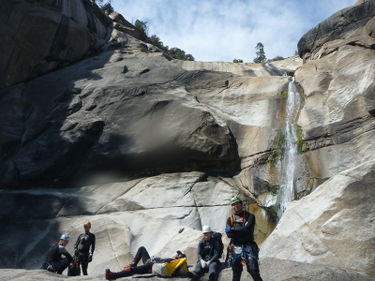
This is a great canyon, with magnificent views, jumps, slides and big rappels and short enough to be descended in one day.
Water levels can vary dramatically in this canyon, depending on the time of year and the snowpack of that year. Granite Creek is known to run CRAZY in big snow years.
Approach[edit]
Drive on Minaret Road to waypoint N37.47756 W119.27427, turn NE on Forest Rd 5s65 (named Piyau Rd) and go 1.4 miles to the end on the road and leave car in Trailhead lot. Hike East 1.3 down-hill on a sparse use-trail to Granite Creek. Several entry points near waypoint N37.49058 W119.24628, or further downstream to waypoint N37.48565 W119.24368 at 5450 feet (1st Descent party's entry). Any lower down will be difficult to drop into the canyon. A lot of Ceanothus leucodermis (a thorny brush plant) have grown up in the first half of a mile of the approach and are unavoidable in places. They don't exist after the first half of a mile.
Descent[edit]
Checkpoint: From the first truly committing rappel one can see the first set of narrows and gauge how much water runs through them. If you do not feel comfortable descending the canyon in those conditions abort the descent. There is a another drainage parallel to this canyon that carries much less water, this may be a fun route to descend if the main canyon turns out to be too high water.
The big rappels are all bolted but lesser one's use natural anchors in the watercourse. Anyone looking to descend this canyon will have to carefully gauge the water conditions and be prepared to rebuild anchors or add bolts to avoid risky situations.
Exit[edit]
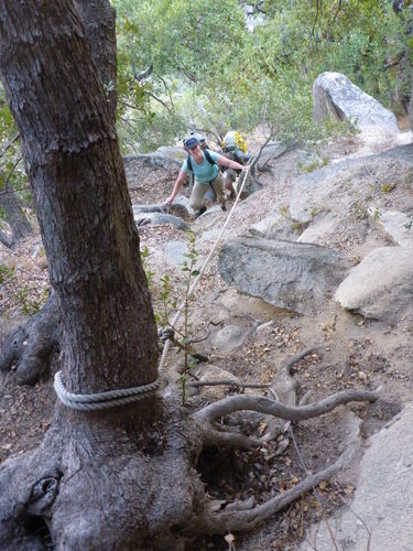
As of September 2014, there is a rope protected use trail from the San Joaquin River that heads back up out of the canyon - a very useful way to get out from the bottom and avoids attempting a wild unknown bushwhack / scramble to get back to the vehicles. Probably built by climbers getting access to Balloon Dome. After the final rappel walk several hundred feet on the canyon right side, through a primitive campsite, and look for the fixed ropes which signifies the beginning of the trail. The trail after the ropes is generously marked with cairns and is generally easy to follow.
Red tape[edit]
Canyon is inside burn area of 2020 Creek Fire. Expect impacts to road, canyon, and surrounding area. Before going, review any relevant Sierra NF alerts and closure orders. See also Sierra NF road conditions.
Beta sites[edit]
Trip reports and media[edit]
FIRST DESCENT TRIP REPORT - 9-12-2014:
https://www.facebook.com/scott.swaney/media_set?set=a.10156004857847930.1073742438.668617929&type=1
Video from September 3rd 2024 descent: https://www.youtube.com/watch?v=9VWseuDv4Zs
Background[edit]
The first descent of this canyon was led by Scott Swaney on Sept. 12, 2014 and the team included Dave Red, Luca Chiarabini, Michelle Nilles, Dominik Nadolski, Itaru Hiromi and Becca Greene. The first descent party used a higher longer entry point and after scouting the return trail, we found the better approach route described in this page. The first descent was intentionally run in low water conditions to minimize risks, future descents will have to gauge the water level carefully before they commit to the descent.


