Hamongoggins
| Rating: | |||||||||||||||||||||||||||||||
|---|---|---|---|---|---|---|---|---|---|---|---|---|---|---|---|---|---|---|---|---|---|---|---|---|---|---|---|---|---|---|---|
| | Raps:14-16, max ↨100ft
Red Tape: Shuttle:Optional 5 min Vehicle:Passenger Rock type:Granite | ||||||||||||||||||||||||||||||
| Start: | |||||||||||||||||||||||||||||||
| Parking: | |||||||||||||||||||||||||||||||
| Shuttle: | |||||||||||||||||||||||||||||||
| Condition Reports: | |||||||||||||||||||||||||||||||
| Best season: | May-Oct
|
||||||||||||||||||||||||||||||
| Regions: | |||||||||||||||||||||||||||||||
Introduction[edit]
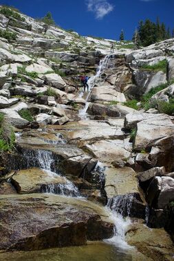
Big Brother route to East Hamongog.
Explored on 8/11/23 - 8/12/23 as an overnight trip to Lake Hardy (hiking up the western trail past second hamongog to the lake). The upper section of this route isn't vertical like the lower section, but it is definitely worth checking out. Sweeping views of the valley and Utah Lake that are quite incredible. Great way to link up a Lake Hardy visit with a full day descent.
Approach[edit]
The main road is North Three Falls Way, and the turn off to the trailhead has a "no trespassing" sign (north aspen drive). Driving this dirt road takes you to the TH parking, which appears to be legal by all the locals. This is where we parked. Starting your hike past the gate, you will stay on the dirt east of Schoolhouse Springs. From the SHS approach it is 2.1 miles and 2100' of gain to get to the drainage, hiking up to the First Hamongog and then continuing east up past the East Hamongog. Cross the creek and continue up the trail towards Lake Hardy.
Or you can approach the western trail past the second hamongog (which will be less direct to the drainage). We chose this option as we decided to camp up at the lake and take our time in the 2-day exploration.
Descent[edit]
UPPER SECTION
r1: 15'
> downclimb/cave
r2: 20'
> long cascading downclimb
r3: 60'
r4: 50'
r5: 70'
r6: 25'
Continue downclimbing the drainage until you meet up with the trail and the drop in for East Hamongog. Prior to reaching the trail (after r6) it is a little bushy, but nothing bad.
EAST HAMONGOG (Lower Section):
https://ropewiki.com/East_Hamongog#Descent
r1: 30'
r2: 30'
r3: 80' (2-stage)
r4: 40'
r5: 100'
r6: 100'
r7: 60'
r8: 100'
r9: 80'
r10: 80'
Exit[edit]
Head directly south up and over to Dry Creek. You will cross over another short drainage, and on the second ridge you will find a clear trail leading you down to the private property. Once you see the fence/boundary turn left and stay on the east side down to Dry Creek. Cross over the creek and head to the parking lot.
