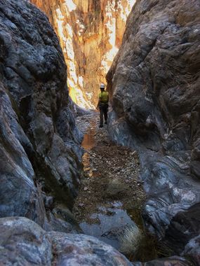
Horn Creek
| Rating: | |||||||||||||||||||||||||||||||
|---|---|---|---|---|---|---|---|---|---|---|---|---|---|---|---|---|---|---|---|---|---|---|---|---|---|---|---|---|---|---|---|
| | Difficulty:3A VI (v3a1 VI) Raps:2-3, max ↨130ft
Red Tape: Shuttle:None Vehicle:Passenger | ||||||||||||||||||||||||||||||
| Location: | |||||||||||||||||||||||||||||||
| Condition Reports: | 14 Apr 2018
"12 hours rim to rim descending to the river and ascending back up the fixed ropes - though this is a difficult day that wont work for everyone. I en |
||||||||||||||||||||||||||||||
| Best season: | Spring;Fall
|
||||||||||||||||||||||||||||||
| Regions: | |||||||||||||||||||||||||||||||
Introduction[edit]
Check the trip report for potentially helpful information.
There are two basic options to complete a descent of Horn Creek: a one way trip using packrafts to float to Monument Creek for the exit (with some advanced packrafting skills), or out and back for those adept at ascending ropes.
Approach[edit]
The western fork isn't much farther and provides a very simple, no nonsense approach compared to the one tricky downclimb in the eastern fork.
Descent[edit]
Exit[edit]
Red tape[edit]
Permits are required for all overnight trips in Grand Canyon National Park. There is a small, but nice camping area in the eastern fork where the trail crosses the drainage, but the park advises that you not drink the water due to trace radioactivity from a uranium mine upstream. NPS information can be found here: https://www.nps.gov/grca/planyourvisit/upload/tonto-bright_angel_to_hermit.pdf.
Beta sites[edit]
 Super Amazing Map : Horn Creek
 Grand Canyoneering Book by Todd Martin : Horn Creek
