John Blue Canyon
| Rating: | |||||||||||||||||||||||||||||||
|---|---|---|---|---|---|---|---|---|---|---|---|---|---|---|---|---|---|---|---|---|---|---|---|---|---|---|---|---|---|---|---|
| | Difficulty:3A I (v2a1 II) Raps:1-4, max ↨40ft
Red Tape:No permit required Shuttle:Optional 0.7 miles Vehicle:4WD Rock type:Limestone | ||||||||||||||||||||||||||||||
| Start: | |||||||||||||||||||||||||||||||
| Parking: | |||||||||||||||||||||||||||||||
| Shuttle: | |||||||||||||||||||||||||||||||
| Condition Reports: | 26 Jul 2025
"Nice to finally check this out, but hard to recommend highly. A couple nice features and lots of vegetation to bash through. It is a good addition to |
||||||||||||||||||||||||||||||
| Best season: | May-Oct, hot in summer
|
||||||||||||||||||||||||||||||
| Regions: | |||||||||||||||||||||||||||||||
Introduction[edit]
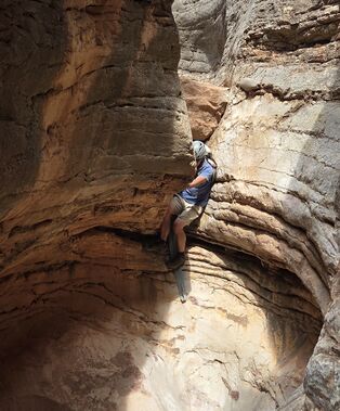
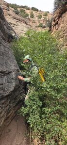
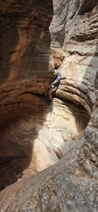
Comparing to Spur Canyon, John Blue Canyon also carves through a nice section of limestone. However, John Blue Canyon doesn't seem to get nearly the same water that Spur does. In Spur, this is evident by giant log jams and cleared out sections between obstacles. In John Blue Canyon, the vegetation has taken over in many locations making a descent annoying.
If in the area, it's a nice option to pair with Spur to make a full day, but it's hard to recommend very highly.
Times are listed using a car shuttle, parking on a wider section of the steep parallel road.
Approach from the bottom without a shuttle: 0.6 miles +340ft up the road.
Approach[edit]
Drive East from Lovell, WY on Alt Highway 14 over Bighorn Lake. Turn North on John Blue Road, following the dirt road to the base of John Blue Canyon.
Either set a Shuttle at (44.91104, -108.14577) and hike a short ways into the drainage 0.3 miles above the first obstacle or
Hike up the dirt road west of the drainage from the bottom parking and depart the road around (44.90852, -108.14786).
Descent[edit]
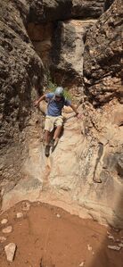
DC: 20'
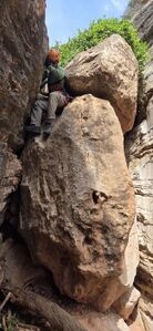
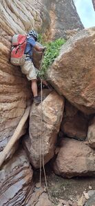
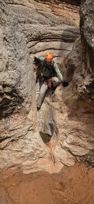
R1: 20' over a large chockstone from a tree DCL or bypass DCR
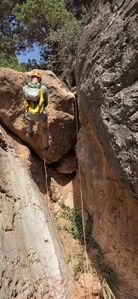
R2: 40' from the base of willows 25' back from the 15' drop or DC 15'
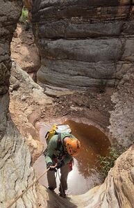
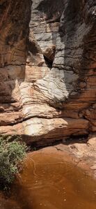
R3: 35' from a rock pinch DCL for two drops. The first can be downclimbed, but having a rope for the second helps avoid a muddy pool. The second drop is worn smooth, but could be partner assisted.
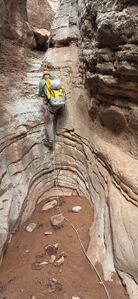
R4: 15' from an old rope tied around a chockstone at the top of the drop. This would be a downclimb if the limestone weren't so slippery.
DC: 10' using an old tow strap
DC: 10' past a tiny pothole
Exit[edit]
After the last obstacle, consider escaping the canyon DCR to avoid thick vegetation. Then hike the short distance back to the large parking area.
Red tape[edit]
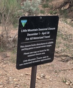
This area is Closed December 1 - April 30 for wildlife and big game.
Beta sites[edit]
 Super Amazing Map : John Blue Canyon
 CanyoneeringNorthwest.com (archive.org) : Big Horn Canyon National Recreation Area
Copied text from the CanyoneeringNorthwest.com archive page (dated around the early or mid 2000s)
Big Horn Canyon National Recreation Area Jeff Baird has contributed the beta and photos for John Blue Canyon and Spur Canyon. Though they aren’t in the Northwest, the canyons are definitely worthy of inclusion.
John Blue Slot
"This is a short canyon you can probably do in an hour or less. It has many drops less than 20 feet. We rappelled the first two drops, because there was a convenient tree at the drop. All the other drops we down climbed.
To get there, from Lovell Wyoming, drive East on Highway 14. Turn North at 44.8567 108.1749 and drive into John Blue Canyon. If you have time, stop and take a look at John Blue's Cabin, and old mountain man's cabin (N 44.901167 W 108.154900). You'll soon come to the exit of the slot canyon. There is a 4 wheel drive road that runs parallel to the slot canyon.
There's not many good places to park along that road, so you will probably want to park at the exit, then hike up the road until you get to a good drop in point. Then just scramble your way down into the canyon, and then the fun begins. Watch out for rattlesnakes!"
Trip reports and media[edit]
2025-07-26 a hot day in July chasing old beta to update ropewiki with new details, photos and kml. Ira Lewis, Wayne Herrick and Carl Bern.
