Kingsnake (Dinosaur)
| Rating: | |||||||||||||||||||||||||||||||
|---|---|---|---|---|---|---|---|---|---|---|---|---|---|---|---|---|---|---|---|---|---|---|---|---|---|---|---|---|---|---|---|
| | Difficulty:3A III (v3a1 II) Raps:0-3, max ↨50ft
Red Tape:No permit required Shuttle:Optional 45 min Vehicle:4WD - High Clearance Rock type:Sandstone | ||||||||||||||||||||||||||||||
| Start: | |||||||||||||||||||||||||||||||
| Parking: | |||||||||||||||||||||||||||||||
| Shuttle: | |||||||||||||||||||||||||||||||
| Condition Reports: | 4 May 2025
"The descent of Kingsnake took our team 1hr 40min. Some members of our team downclimbed every obstacle. We moved some loose rocks at the optional R2, w |
||||||||||||||||||||||||||||||
| Best season: | Autumn to Spring
|
||||||||||||||||||||||||||||||
| Regions: | |||||||||||||||||||||||||||||||
Introduction[edit]
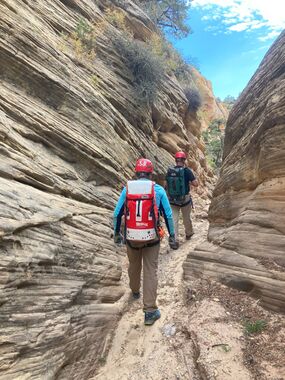
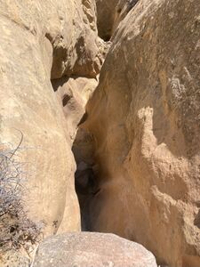
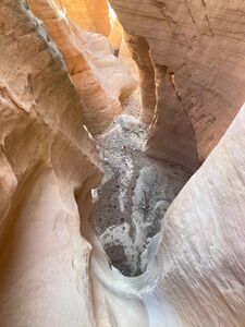
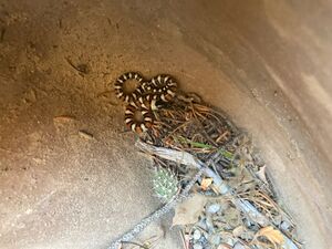
Kingsnake is located west of Snake Drop and gets its name from a small Kingsnake, which was rescued from a pothole about 2/3 of the way through the canyon. While we weren’t expecting much from this canyon, it surprised us with long sandstone narrows and interesting downclimbs. The sandstone narrows aren’t deep, but did extend for 0.5+ mile. There are a couple of rappels and enough downclimbs mixed in with narrows to keep it interesting. While fun, I probably wouldn’t repeat the canyon.
May 2025 update:
- The dirt BLM road from Harpers Corner Rd to the parking area will be muddy and hard to drive after rain.
- Ticks have been seen on Spring trips in the canyons in the Willow Creek Wilderness Study Area.
- Mormon Crickets are often seen in the Fall. While these may be unsettling to some, they don't bite.
Approach[edit]
Same as Snake Drop. From the Canyon Visitor Center at Hwy 40 and Harpers Corner Road, drive north for approximately 6 miles on Harpers Corner Road. Turn east onto a dirt road at 40.3034, -108.9443. Follow this dirt road east for approximately 2.7 mile and park at 40.3065, -108.9009.
Descent[edit]
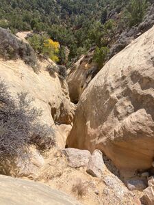
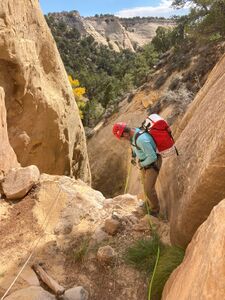
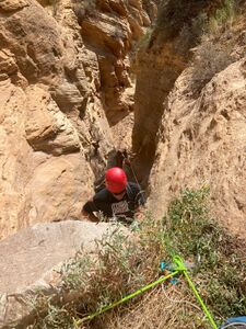
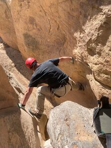
Hike around the private land to the north by the parking area and seek an old road which runs South down the ridge between Bearwater and Kingsnake. Hike this path south to reach the start of the sandstone at approximately 40.29037, -108.88557. The fun starts right from the beginning with a 25' rappel or 15' downclimb. There are multiple small down climbs where a handline is useful. The last person can downclimb with spotting or partner assist.
- DC: 15' (Optional R1: 25' from a meat anchor, or 50' from a tree set back from the edge.)
- DC: 25' (Optional R2: 30’ from a wedged log)
- short DC through a rabbit hole
Caution: Poison ivy chokes the canyon in multiple locations, and starts after this rappel. It can be avoided by carefully scrambling above the canyon floor.
- DC: 20' (Optional R3: 30’ from a large boulder. You can put away the harness.)
Note: We fiddled all of the rappels with no problem retrieving gear. No webbing was used. Canyon was dry.
- Numerous Downclimbs: For the remainder of the canyon there are numerous downclimbs ranging from 5’ to 20’. A handline maybe useful for one or two. The last person can downclimb with spotting or partner assist.
For the next 0.75 miles or so the canyon widens and narrows multiple times, until narrowing for a final time with small potholes and multiple small downclimbs.
Seek an exit drainage to the Northeast at (40.27663, -108.88660).
The canyon starts to widen and become brush choked at approximately (40.2760, -108.8862).
Exit[edit]
- Exit Option 1 (Out and Back) – Seeking the old road to hike back to the top vehicle is the preferred return. This trail has a gentle grade back up to the top and avoids dodging private land below. Exit Kingsnake near (40.27663, -108.88660) and scramble up a short drainage to the West to the old road on the ridge. From here retrace your steps back to the parking spot. About 2.75 miles and 1,500’ of gain from the end of the canyon narrows to the vehicle.
- Exit Option 2 (Car shuttle) - Brom the end of the canyon, hike south approximately 0.75 mile, following the canyon through sandstone walls, wet sections, brush and tree choked areas until approximately (40.2676, -108.8824). From here, leave the canyon and work east 0.4 miles, crossing a ridge, to avoid the private property south of here. Hike south to Hwy 40, leaving the Willow Creek Wilderness Study Area. It’s about 2+ miles from leaving the canyon to Hwy 40.
Red tape[edit]
Beta sites[edit]
Trip reports and media[edit]
Background[edit]
First known decent October 1, 2023. Jim R., Rob D. & team.
Second known decent May 2025. Ira Lewis & team. kml & beta updated
