Knee Canyon (North)
| Rating: | |||||||||||||||||||||||||||||||
|---|---|---|---|---|---|---|---|---|---|---|---|---|---|---|---|---|---|---|---|---|---|---|---|---|---|---|---|---|---|---|---|
| | Difficulty:3A II (v4a1 III) Raps:2, max ↨160ft
Red Tape:No permit required Shuttle:None Vehicle:4WD - High Clearance Rock type:Sandstone | ||||||||||||||||||||||||||||||
| Start: | |||||||||||||||||||||||||||||||
| Parking: | |||||||||||||||||||||||||||||||
| Condition Reports: | |||||||||||||||||||||||||||||||
| Best season: | Apr-Feb
|
||||||||||||||||||||||||||||||
| Regions: | |||||||||||||||||||||||||||||||
Introduction[edit]
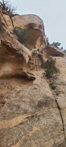
The Knee Canyons are two short canyons with big rappels, awkward starts and free hangs on the western side of Pinon Mesa in the McInnis Canyons National Conservation Area managed by the BLM as well as in the overlapping Black Canyons Wilderness Area. The return path up Mee Canyon Trail is part of the fun with a ledge, rabbit hole, and ladder.
North and South Knee Canyon are named here after what might be a typo on the 1984 USGS topographical map, which calls the drainage below these two canyon routes Knee Canyon. Other maps call this Mee Canyon, which matches the publicized details around the Mee Canyon Trail.
Each Knee Canyon has a separate entry in ropewiki, but can easily be done in a day along with visiting the large alcove upstream, even with the further trailhead parking Aug15-Feb15. The stats are for each canyon individually.
To do both Knees and the alcove in one day, the stats are:
Approach to South Knee Canyon from Mee Canyon Trailhead: 1.1mi -560'
Descend South Knee Canyon: 0.95mi -730'
Exit South Knee Canyon to the canyon bottom: 150ft -100'
Optional side trip to alcove out and back: 0.5mi +/-115'
Approach to North Knee Canyon up the Mee Canyon trail: 1.15mi +550ft
Descend North Knee Canyon: .45mi -400'
Return to Mee Canyon Trailhead from the end of North Knee Canyon: 2.95mi +1445'
Total: 7.15mi -1905ft +2110ft
A special note about roads in the area: From Glade Park, the Upper Access Road is open April 15 to August 15. The Lower Hunter Access Road is open August 15 to February 15. Both roads are closed Feb15-Apr15.
If hiking from the Lower Rattlesnake Arches Lower Trailhead (39.10731, -108.83927) at the end of the Lower Hunter Access Road (Aug15-Feb15), this will add an additional 2.8 miles +/-315' for a Grand Total of 9.9mi -2220ft +2425ft
Approach[edit]
Drive 4.5 miles North on S 16 1/2 Rd from Glade Park. Turn left on Black Ridge Rd for 1.3 miles to a T-intersection with the Upper Access Road (open Apr15-Aug15) and Lower Access Road (open Aug15-Feb15).
Either drive the Upper Access Road directly to the Mee Canyon Trailhead (39.09662, -108.84291) or
drive the Lower Access Road to the Lower Rattlesnake Arches TH (39.10731, -108.83927), which has less space for vehicles. Another parking location is available on the left just north of this gate.
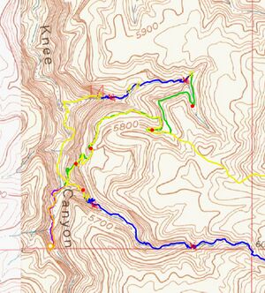
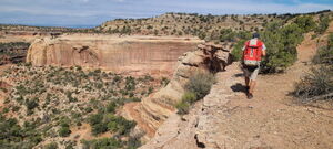
Hike to the Mee Canyon Trailhead from the Lower Access Road, if required. From the Mee Canyon Trailhead, hike the Mee Canyon Trail 1.7 miles to the canyon rim above the ladder, strike right (north) off the trail following a use trail to the head of North Knee Canyon (39.10188, -108.86557).
Descent[edit]
DC 15'
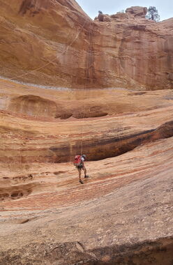
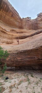
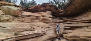
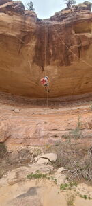
R1: 160' from a tree DCC for a free hanging rappel. A walk off looks possible on Rappeller's Right after feet hit the deck.
DC DCR
DC Bypass this nuisance drop on either side
R2: 110' rope for a 60' drop from a tree set back from the edge
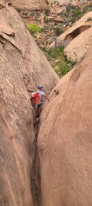
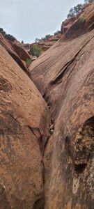
DC in a low angle slot
Exit[edit]
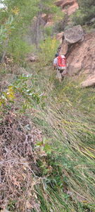
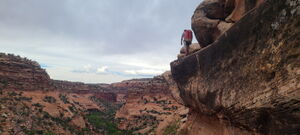
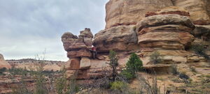
At the bottom of North Knee Canyon, turn left upstream in the main drainage negotiating the reeds to reach the Mee Canyon Trail. Hike up the Mee Canyon Trail to North Knee Canyon or the Mee Canyon Trailhead. The Mee Canyon Trail has abundant cairns to guide the way. Walk the ledge (wide enough), gain a flat section and crawl through a rabbit hole to wrap the corner, then hike around and up to gain the top ridge by climbing a short ladder and crawling through an arch. The trail is easy to follow back to the trailhead.
Red tape[edit]
Beta sites[edit]
https://www.alltrails.com/trail/us/colorado/mee-canyon-trail
The Mee Canyon Trail is an out and back trail starting from the Mee Canyon Trailhead. It descends the ladder, rabbit hole, and ledge down to Mee Canyon (as listed on all maps except the 1984 USGS) with the destination being a large alcove (39.09388, -108.87394) further upstream.
Trip reports and media[edit]
2024-09-21 first known descent. Ira Lewis, Wayne Herrick
