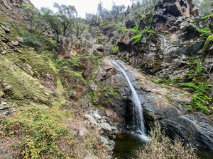
Knickerbocker Creek
| Rating: | |||||||||||||||||||||||||||||||
|---|---|---|---|---|---|---|---|---|---|---|---|---|---|---|---|---|---|---|---|---|---|---|---|---|---|---|---|---|---|---|---|
| | Difficulty:3B II (v3a2 II) Raps:1-3, max ↨105ft
Red Tape:No permit required Shuttle:Optional 20 min Vehicle:Passenger | ||||||||||||||||||||||||||||||
| Start: | |||||||||||||||||||||||||||||||
| Parking: | |||||||||||||||||||||||||||||||
| Shuttle: | |||||||||||||||||||||||||||||||
| Condition Reports: | 31 Jul 2024
"Some enjoyable raps and creek walking in between bouts of blackberry bush shralping and very slippery rocks. Water was a little low (50csf Lake Clem |
||||||||||||||||||||||||||||||
| Best season: | Year round, at night in Summer
|
||||||||||||||||||||||||||||||
| Regions: | |||||||||||||||||||||||||||||||
Introduction[edit]
Knickerbocker Creek is notable mostly for its location close to population centers at the foothills of the Sierra and for its numerous fig trees.
It was first descended in late summer of a low water year, but there was still a surprising amount of water, including one (probably avoidable if you cared) swim. It likely remains class B throughout the year with bouts of swiftwater during rains and in the spring, although it is not believed to be highly snowmelt driven.
Approach[edit]
Located entirely within the Auburn State Recreation Area (Auburn SRA). Parking coordinates are given, for the shuttle it's at Gate 144 to Auburn SRA. Shuttle to the Knickerbocker side of the North Fork American by returning to Auburn and taking Highway 49 south. Park near the Cool Church.
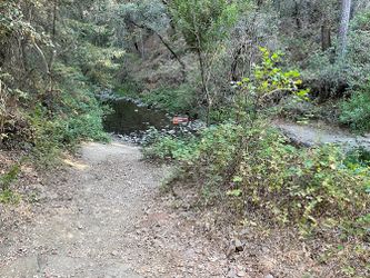
The trails are a bit maze-y on the approach, so have a map handy. The trail crosses a fork of Knickerbocker but continue past to the second crossing. At the second crossing, about a mile in, you should be able to assess waterflow/conditions.
Descent[edit]
Proceed downcreek, taking the path of least resistance when presented with brambles/branches/poison oak. After a bit you come to an easy downclimb, which begins the technical section.
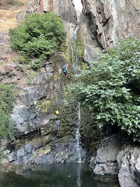
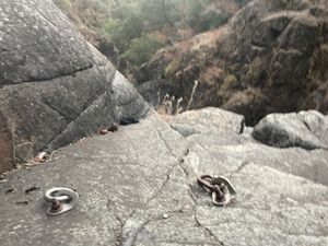
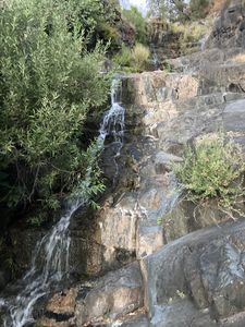
R1: Narrow slot leads to the ~70' waterfall in the cover photo. Single traverse bolt DCL in the slot which can be used to access rappel bolts DCL around the edge at the end of the slot. Traverse highly recommended if there is flow as the rock is quite slick. Down-climbable DCL to skip.
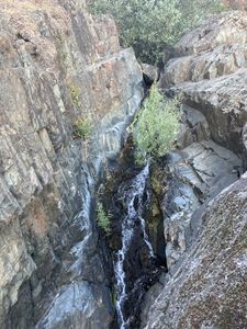
R2: There are three cascades of rock in the middle section, which are all mostly down-climbable. The second one is quite slippery, and there are two bolts DCL to avoid this hazard. Rappel ~50' to the second obvious spot to get off rope.
R3: Wide, smooth rappel -- someone please bolt this! Otherwise take a tree rappel DCR or downclimb dry crack DCL.
Exit[edit]
After the final rappel, continue downcanyon until the walls start to widen. Pick your way out of the canyon (use trail DCR) and down to the riverbed.
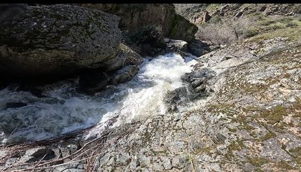
Scramble option: If it is safe to, cross the North Fork American at the canyon's end; there is a small, maybe class 2 rapid here (Dreamflows gauge). During summer, the flows are generally determined by the Oxbow recreational releases (Schedule). Scramble up the hillside to the road, then take the road and the Cardiac Bypass trail to your car.
Float exit: Bring a pfd, tube, or just rely on the buoyancy of your pack and float down to the easy trail that leads to the Oregon Bar river takeout. The river is very mild (no rapids) between the end of the canyon and the takeout point. It should be safe all summer as long as the dam is in release mode (Dreamflows gauge). Always check levels and rely on your own judgement. Note, it costs $10 to leave a car at this exit point. It's a small lot, so it's recommended to leave any additional vehicles at the Parking Exit marked on the map.
No-shuttle exit (untested): Turn right at exit of canyon and make your way northwest along the riverbank to the marked trail.
Red tape[edit]
Auburn SRA closes at night, so carefully consider where you leave your car. Also Auburn SRA has fees.
Beta sites[edit]
Trip reports and media[edit]
Not canyoneering: https://insuremekevin.com/hiking-knickerbocker-creek-canyon-waterfalls/amp/
Background[edit]
Scouted by Jacob Egorov in 2021 and descended/documented by Jacob Egorov and Carly Robison in August 2021.
