Landers Falls
| Rating: | |||||||||||||||||||||||||||||||
|---|---|---|---|---|---|---|---|---|---|---|---|---|---|---|---|---|---|---|---|---|---|---|---|---|---|---|---|---|---|---|---|
| | Difficulty:4B IV (v4a2 IV) Raps:6, max ↨148ft
Red Tape:No permit required Shuttle:None Vehicle:4WD Rock type:Rhyolite | ||||||||||||||||||||||||||||||
| Location: | |||||||||||||||||||||||||||||||
| Condition Reports: | |||||||||||||||||||||||||||||||
| Best season: | Oct-Mar
|
||||||||||||||||||||||||||||||
| Regions: | |||||||||||||||||||||||||||||||
Introduction[edit]
This canyon is described in comprehensive detail in Canyoning Around Victoria guidebook
There is some useful previous rainfall data available from the BOM Cabramurra SMHEA AWS {station 072161} - http://www.bom.gov.au/climate/dwo/IDCJDW2023.latest.shtml
Approach[edit]
The approach is short. Follow the track for the Landers Falls Lookout and turn off the track towards the creek.
The map is detailed in the guidebook. Enter the creek via some scrambling and bush bashing depending on where you enter.
Descent[edit]
The Canyoning Around Victoria guide contains an excellent topo. Buy the book and support Rob and Sam. They put in an inordinate amount of effort to create the book.
Tips[edit]
- The canyon is in shade pretty much all day and the water is very cold... so dress appropriately
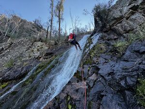
- The crux is from R4 down to the bottom of R5. The bolts for R5 are at a very small ledge (2 person only) that is ~10cm wide in sections and close to the flow. It is almost a hanging belay.
- Be cautious not to miss the R5 bolts as you come down the R4 abseil.
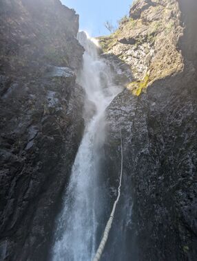
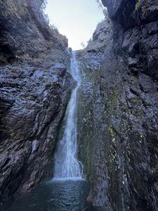
- Re-rig at the R5 to descend to the pool via the small slot that is the last 15m of R5. Look up and view the amphitheatre of rock and spray!
- Most of the flow can be avoided until the last ~5m of R5 by following the large mossy slab to the TL of the slot.
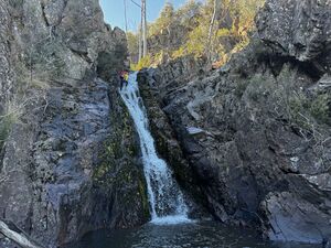
- Use a meat anchor for safety to reach the bolts for R6.
Photos[edit]
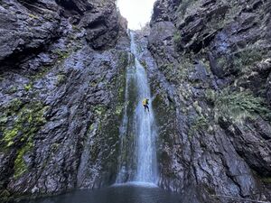
Photo shows canyoner situated at anchor for R5. Very small ledge. Basically enough for your foot to rest on.
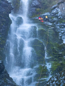
Spot the canyoner :D
Exit[edit]
The exit is quite steep in sections with some exposure. Allow plenty of time for this, especially if your party is not confident with steep bush bashing and bouldering with exposure. Be prepared for plenty of bush bashing as the bush continues to recover from the 2019-2020 fires.
The exit route was tape flagged towards the top when first established but these have deteriorated over time... bleached in the sun and basically only visible when right next to them... and some had fallen to the ground.
The map provided in the Canyoning In Victoria Guidebook provides a yellow exit line that aligns well with downloadable topo maps that you can reference your GPS position on.
There are climbing moves required at the steep final section up to Ewbank grade 12. These can be assisted by throwing a handline at the start of the day from R1 directly opposite the bolts. Around 30-40m should cover most of the more difficult final section. Make sure to descend the hand line (and obviously come back up) until you know the rope is where it needs to be. It's easy to throw it in the wrong direction (or it just doesn't travel far enough) and you'll have to free solo the crux anyway.
Red tape[edit]
The access road to Landers Falls 4WD carpark point is often closed during winter - check NPWS website.
Beta sites[edit]
Read this for a trip report with a lot of useful information: https://sleepwhenwearedead.net/2025/10/08/landers-falls-canyon/
