Lower Lindsey Creek
| Rating: | |||||||||||||||||||||||||||||||
|---|---|---|---|---|---|---|---|---|---|---|---|---|---|---|---|---|---|---|---|---|---|---|---|---|---|---|---|---|---|---|---|
| | Raps:4-5, max ↨35ft
Red Tape:No permit required Shuttle:None Vehicle:Passenger | ||||||||||||||||||||||||||||||
| Start: | |||||||||||||||||||||||||||||||
| Parking: | |||||||||||||||||||||||||||||||
| Condition Reports: | 14 Sep 2024
"Fun day out. Cool but not cold and the sun peeked through the clouds a few times. Pretty creek, enjoyed the narrows and the challenge of finding our w |
||||||||||||||||||||||||||||||
| Best season: | Jul-Oct
|
||||||||||||||||||||||||||||||
| Regions: | |||||||||||||||||||||||||||||||
Introduction[edit]
Lindsey Creek is a major drainage located between Shellrock Mountain and Mt. Defiance on the south side of the Columbia River Gorge. This page describes the shorter, lower section of the creek (aka "Lower Lindsey). Lower Lindsey has a number of short drops and fun obstacles. This section is a nice one for training, an after-work adventure, or as simply something fun to do on a rainy day in the autumn. This section of the canyon takes only a few hours to run.
- See also Lindsey Creek for information on the upper canyon which is a much longer and committing adventure. (Another option would be the "short+" version which drops you in just above Lindsey Creek Falls. This would make Lower Lindsey just a bit longer.)
- Lower Lindsey could be combined with nearby Summit Creek Falls a slightly longer day.
Watershed[edit]
Lindsey Creek drains a large part of the north face of Mt. Defiance, including North Lake and Bear Lake, and sports significant water into early August and September. Lindsey is likely quite dangerous earlier in the season. Hydraulics will be present at many of the falls in high water conditions. There are a number of deep pools along the way. Watershed: 4.45mi^2.
Approach[edit]
Directions[edit]
Note: the parking area is ONLY accessible from I-84 traveling eastbound.
Take I-84 east into the Columbia Gorge. About 2.3mi past Wyeth (exit 51), park in a gravel pulloff just off the highway's shoulder. There is room for 4-5 vehicles. Be aware: this trailhead comes up fast and is easy to miss when moving at speed. Be ready for it. A gated powerline access track leads up from the pulloff. Do not block the gate. This is the same trailhead for Summit Creek.
- If you miss the pullout, you can continue 1.5mi east to Starvation Creek (exit 55) and park there. From there, you can hike the paved bike path back west for ~1.5mi. This approach takes about 20-30min one way.
Hiking In[edit]
From the pullout, walk past the gate and follow the powerline access track upwards, crossing the paved bike path along the way. Once under the powerlines, bear left and follow the track on a rising traverse up to its end. There used to be an old user trail here leading south into the woods and dropping down to an overgrown logging track. Follow the old road grade south about two minutes and watch for a place where the user trail drops down into Lindsey Creek to your left.
Follow the trail down and break off left when you can. There's a decent spot to change into wetsuits under some trees just adjacent to the creek. Drop in and head downstream about 5-10min to the first obstacle.
Descent[edit]
Lower Lindsey gets going as the creek enters a mini-narrows with wall-to-wall water.
- 4ft drop. Downclimb carefully into a chest-deep pool.
- R1: 12ft anchored from a tree DCR. Deep pool at the bottom.
- R2: 10ft from tree DCR (or downclimb).
- 12ft drop. Downclimb DCR at first, then left into a pool.
Creek turns a corner here into a large logjam. Climb out over a rock formation creek center.
- Creek diverts around a giant boulder. Downclimb carefully DCL. For extra points, swim into the hidden cave-like space underneath.
- R3: 35ft anchored from a tree DCL. Rappel is mostly out of the water until the bottom.
- R4: Short 6ft dry nuisance rappel from a tree DCL.
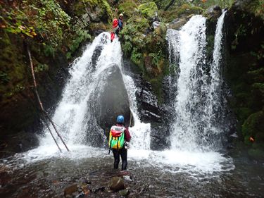
- R5: Harrison Falls. 25ft from a bolt station on left side of a boulder creek center.
- 12ft drop. Downclimb DCL.
- 10ft drop. Downclimb DCR.
Exit[edit]
A short streamwalk brings you to I-84 where the creek passes under the highway in a mighty culvert. Exit up either side to the bike path. Walk back to your car.
Red tape[edit]
On Sept. 14 2024, we parked in the gravel pulloff just off the highway's shoulder about 2.3mi past Wyeth (exit 51). When we returned to the car there was a neon green "abandoned vehicle" sticker on the car, with a date and time, warning that the car would be towed in less than 24 hours. The car was still there, we had no issues other than peeling off the darned sticker. Shouldn't be a problem, but who knows...
Beta sites[edit]
Trip reports and media[edit]
Background[edit]
Creek was probably first run by Portland locals. The last falls on the creek is frequently visited by waterfall photographers.
