Lindsey Creek
| Rating: | |||||||||||||||||||||||||||||||
|---|---|---|---|---|---|---|---|---|---|---|---|---|---|---|---|---|---|---|---|---|---|---|---|---|---|---|---|---|---|---|---|
| | Raps:8-13, max ↨100ft
Red Tape:No permit required Shuttle:None Vehicle:Passenger | ||||||||||||||||||||||||||||||
| Start: | |||||||||||||||||||||||||||||||
| Parking: | |||||||||||||||||||||||||||||||
| Condition Reports: | 11 Sep 2022
"Thrashed up and dropped in just above R9. Lots of blowdown in the creek post-fire. Beware the rope-eating crack at Lindsey Falls. Continued on down Lo |
||||||||||||||||||||||||||||||
| Best season: | Aug-Sept
|
||||||||||||||||||||||||||||||
| Regions: | |||||||||||||||||||||||||||||||
Introduction[edit]
Be aware: Upper Lindsey Creek was overrun by the Eagle Creek wildfire in Sept 2017. While the area been reopened, use extreme caution when descending the creek. Between landslides, fallen trees, and loose rocks, this area may be extremely unstable and dangerous for years to come. The canyon may have changed dramatically. Do not rely on the beta below being accurate. If you run the canyon, please update the beta.
Lindsey Creek is a major drainage located between Shellrock Mountain and Mt. Defiance on the south side of the Columbia River Gorge. This page describes the upper section of the creek which has a superb set of narrows and falls located between 700-1100ft elevation - with some 6+ drops in rapid succession. Be ready, however, for a long day out. The relentless logjams and damage from the Eagle Creek Fire in 2017 may tarnish the allure of what would otherwise was a splendid canyon.
- Shorter Version - For a shorter option that was not overrun by the Eagle Creek fire, check out Lower Lindsey Creek.
- Short+ Version - For a slightly longer option that doesn't enter as much of the burned area, take the "early entrance" and combine Lindsey Creek Falls (R9 & R10) with Lower Lindsey.
Watershed[edit]
Lindsey Creek drains a large part of the north face of Mt. Defiance, including North Lake and Bear Lake, and sports significant water into early August and September. Lindsey is likely quite dangerous earlier in the season. Hydraulics will be present at many of the falls in high water conditions. There are a number of deep pools along the way. Watershed: 4.45mi^2.
Approach[edit]
Directions[edit]
Note: the parking area is ONLY accessible from I-84 traveling eastbound. About 2.3mi past Wyeth (exit 51), park in a gravel pulloff just off the highway's shoulder. There is room for 4-5 vehicles. Be aware: this trailhead comes up fast and is easy to miss when moving at speed. Be ready for it. A gated powerline access track leads up from the pulloff to a junction with the bike trail above (~2min). Do not block the gate. This is the same trailhead for Summit Creek.
- If you miss the pullout, you can also continue 1.5mi east to Starvation Creek (exit 55) and park there. Hike the paved bike path back west for ~1.5mi. This approach takes about 20-30min one way.
Hiking In[edit]
From the pullout, walk past the gate and follow the powerline access track upwards, crossing the paved bike path along the way. Once under the powerlines, bear left and follow the track on a rising traverse up to its end. There's a faint use trail here leading south into the woods here, which drops onto an overgrown logging track. Follow the old road grade south about two minutes and watch for a place where the user trail drops down into Lindsey Creek to your left. This will likely be your exit.
Follow the logging grade a short distance further, then break off to ascend the ridge. (The road grade is overgrown and trying to follow it is more trouble than it's worth.) The ridge, however, is fairly open forest, but was hit hard by the Eagle Creek Fire.
- Early Entrance - Once up the first steep-ish area, contour left/south until you can find an easy way down to drop into the creek above Lindsey Creek Falls.
- Full Lindsey - Continue on up the ridge. One cannot really get lost; when in doubt, go uphill. You'll cross the old road grade which switchbacks up the ridge several times. Just keep going until the ridge starts to narrow up and eventually, around 1400', the slope angle becomes easier. Keep going along the ridge until about 1700ft elevation. At this point, drop off the ridge to climber's left and make your way down on a southeasterly heading, losing some 600ft of elevation to reach the creek just above the narrows. It gets steep, but never cliffs out (if you're in the right place). We dropped in around UTM 10 599136mE 5058768mN. If you drop into this point, you will be starting at R3 below. Lindsey complete-ists will want to thrash their way 0.1mi upstream which will net you +2 waterfalls.
Descent[edit]
- R1: 6ft.
- R2: 40ft into a small bowl.
Continue downstream ~5min to reach the place where you dropped in. Continue downstream to the top of the narrows.
- R3: Descend short slide and cross pool to 20ft drop. This is the entrance to the narrows. Short walk to the next falls.
- R4: 60ft from boulder DCR. Rappel down between twin flows merging at the bottom. Escape possible DCL.
- R5: 80ft direct, or 100ft dry rappel from tree high DCR into impressive amphitheater. Walk downstream 200yrds to the next rappel.
- R6: Creek sluices through two pockets to a 20ft drop. Walk 200ft to the next falls.
- R7: 25ft. Neat section of narrows below the falls.
Hike 0.1mi to the next rappel.
- R8: 30ft. Previously, there was a massive logjam atop the falls. Possible good place for a guided rappel to avoid the mess.
Below R8, the creek passes through some beautiful sections of bedrock to a couple of short steps.
- Downclimb: 5ft & 15ft DCR.
Below, significant tributary enters DCR. May be possible to escape DCR here up to overgrown logging grade on the east side of the canyon.
Hike downstream 0.5mi, climbing over innumerable logjams. Eventually the canyon narrows up again. Just before this happens, watch for a user trail DCR which may be a possible exit to the aforementioned road grade. It's also possible to exit DCL up onto Lindsey Ridge just above R9. (This is the "early entrance.")
- Downclimb 10ft.
- R9: 15ft from log.
- Downclimb 10ft DCR or DCR. Walk a short distance.
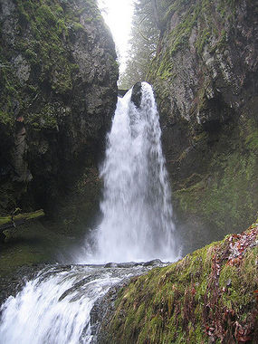
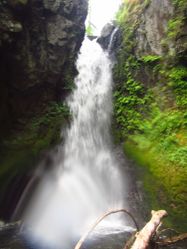
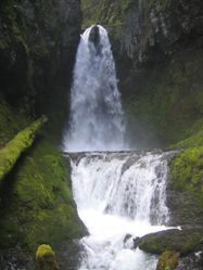
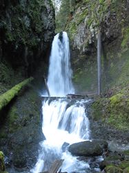
- R10: Lindsey Falls. 45ft into a pool. A huge chockstone is situated atop the drop with the creek dividing around it; most of the flow DCR. Anchored from a log DCL. Beware a rope-eating groove on the DCL side of the boulder. This falls is a good candidate for bolting (or possibly a redirect could be placed to keep the rappel rope out of the crack).
Exit[edit]
Below Lindsey Falls, head downstream wherever is easiest. There's occasionally a bit of a user trail on DCL side of the creek as waterfall hunters visit R10 frequently. After about 10min downstream, the trail cuts away from the creek and it ascends back to the old logging grade where you started.
- Alternatively, you can continue downstream to run Lower Lindsey Creek.
Red tape[edit]
None.
Beta sites[edit]
[NW Waterfall Survey: Lindsey Falls]
Trip reports and media[edit]
Background[edit]
Creek was likely first descended by Portland locals.


