Marten Creek (North Cascades)
| Rating: | |||||||||||||||||||||||||||||||
|---|---|---|---|---|---|---|---|---|---|---|---|---|---|---|---|---|---|---|---|---|---|---|---|---|---|---|---|---|---|---|---|
| | Raps:5-8, max ↨70ft
Red Tape:No permit required Shuttle:None Vehicle:Passenger | ||||||||||||||||||||||||||||||
| Location: | |||||||||||||||||||||||||||||||
| Condition Reports: | 29 Sep 2024
"Lovely day at Marten. It was a lot of fun at current flow levels. We set a couple of new anchors with webbing to rap in the flow. We did more rappels |
||||||||||||||||||||||||||||||
| Best season: | Aug-Oct
|
||||||||||||||||||||||||||||||
| Regions: | |||||||||||||||||||||||||||||||
Introduction[edit]
Don't confuse with Marten Creek (Alpine Lakes).
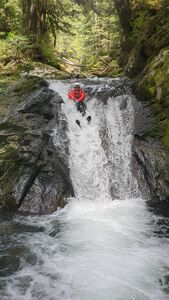
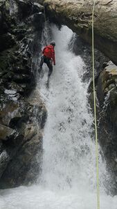
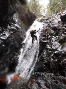
This beautiful & easily accessed watercourse is a combination of steep slabs and large potholes with many small drops and a few more substantial ones.
The current can create dangerous conditions, especially since the creek bed is very narrow in places. Fortunately, the drainage is easy to escape from in many places, so it is possible to bypass many of the drops and re-enter the canyon further downstream. The class 4 rating was initially chosen because of anchor building; you may find few anchors and need to make the others.
Marten Creek has some of the most beautiful nuance rappels around, intermixed with raps which have real teeth.
Special considerations
- Frequent down-climbing, which while being possibly protected with impromptu natural anchors, will greatly slow down teams not confident in personal movement.
- Potholes & constrictions mean there's hydraulics & siphons to account for. Real risk to persons & equipment exist.
Approach[edit]
From Granite Falls, follow the Mountain Loop Highway east. The trailhead (a small pullout, actually) is immediately east of Marten Creek itself (signed at the bridge), 9.6 miles east of the Verlot Ranger Station.
Hike about a mile up the excellent trail, gaining 1100 feet of elevation. Marten Creek Trail 713 has an interesting history, once running all the way to Darrington over Granite Pass. Along the way it provided access to mines still visitable today. In 1925 it was the site of an experimental forest to investigate the growth of different specifics of tree.
Leave the trail and drop into the drainage of Marten Creek when the trail makes the right turn into the now gentle Marten Creek Valley. This will be obvious since the slopes on the west side of the trail will become substantially less steep. You are aiming for a creek elevation of about 2300'.
Descent[edit]
The descent contains numerous sections of down-climbing and/or nuance rappels using natural anchors. Therefore depending on the conditions and if anchors survived or not, it's hard to give a complete description of the descent.
There are many pools which look very appealing to jump/slide - sadly most require a very technical landing. That said there are still enough safe ones to provide good fun.
Highlights[edit]
Since it's hard to give a complete description of the descent, here's some highlight to look out for.
The technical portion of the creek drops 700 feet in 0.6 miles and includes a short gorge.
R1: 30’ from tree between the split falls into pool
Creek walk for 20-30 minutes.
S1: 10’
R2: 45’ RDC from bolt
R3: 70’ LDC from pinch - Two-stages and empties into a pool. In higher flow, beware the siphon LDC at the bottom since it may not be visible. (alternatively, 40' RDC from tree)
S2: 20'
DC 12’ on left through rabbit hole and continue DCL (alternatively, DCR in the falls).
J1: 15' into deep pool
R4: 20’ DCR from single bolt - In higher flow, the exit from this may be difficult due to the recirculation.
R5: 70’ DCR from single bolt - Two-stage rappel through three falls and a huge water-filled alcove. At higher flow, the exit here may be difficult due to the recirculating pool.
R6: 70’ DCL from huge log
R7: 50’ DCL from tree root
R8: 50’ DCR from root ball. Note that the approach to this is a false floor.
DC several more short downclimbs and DC 50’ on right in crack
The creek's gradient is consistently steep. If you trust your scrambling skills and have high traction footwear, you can scramble a lot of these steep sections.
Exit[edit]
Follow the creek down to the road, cross under the bridge and exit left on a clean trail up. There are several log piles that appear difficult but have large openings that make them easy to surmount.
Alternatively if the debris in the creek is frustrating you, consider exiting hard left, and climb up the clear(er) forest to rejoin the approach trail for the final section (just an idea - not tried yet).
Red tape[edit]
Beta sites[edit]
Trip reports and media[edit]
https://www.facebook.com/groups/pnwcanyoning/posts/10154001548435789/ 2016 with video.


