Mineral Creek (Alpine Lakes)
| Rating: | |||||||||||||||||||||||||||||||
|---|---|---|---|---|---|---|---|---|---|---|---|---|---|---|---|---|---|---|---|---|---|---|---|---|---|---|---|---|---|---|---|
| | Raps:4-7, max ↨60ft
Red Tape:No permit required Shuttle:None Vehicle:Passenger | ||||||||||||||||||||||||||||||
| Start: | |||||||||||||||||||||||||||||||
| Parking: | |||||||||||||||||||||||||||||||
| Condition Reports: | |||||||||||||||||||||||||||||||
| Best season: | Jul-Sep
|
||||||||||||||||||||||||||||||
| Regions: | |||||||||||||||||||||||||||||||
Introduction[edit]
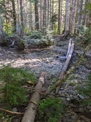
June 2024: Phase I of the Upper Kachess River Restoration project is complete. This has dramatically changed the forest and tributaries adjacent to the original trailhead (currently open). Phase II is planned for summer 2023 onward, which will decommission the original trailhead in favor of the new one located uphill out of the floodplain (currently closed) along with new connector trails.
Aerial view of new & old trailheads: https://youtu.be/WoM-vqFFj-E
Relevant links:
- https://www.fws.gov/story/2024-05/upper-kachess-river-restoration-bull-trout
- https://www.kittitasconservationtrust.org/projects/upper-kachess-river-restoration/
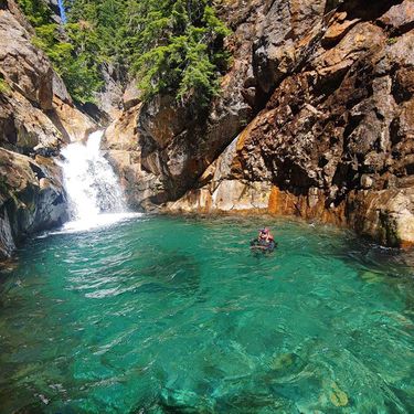
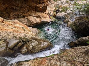
Mineral Creek is a gem of a canyon (pun intended!). This route has stunning turquoise pools, jumps, orange colored rock, and an easy approach and exit. If you look closely, you may see an old mineshaft or veins of pyrite (fool's gold) in the rock!
This route is half-equipped, it’s been bolted for for high-water conditions for flow avoidance. Bolt stations for rappelling in the flow have not been installed. If you like small jumps and slides it’s a great little water park. If you like rappelling in the flow you will need to bring a drill as natural anchor options for wet rappelling are not available.
Mineral is a higher flow canyon in early season compared to many in the vicinity, but water levels drop quickly in the late summer. It shares a trailhead with Incognito and the two can be combined with nearby Incognito Canyon for a full weekend (an efficient team can do both in one day, typically starting with Incognito first and Mineral second, due to the logistics of the hiking trails).
Sensitive species impact mitigation: Mineral Creek is a critical resource for a struggling population of Bull Trout. Bull Trout spawn in the fall, peaking in October-November, requiring up to 220 days of undisturbed gravel residence before emerging. To provide adequate buffer, it's best to travel through Mineral between July 15-Sept 15 when the creek would not be host to Bull Trout redds.
Approach[edit]
Getting to the Trailhead Take I-90 west to exit 80 and follow Bullfrog Road through the small town of Roslyn (alternatively, take exit 84 to Cle Elum if coming from the east). Follow SR-903 (which soon becomes Salmon La Sac road) north out of Roslyn for a little over 14 miles. Turn left onto Forest Road 46 and cross the Salmon La Sac River. Drive 9.4 miles over Cooper Pass to the Mineral Creek Trailhead. No recreation passes are required at the trailhead. There are also no toilets available.
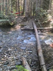
Getting to the Canyon Follow the trail from the parking area. Cross the Kachess River close to the point you first meet it, using an upstream log secured with metal cables. From the log the trail continues up the hillside about 1/3rd of a mile until you reach the T junction between the Mineral Creek Trail and the Little Kachess Trail. Turn right and hike for 1.2 miles until the trail intersects with Mineral Creek.
Descent[edit]
Commitment Factor: Moderate. The upper canyon has many potential, though steep, exit options. Once into the lower section, escape options are limited.
Upper Section[edit]
The upper section consists mostly of a creek walk along bedrock, interspersed with water park features: downclimb, slide, jump, slide, slide, jump, downclimb. Almost everything is by-passable.
One of the largest features in the upper section is the "mine jump". At a larger drop note the old mine in the hillside on your immediate right, and the strikingly red cliff across the pool below. There is a DCR ledge to shallow jump from, alternatively there's a single bolt anchor DCL on the backside of a very large boulder.
It is approximately 0.6 miles from the drop-in to the lower section. Early in the season expect to jump more features, later in the season expect more down-climbs.
Lower Section[edit]
Compared to the upper section, the lower sections obstacles come in quick succession. From some spots it's possible to look back and see your last three rappels all in the same view.
R1: DCL - 50' wet rappel from bolts. This drop can be identified by the large log spanning the canyon. Or a low-angle rap into a deep pool below large overhanging cliff face. Alternatively in low flow, 15’ downclimb on usually grippy rock then a 15’ low angle slide.
J1: 12' from center canyon, or down-climb DCL.
R2: DCR - dry rappel 50' from a bolt station next to a small alcove in the rock. The pool is deceptively shallow, but can be jumped carefully from lower down.
J2: 5' technical jump into a short, narrow V corridor that turns abruptly DCR. The far walls of the corridor slope significantly inwards under the water, creating a narrow safe landing zone. Use L-jump technique with your legs facing downstream. Alternatively in low flow, 5’ downclimb DCL.
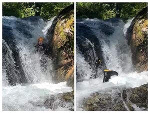
R3: DCL - 60' from a bolt station. This rappel is known as The Washing Machine as the water circles around in a shallow, slippery bowl mid-rappel. This lower pool has been jumped from the midpoint ledge, but can be shallower than expected (~6ft).
R4: caution strong pour-overs can develop at the exit of this pool.
- Rap: 40' from bolts DCR. Requires a scramble out of the pool to reach. Water line bolts are present to protect access to the primary bolts in high flow.
- or Slide: DCL ejection slide via the obvious rooster tail chute.
R5:
- Dry: DCR - 40' from traverse line over a logjam to a 50' rappel from bolts.
- or Wet: DCL- 20' traverse line to bolts near the lip for a 50' in-flow rappel.
R6: DCR - 20' dry rappel from a bolt station, use rope protection for abrasion. Jumping is possible here from various heights, but caution must be taken to clear the ledge beneath and any logs below.
Exit[edit]
Follow the creek for a short distance until you reach a large log-jam. This can be bypassed on DCR.
Keep an eye out for blue flagging-tape left by the Department of Fish & Wildlife.
About 100 yards beyond the log-jam, exit up the bank DCR wherever is easiest. In 2021 there was some blue tape marking the exit point.
Parallel the creek downstream (along what used to be the NF-4600 road, but now overgrown) until you reach the log you used earlier to cross the river.
Walk back to the cars. Beer, song, and general merriment should ensue.
Red tape[edit]
Beta sites[edit]
FB photo album from first descent
Trip reports and media[edit]
Background[edit]
This canyon was first descended on July 26, 2020 by Jake Huddleston, Kevin Steffa, Ryan Ernst, Barry Specht, Haruka Lipscomb, and Tiffanie Lin. It might be too early to reminisce on the 2020 season but this canyon likely be the next PNW canyon waterpark -- Dingford has competition!
