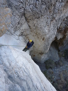
Pagan Canyon
| Rating: | |||||||||||||||||||||||||||||||
|---|---|---|---|---|---|---|---|---|---|---|---|---|---|---|---|---|---|---|---|---|---|---|---|---|---|---|---|---|---|---|---|
| | Difficulty:3A IV (v3a1 IV) Raps:10, max ↨150ft
Red Tape:No permit required Shuttle: | ||||||||||||||||||||||||||||||
| Location: | |||||||||||||||||||||||||||||||
| Condition Reports: | 26 Apr 2025
"We were really impressed with the polished limestone rappels in the upper canyon (first 8 raps or so). The terminal narrows below the confluence with |
||||||||||||||||||||||||||||||
| Best season: | Nov-Mar (avg for this region)
|
||||||||||||||||||||||||||||||
| Regions: | |||||||||||||||||||||||||||||||
Introduction[edit]
Approach[edit]
Descent[edit]
Optional R1 (20') or bypass left.
R2 (90') from a cairn. Rappel down a chute, past an easy dry pothole. Be cautious not to step on the endemic Death Valley monkeyflowers (Diplacus rupicola) that grown in the limestone cracks of this rappel.
R3 (110') is immediately after R2, anchored from a cairn.
R4 (40') from a cairn. Look out for Death Valley monkeyflowers in the rappel route again.
R5 (150-160') two-stage rappel from a cairn in a pothole surrounded by white rock.
R6 (90-105') from a large shrub set back from the edge.
R7 (80') from rock chock on shelf on left.
Canyon opens up.
R8 (40') anchored from a big rock in the wash.
R9 (90') anchored from a cairn.
R10 (110') is immediately after previous rappel. It is anchored from a cairn. The first stage of the rappel is 40', the second stage can be bypassed on the left.
Confluence with Troll Canyon.
Optional R11 (20') from a pinch on the left, or downclimb a chute.
R12 (15') from pinch on left.
R13 (forgot to record length), clearly the end of the canyon.
Exit[edit]
Red tape[edit]
NPS webpage about canyoneering in Death Valley National Park
Beta sites[edit]
 Super Amazing Map : Pagan
Trip reports and media[edit]
First Descent Trip Report 12-16-2012:
Background[edit]
Originally explored by Scott Swaney and team on 12-16-2012 - with RICK KENT, ET AL, SEE TRIP REPORT for details
