Parachute Creek (East Fork)
| Rating: | |||||||||||||||||||||||||||||||
|---|---|---|---|---|---|---|---|---|---|---|---|---|---|---|---|---|---|---|---|---|---|---|---|---|---|---|---|---|---|---|---|
| | Raps:1, max ↨220ft
Red Tape:No permit required Shuttle:None Vehicle:4WD - High Clearance Rock type:Shale | ||||||||||||||||||||||||||||||
| Location: | |||||||||||||||||||||||||||||||
| Condition Reports: | |||||||||||||||||||||||||||||||
| Best season: | Jul-Sep
|
||||||||||||||||||||||||||||||
| Regions: | |||||||||||||||||||||||||||||||
Introduction[edit]
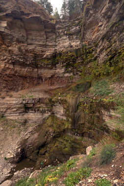
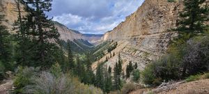
Some of the tallest waterfalls in Colorado drop within the Roan Plateau and the Book Cliffs in the tributaries of Parachute Creek and nearby Clear Creek, to the west. These are large single waterfalls off the higher mesa plateau into eroded valleys below, rather than canyons with continuous sequential drops.
The first challenge of this area is land ownership. Aside from East Fork Parachute Creek Falls, all of these waterfalls are in lands, which are currently actively mined for Oil Shale and Natural Gas by large energy companies and not available for public access. This follows a 2007 decision by the BLM to open up these lands for drilling, which caused outcrys from hunters, anglers and environmentalists concerned about the impact to this unique environment on top of the plateau which is prized for mule deer, elk and genetically pure cutthroat trout. The concerns extend to also include disturbing big game winter range at the base of the plateau and blocking big game migration cooridors.
Hunting: During hunting season, wear bright clothing as this area is frequented by hunters.
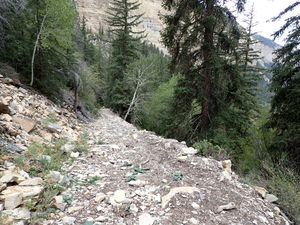
While moot today, the second area challenge would be determining reasonable loop hikes to avoid ridiculous top to bottom car shuttles. East Fork Parachute Creek Falls benefits from an old jeep road now used as a wide horse trail connecting the bottom of the rappel to the trail above.
A third point to mention is that this horizontally layered shale is sharp. Beware when setting anchors to prevent sawing motions on the rope under tension. The Book Cliffs were named for these horizontal shale layers, which were said to look like a book that had been opened when viewed from the side.
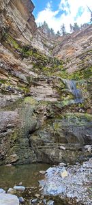
Season: Earlier in the year, this drop can produce a substantial waterfall. By mid-September, it is barely at a trickle.
Approach[edit]
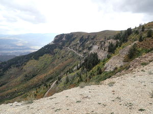
Two driving paths exist to reach the BLM public access the Roan Plateau, 3000' above the town of Rifle. Both routes depart toward the west from Government Road (CR 13), which runs north out of Rifle and are rutted sufficiently to require High Clearance 4WD. Bear in mind that hunters have brought travel trailers up Cow Creek Gulch during the hunting season. The internet says the road gets graded before hunting season, but this did not seem to be the case in Sept 2021. Heavy rain will likely make the road slick.
Cow Creek Gulch
This long, more gradual route follows Government Road (CR 13) 17.75 miles north of Rifle, then
- Go left (west) on CR 5 for 3.3 miles,
- Then south on Cow Creek Gulch (County Highway 249) for 12.5 miles gaining 2775' in elevation,
- Then turn right on Roan Cliffs Rd for 5.65 miles as it follows the steep dropoff of the plateau.
- Turn right on Long Ridge Rd #8008 to access the interior of the plateau for 5.7 miles.
- Turn left onto Short Ridge Rd #8011 at a T-intersection for 1.0 mile, and
- Pass through a green gate leaving it in the open or closed state that was found then turning left on Bull Gulch Rd #8012 for 1.9 miles.
- Bull Gulch Rd terminates at the trailhead, but passes through an actively worked cabin. Turn the volume of the off-road music down and pass slowly and politely through this property.
JQS Trail Rd
The shorter approach is JQS Road, which is apparently named for the cattle brand used by H.W. Hallett, an early founder of the town of Rifle. The records do not indicate what JQS stood for. Hallet established the trail in 1885 as one of six stock trails to move cattle to the higher range and also for recreation.
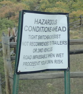
The JQS Trail is steep and is signed to indicate tight switchbacks and expressly prohibits trailers and 2WD vehicles. Large full-size 4WD pickups can make this trail as long as the few wider locations are utilized to pass oncoming traffic. There is space to make a multipoint turn without putting the bed over the precipice at the sharpest switchback toward the top. Do not have anyone with vertigo stare downslope.
This short, get-the-job-done route follows Government Road (CR 13) 2.5 miles north of Rifle, then
- Go left (west) on CR 242 at the Hubbard Mesa OHV Area for 11.35 miles, reaching the top of the plateau above
- Continue north on Roan Cliffs Rd for 1.6 miles, then
- Turn left on Long Ridge Rd #8008 to access the interior of the plateau for 5.7 miles.
- Turn left onto Short Ridge Rd #8011 at a T-intersection for 1.0 mile, and
- Pass through a green gate leaving it in the open or closed state that was found then turning left on Bull Gulch Rd #8012 for 1.9 miles.
- Bull Gulch Rd terminates at the trailhead, but passes through an actively worked cabin. Turn the volume of the off-road music down and pass slowly and politely through this property.
On foot
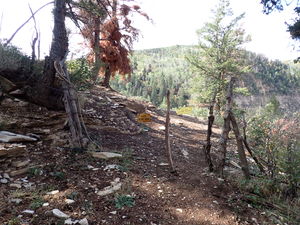
Depart the parking at the end of the road to the southwest as Bull Gulch loses elevation. Pass a cow/human sized fence held in place with barbed wire. Leave this fence as found. Continue to the left (southeast) losing elevation to intersect the East Fork of Parachute Creek below. Total distance is 0.75 miles.
Descent[edit]
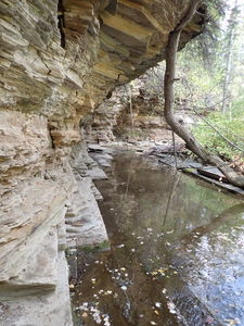
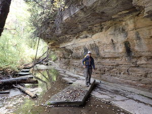
Enter the East Fork of Parachute Creek and streamwalk for 950 feet in a very unique shale corridor to the edge of the main waterfall.
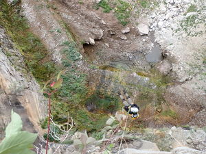
R1: 220' from a large pine tree in Canyon Center. Have a team member manage the rope and sharp shale edges at this station with a ledge to stand against.
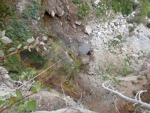
This rappel is free hanging for over 150 feet.
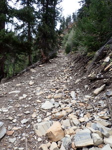
Exit after the main rappel up the scree slope into the forest and to the old road or...
Continue downstream for another 1250 ft, downclimb or rappel a seasonal waterfall and gain the old road by hiking up a few feet of the Chicken Gulch drainage.
Exit[edit]
Follow the old jeep road to where the approach trail intersected East Fork Parachute Creek above the falls for 0.55 miles and +570 feet. Retrace the approach back to the trailhead.
Red tape[edit]
Beta sites[edit]
Trip reports and media[edit]
2021-09-19 explored by Ira Lewis, Andrew Tanasescu and Kati Wright
Main Photo by Andrew Tanasescu
