Parker Canyon
| Rating: | |||||||||||||||||||||||||||||||
|---|---|---|---|---|---|---|---|---|---|---|---|---|---|---|---|---|---|---|---|---|---|---|---|---|---|---|---|---|---|---|---|
| | Raps:5, max ↨80ft
Red Tape:No permit required Shuttle: Vehicle:4WD - High Clearance | ||||||||||||||||||||||||||||||
| Start: | |||||||||||||||||||||||||||||||
| Parking: | |||||||||||||||||||||||||||||||
| Condition Reports: | 9 Nov 2025
"No flow. One mandatory thigh-depth pool below the second-to-last rap. Several other deep pools that were avoided. Damage from the the recent fire was |
||||||||||||||||||||||||||||||
| Best season: | Spring
|
||||||||||||||||||||||||||||||
| Regions: | |||||||||||||||||||||||||||||||
Introduction[edit]
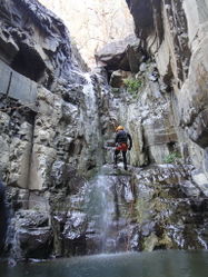
A very scenic canyon - fantastic if done at the right flow. Some of the rappels can be slid or jumped (check depth first).
Best done in the afternoon when the sun hits at an angle and lights up the canyon walls with a magical glow. Parker can be easily combined with Salome Jug by doing Salome Jug in the morning and Parker Canyon in the afternoon (taking A Cross Road).
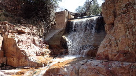
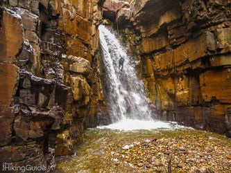
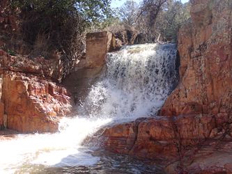
The waterflow checkpoint is 15 minutes into the approach when Pocket Creek enters on canyon left. Abort the descent if you see more water than the one depicted in the picture below.
There is a USGS flow meter. The gauge is situated ~1.5 miles upstream on the other side of the 288 road prior to the confluence with Pocket Creek, which adds an appreciable amount of flow. Around 1.2 ft (or well under 1 CFS) on the gauge is typical and equates to low flow. Approaching 2 ft is high flow and 2+ ft is very high / extreme.
Note: The CFS gauge is notoriously unreliable at higher flows and thus, for planning purposes, the recommendation is to reference the height gauge. Also, remember that this gauge is upstream of the Pocket Creek confluence which at high flow can easily add a few more CFS.
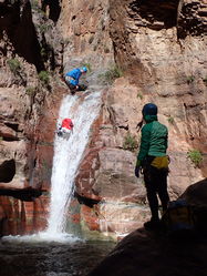
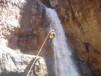
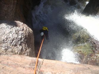
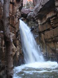
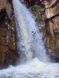
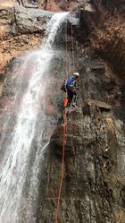
The pictures below compare the conditions of the big rappel experienced at different dates and flow levels.
Other notes:
- The Parker Creek Trailhead just up the road is not the trailhead for this canyon.
- If you do not have 4x4 / high clearance you can park by the start of the forest road but this will add some distance to the approach and exit hikes.
Approach[edit]
4X4 road is rocky, rutted, and narrowly lined with brush. Expect some pin striping if you drive further than the bridge. Depending on road conditions, most factory off-road vehicles with high clearance should be capable of accessing the drop in/parking at 33.77992, -110.97539.
Descent[edit]
R1: 15' off single bolt canyon left.
Slide on canyon left, or downclimb on canyon right.
R2: 25' off single bolt canyon left. There's also an alternate anchor high canyon right (walk along the shelf and then look around the corner) if you wanted to rap outside the watercourse
R3: 30’ off rock pinch set back canyon left.
R4: 50’ off tree. Can be done as an overhang canyon left or directly in the water course.
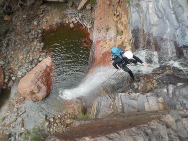
R5: 80’ off boulder. This rappel is very slick - use caution.
Exit[edit]
A short walk (about one hundred feet after R5) there will be an opening in the canyon on the right. The gully is a scramble with bouldering and lots of prickly brush so don't expect a defined use trail. It can get warm on the exposed sections. Once on the ridge top keep the canyon in sight and follow it along the up/downs of the cross country walk to the jeep trail/road.
Red tape[edit]
Beta sites[edit]
 OnRopeCanyoneering.com : Parker Creek Canyon
 CanyonChronicles.com : Parker Canyon
 HikeArizona.com : Parker Canyon - Tonto NF
 Arizona Technical Canyoneering Book by Todd Martin : Parker Creek Canyon
 ToddsHikingGuide.com : Parker; Hog and First Water Canyons
 CanyonCollective.com : Parker
 Super Amazing Map : Parker Canyon
 ZionCanyoneering.com : Parker Canyon
 ToddsHikingGuide.com : Parker Creek Trail
 https://www.stavislost.com/hikes/trail/parker-canyon
 WildPathsAZ.com : Parker Canyon
Trip reports and media[edit]
 Candition.com : Parker Creek
