Parker Creek
| Rating: | |||||||||||||||||||||||||||||||
|---|---|---|---|---|---|---|---|---|---|---|---|---|---|---|---|---|---|---|---|---|---|---|---|---|---|---|---|---|---|---|---|
| | Raps:4-8, max ↨150ft
Red Tape:No permit required Shuttle:Optional 5min Vehicle:Passenger | ||||||||||||||||||||||||||||||
| Location: | |||||||||||||||||||||||||||||||
| Condition Reports: | 11 Sep 2024
"BUTT SLIDE ALL DAY! This may not be the most "fun" canyon, but the access super easy. The creek walk down the the rappels is a little steep and slippe |
||||||||||||||||||||||||||||||
| Best season: | Mar-Apr
|
||||||||||||||||||||||||||||||
| Regions: | |||||||||||||||||||||||||||||||
Introduction[edit]
The beauty of this canyon stems from its accessibility and distance from the city of Corvallis. It's highly noncommittal: if you forget something or an incident occurs, it's relatively easy to exit on either side. (This may not be present for portions of the lower canyon.) How many rappels you do will depend on your comfort level, experience of your team, and how much you want to stay in the water. All but one rappel can be easily downclimbed. For a fun variation, consider running this canyon in reverse! This is a good creek for beginners.
This canyon may hold water quite well, allowing descents year-round. It is likely spring-fed. The canyon has been run in wintertime (February) and in low-light conditions (dusk/night). In winter, the gate may be closed at Conner's Corner, so you'll have a longer approach/exit. During the summer, you may not need a wetsuit.
There are two options:
- Upper Parker: Start at the campground and descend to the midpoint. Could be done in an hour or two by an experienced team. Possible after-work adventure.
- Full Parker: Start at the campground and descend all the way to the lower parking area. Can be done in about a half-day.
This canyon is over-bolted. Please do not add any more. There's a wealth of natural anchors to choose from.
Approach[edit]
Drive up towards Mary's Peak to Connor's Corner (aka Mary's Peak East Ridge trailhead). If the road is closed, the gate is just above Connor's Corner on the main road.
- Lower Parking: Just before the trailhead, turn off left on Mary's Peak Rd (gravel & potholes) for 1.5mi to Parker Creek. Room here for a few vehicles.
- Midpoint: Return to Connor's Corner and head up 1.4mi to a nice pullout where Parker Creek passes under the road.
- Campground (Upper Parking): Continue past the midpoint for 2mi to the Mary's Peak Campground. There is a parking lot just outside the campground.
From the parking area, make your way through the campground, trending southwesterly. The upper area of the creek is a bit brushy, so it may be helpful to stay on the DCR right side and traverse along the base of an open meadowed slope, dropping into the creek when it plunges off the top of the plateau. Distance is about 0.15mi.
Descent[edit]
Please do not attach webbing to unlinked bolts.
DCL = Down Canyon Left, DCR = Down Canyon Right
Upper Parker[edit]
For the upper section, 2x 200ft ropes are preferable but with a little creativity (or a pull cord) one rope would be possible.
- When you get going there are a couple short drops that can be downclimbed or rappelled.
- R1: 15ft from log or tree DCR.
- R2: 40ft from tree DCR.
Continue downstream a short distance until a small tributary enters DCL.
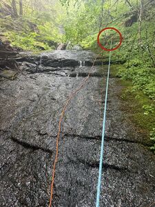
- R3: 105ft from two unlinked bolts hidden in the moss DCL just before the tributary.
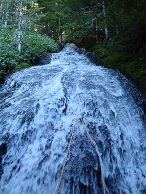
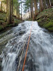
- R4: 150ft from large tree DCL. The midpoint road is visible from here. There is a bolt in the watercourse just up from this anchor station. This bolt is used for training when large groups go down the canyon. Watch carefully for the next anchor while rappelling. This section provides a fun butt slide!
- R5: 80ft from two bolts in the middle of the watercourse. This rappel goes vertical at the end into a man-made pool/culvert just above the road. Rappel over the edge and note a sloping ledge that you can use, while remaining on rappel, to carefully work your way DCL and step over the railing. Easier than it looks. (sept 2024) there is a log in the watercourse mid way down, it makes for an easier pull if you route your pull cord over the top of the log.
Huzzah! You made it to the midpoint. Option to exit here. There may be spectators watching you.
Lower Parker[edit]
You could probably get away with a single 50ft rope on this section. Beware leaving fixed anchors in the lower canyon (e.g. R8 on) as it seems this section of the creek is visited frequently by locals in the summer. It's recommended to use the super-secret bolts, downclimb, or use retrievables.
- R6: Rappel off the guardrail maybe 25ft down the metal wall to the top of the culvert below. (Or bypass on trail down through the woods DCL.)
The creek is a bit of a mess of rocks, debris, and brush below the road. Bushwhack 20-30 minutes downstream (or perhaps bypass most of it left on steep slopes down through the trees). The creek eventually opens up and you'll pass some beautiful old growth trees missed by the loggers.
- The creek constricts a bit into a short 8ft chute. Downclimb or rappel from an unnecessary single glue-in bolt just above water level DCR.
Walk for another 15-20min.
- Several trees have fallen across the creek (can squeeze underneath) just before a short ramp. Downclimb or rappel/hand line from an unnecessary single bolt in the watercourse just above the trees.
Walk downstream 200 yards. Creek narrows up just ahead.
- R7: Downclimb to 15ft rappel anchored by two bolts hidden behind a rock in the watercourse DCR. Use caution on this rappel to avoid a pendulum. Best rappel on Lower Parker.
There are a few more downclimbs, but nothing too serious. Note a decent user trail on one side of the creek or the other which will eventually bring you to the lower parking area. Declare victory.
Exit[edit]
See above.
Red tape[edit]
A NW Forest Pass is required to park at the campground parking area at the top. You might be able to park at a saddle area 0.25mi to the west and not need a pass (?). There were no signs in 2021. (The original beta suggests that someone got towed while descending the canyon, likely per blocking the gate up to the radio tower.) Parking at the midpoint or the bottom does not appear to require a NW Forest Pass.
Beta sites[edit]
Trip reports and media[edit]
 Karl Helser's NW Adventures : Parker Creek Canyoneer 5-15-16
 Karl Helser's NW Adventures : Parker Creek Canyoneer 1-14-17
Background[edit]
For extra bonus points, go tag the summit of Mary's Peak: the highest point in the Oregon Coast Range.


