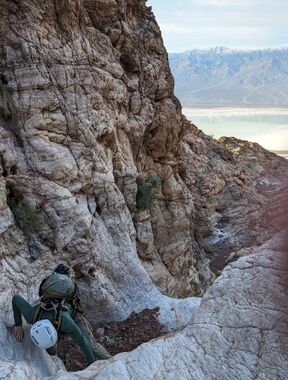
Purgatory Canyon (North Fork)
| Rating: | |||||||||||||||||||||||||||||||
|---|---|---|---|---|---|---|---|---|---|---|---|---|---|---|---|---|---|---|---|---|---|---|---|---|---|---|---|---|---|---|---|
| | Difficulty:3A IV (v3a1 IV) Raps:17, max ↨120ft
Red Tape:No permit required Shuttle:Required 37.9 mi Vehicle:Passenger | ||||||||||||||||||||||||||||||
| Start: | |||||||||||||||||||||||||||||||
| Parking: | |||||||||||||||||||||||||||||||
| Shuttle: | |||||||||||||||||||||||||||||||
| Condition Reports: | 1 Jan 2025
"Fun descent of Purgatory on New Years Day. We did the top-down approach, but its quite a hike from Dantes, so the bottom-up approach is likely more |
||||||||||||||||||||||||||||||
| Best season: | Nov-Mar (avg for this region)
|
||||||||||||||||||||||||||||||
| Regions: | |||||||||||||||||||||||||||||||
Introduction[edit]
Approach[edit]
From the junction of highways 178 (Badwater Road) and 190, drive about 10.7 miles east on highway 190 to the turnoff for Dante's View. Follow the signs to Dante's View, which is another 13.1 miles.
From the Dantes View parking lot, start hiking north on the unsigned but obvious trail up the ridge. After 3.0 miles, fork left off the trail, continuing north on the ridge for a couple-hundred feet to the top of a small hump. This is the top of "Erebus Ridge," a west-facing ridge that is the approach for canyons Typhon4, Erebus, Purgatory, and Purgamal, and an alternate approach for Abysmal.
Turn left and head west-northwest down Erebus Ridge for about .6 miles, descending about 900 feet. This spot is not very obvious, except the terrain to the right (north) finally looks reasonable, and there are now (after 14 years of canyoneering traffic) even signs of human foot traffic.
Head down the slope to the north, into the drainage. This is an upper drainage of Typhon4.
Head downcanyon in Typhon4 for a couple-hundred feet and then exit up the slope to the right (north).
At the top of the ridge, turn right (northeast) and contour over to the next drainage. This drainage is the top Erebus Canyon.
Continue north-northwest for about a quarter mile, over rolling terrain but gradually losing elevation. You will cross a broad drainage north of Erebus Canyon. This drainage also leads into Erebus and is not the route to Purgatory. Continue a bit further and turn left into the drainage that is a full quarter-mile beyond Erebus. This drainage is the top of Purgatory Canyon.
Descent[edit]
Waypoints in the KML map contain detailed descriptions of all the rappels (courtesy of Bluugnome.com).
Note from 1/1/2025: We ended up doing a maximum rappel of 165' rather than the 120' listed. This drop was anchored from the precipice and did not appear to have any obvious intermediate anchor opportunities. As a result, you may wish to bring a rope of at least 165' in case you can't find anchors, either.
Exit[edit]
To reach the final canyon floor, down climb on the right to the pothole, traverse the lip, and exit on the left.
Red tape[edit]
Beta sites[edit]
 BluuGnome.com : Purgatory Canyon North Fork
 Super Amazing Map : Purgatory Canyon (Death Valley)
EVEN FURTHER PURGATORY CANYON==Trip reports and media==
Background[edit]
Discovered and named by Rick Kent. First descent, 11 October 2008: Rick Kent, Deann Burnett, Courtney Purcell, and Mike Cressman.
