Rock Creek (Sphinx)
| Rating: | |||||||||||||||||||||||||||||||
|---|---|---|---|---|---|---|---|---|---|---|---|---|---|---|---|---|---|---|---|---|---|---|---|---|---|---|---|---|---|---|---|
| | Raps:7 - 14, max ↨200ft
Red Tape:No permit required Shuttle:None Vehicle:Passenger Rock type:Granite | ||||||||||||||||||||||||||||||
| Start: | |||||||||||||||||||||||||||||||
| Parking: | |||||||||||||||||||||||||||||||
| Condition Reports: | 26 Aug 2023
"Doing a first descent in substantial flow was a grave error. Learn from our mistakes: if the flow is fun on a first descent, you shouldn’t be there. |
||||||||||||||||||||||||||||||
| Best season: | Jul - Oct
|
||||||||||||||||||||||||||||||
| Regions: | |||||||||||||||||||||||||||||||
Introduction[edit]
Sphinx canyon is a challenging, rewarding experience for advanced canyoneers. It’s got some uniquely picturesque rappels and pleasantly forceful water. This comes at the cost of frequent water hazards including high flow pinches, strainers, and foot-grabbing cracks, making it the riskiest canyon found so far in its vicinity. Nobody’s descended the penultimate rappel safely yet, and nobody’s tried the bailout which lets you experience the majority of the canyon before the drop.
As with the neighboring San Joaquin canyons, the exit is a mix of punishing hill climbing and easy road walking up roughly 2000’ elevation.
Although Rock Creek campground is closed for the foreseeable future, there are flat spots to be found off the forest roads. A passenger vehicle can make it to the marked location with a little care, which also makes for a good start to the hike.
Approach[edit]
From Minarets road, walk down the road through Rock Creek Campground until you see the canyon start to slot up on your right, then drop into the drainage.
Descent[edit]
R1: 60’ DCR off an arch formed by a pothole
R2: 160’ DCR off a bolt on the wall shortly before the drop. Watch out for strainers, log jams, and foot entrapments throughout.
A cascade makes for some fun options here, but we bypassed DCL. Ends with a shallow water jump DCR, which can be bypassed DCL for a depth check. A creekwalk section follows.
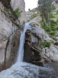
R3: 200’ from a rock chock at floor level in the back wall DCR. Extend your pull strand an extra ~30’ to get to a better position
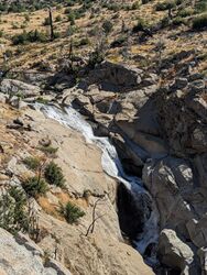
After more creekwalking, the canyon opens up. Note the abandoned road - if the canyon has been going poorly so far, now would be a good time to exit.
There follow a few short good looking raps which we bypassed this time
R4: 80’ anchored DCL off a boulder, but needs to be rerigged to DCR. The next anchor is immediately DCR, and there is a real risk of being swept over from the pool, so don’t get off rope until you’re on solid ground
R5: 70’ off a bolt above the drop DCR. After a short corridor swim, the next nuisance drop can be bypassed by a crack downclimb DCL. This drop can be rapped by extending the top anchor to 150’, but poses a serious risk of sticking your rope in strainers
R6: V-crack with strong current, we bypassed via fiddlestick off a rock chock DCR
R7: 70’ off a bolt on the wall of the ledge DCR. There is a spot closer to the flow that could be bolted for a more interesting rappel in lower flows.
R8: 70’ off a boulder DCL
At this point, if flows are anything greater than low, your descent ends here. The next rappel drops you into an unavoidable constriction with unsafe hydraulics. Although this exit hasn’t been tested yet, you can probably scramble up the sketchy talus slope DCL up to the exit road. If that’s too steep, you can clamber up DCR until the road crossing, experiencing regrets.
If the canyon is dry or very low, you can continue down by walking down the smooth spine DCR.
R9: We bypassed the first stage of the drop by rapping about 60’ off an oak DCR to a small conifer, then maybe 150’ to the bottom, but this was a bad way to get down. This drop should be really rigged as a single ~250’ rap from the top, which would keep you in the flow for the awesome-looking first stage. To break up this drop to under 200’, you could set a v-thread anchor above the second stage, expecting to replace it every year. For the second stage you could probably set up a rebelay or deviation to avoid the hydraulic, but the walls of the canyon funnel you towards it, so it'll be a tricky placement problem.
Once again, flows that are moderate in the rest of the canyon are potentially fatal at the base of the second drop, so the second descent below here should only be done in low flow.
R10: 30’ off a rock chock DCR
Exit[edit]
Clamber up the hillside DCL. Once you’ve summited the tailings pile, a little more bushwhacking and climbing will reunite you with the road, which is in pleasantly good shape for most of its length. Continue up the road all the way back to Minarets.
Red tape[edit]
Red tape[edit]
Minarets road is sometimes closed for repairs without updating Caltrans or Google Maps. Before leaving, consult the USFS and look for a map of closures under alerts and warnings.
Beta sites[edit]
Trip reports and media[edit]
Background[edit]
First descent by Epeairs, Sqshemet, and Feroz.
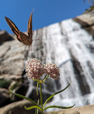
Named after the friendly sphinx moth that joined us for lunch at the base of R3.


