Ross Creek
| Rating: | |||||||||||||||||||||||||||||||
|---|---|---|---|---|---|---|---|---|---|---|---|---|---|---|---|---|---|---|---|---|---|---|---|---|---|---|---|---|---|---|---|
| | Raps:8-11, max ↨190ft
Red Tape:No permit required Shuttle:Optional Vehicle:Passenger Rock type:Granite | ||||||||||||||||||||||||||||||
| Start: | |||||||||||||||||||||||||||||||
| Parking: | |||||||||||||||||||||||||||||||
| Shuttle: | |||||||||||||||||||||||||||||||
| Condition Reports: | 7 Jun 2025
"First descent trip for the second half, plus we added some new stations in the first half, so time includes a fair bit of bolting. Flows were low enou |
||||||||||||||||||||||||||||||
| Best season: | May - Jul
|
||||||||||||||||||||||||||||||
| Regions: | |||||||||||||||||||||||||||||||
Introduction[edit]
Ross Creek is a good early-season canyon for when the rest of the Sierras are running too high. It features tight channels which make for challenging footwork, complemented by some slippery, wide cascades.
Be warned that Ross has foot-grabbing cracks, strainers, and rope pinches on many rappels, especially the upper half.
The canyon has a convenient shuttle option when the San Joaquin is navigable. Groups attempting this canyon when the river is high should be prepared for a steep bushwhack hike out if the exit proves unsafe.
Approach[edit]
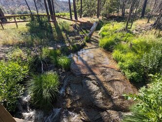
From the parking, head north along the access road, then drop into the drainage around where it starts to get cliffy. Dropping in later saves some sections in the watercourse which could be inconvenient to impossible depending on flow.
Descent[edit]
R0: ~50’, fiddlestick off of buckeye tree DCR to drop into drainage. In moderate-low flow, you can just walk into the drainage and climb your way down the crack
R1: 30' DCR webbing around a pinch
R2: 100'? DCL off a single bolt. Rope line takes you through the crack. Only drop to the middle ledge, watch for strainers and foot grabbers, especially near the next anchor. Bypass this series in moderate flow or above
R3: 50'? DCL single bolt
R4: ~30’, single bolt DCR
R5: ~60’ webbing around a pinch DCL.
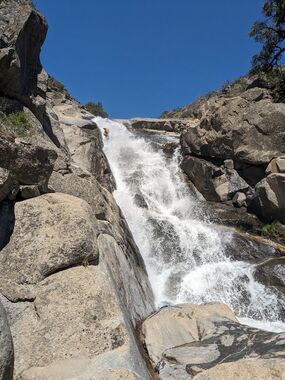
R6: 190’ off a boulder pile DCR. This rappel could probably be rigged shorter if your rope doesn’t reach, and can be bypassed entirely DCL, but is fun the whole way if you have the rope length for it. Watch out for a foot-grabbing crack halfway down.
R7: ~80’ Fiddlestick off a boulder high and dry DCL. This could probably be rigged in the flow DCR, or off a rock chock mid DCL, but we played it safe on the first descent trip.
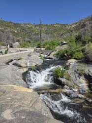
A creekwalking section follows, including the diversion dam and road deliniating the upper and lower canyon sections.
R8: 170' Webbing off a small tree DCL
Shortly thereafter there's a short drop to a shallow pool which can be slid with care in the dry section depending on sand levels
R9: 90' off a single bolt center-left, on the bushy ledge below the rim
R10: 60' off a single bolt DCR
R11: 130' off a single bolt DCL. The final lip before the pool is especially rope grabby, rap and pull with care
Exit[edit]
You're at the San Joaquin river! If the river flows are particularly low, it's possible to carefully float the flatwater sections and walk the banks at any rapids to get back to the powerhouse. Please don't swim in this river if you aren't whitewater safety trained and don't know how to judge the risk. If the flow is too high to walk the bank don't risk going for a fatal swim; shed a tear, turn around, and work your way up the ridgeline DCL of Ross, which will eventually return you to the creekwalk section.
Once you hit the powerhouse there's no more banks to walk. You can probably climb up behind the rear wall, we swam past the powerhouse outflow but it was tricky.
River flows ~7 miles upstream can be found here: https://www.dreamflows.com/graphs/day.096.php . There is often significant hourly variation, complicated by the time it takes the flow to travel from the gauge to the exit section. This is in addition to power demand varying the outflow from the Mammoth Pools Powerhouse at the bridge.
Red tape[edit]
Minarets road is sometimes closed for repairs without updating Caltrans or Google Maps. Before leaving, consult the USFS and look for a map of closures under alerts and warnings.


