Royal Gorge (Upper, Tahoe National Forest)
| Rating: | |||||||||||||||||||||||||||||||
|---|---|---|---|---|---|---|---|---|---|---|---|---|---|---|---|---|---|---|---|---|---|---|---|---|---|---|---|---|---|---|---|
| | Raps:0-2, max ↨60ft
Red Tape:No permit required Shuttle:None Vehicle:High Clearance Rock type:Granite/mixed | ||||||||||||||||||||||||||||||
| Start: | |||||||||||||||||||||||||||||||
| Parking: | |||||||||||||||||||||||||||||||
| Condition Reports: | |||||||||||||||||||||||||||||||
| Best season: | Aug-Sep
|
||||||||||||||||||||||||||||||
| Regions: | |||||||||||||||||||||||||||||||
Introduction[edit]
The upper Royal Gorge forms the headwaters of North Fork American River, and much of it proceeds along beautiful high-walled corridors and pools.
In high flows, the Royal Gorge is occasionally run as an extreme kayaking descent. The canyoneering descent is during low flows in late summer, dropping in from above Heath Falls, and exiting at Palisade Falls. The canyon itself is only a bit over a mile, but has some of the most dramatic features in the Sierra Nevadas. The approach and exit are rather long (relative to the canyon itself), but very pretty and mostly on good trail.
Due to the approach and exit, the trip is best done either as a long day trip with an early start, or as an overnighter setting up camp at one of the nice camp spots along the approach trail or down by the river. If done as an overnighter, camping gear could be left behind for the canyon itself. An additional day can be spent descending Palisade Creek, or by hanging out at the river and cliff jumping.
The canyon can be done without ropes if you are willing to jump up to 45'. The second short rappel is downclimbable either carefully along the rappel line (although most people will want a rope) or by bypassing it up on the hillside.
The best flow indicator for this canyon is likely USGS 11427000, located much further down stream at the inflow of Lake Clementine. The following 3 data points are provided as reference:
- August 13th, 2017: 100cfs - "Moderate" conditions, ideal flow for a canyoneering descent. Sporty, but should not present any real challenges to an experienced class C canyoneer.
- August 19th, 2017: 85cfs - "Moderate Low" conditions, still fun, but the water features are not as impressive.
- August 11th, 2018: 57cfs - "Low" conditions, the flow presents no challenge what so ever.
- August 15th, 2020: 46cfs - "Deep pools" maybe "Low". All the listed jumps were still plenty deep.
A recommended route, courtesy of Ihhhh(link me): Day 1: Approach from the South via Palisade Creek Trail, stash camping gear at the Palisade Falls, run Upper with a lightened pack, camp at Palisade Falls. (Total elevation change: -2800', +500') Day 2: Take all of your gear with you and descend Lower, and exit up to 2nd vehicle via Wabena Creek Trail. (Total elevation change: -750', +2800')
Approach[edit]
Drive to the end of Kidd Lakes Rd. The road is a bit rough, and best done in a high clearance vehicle. From Kidd Lakes Rd, hike down Palisades Creek trail. If you chose to do this as an overnight, decide where you want to drop off your camping gear. There is a very nice spot with a nice view right next to Palisade Creek (see map).
After about half a mile from the campsite, 5.5 miles from the trail head, you cross a bridge over Palisade Creek. Shortly after this is the junction with the trail to Heath Falls. This trail is at times faint to nonexistent, and it is easy to miss the start of it. Use the GPS track, and look for a trail off to your left (east). You will recognize the trail by a tree on the left side about 30' in that has a reflective marker on it. Follow the trail to a clearing where the trail temporarily disappears. Cross the clearing and go left along a rock wall. The trail soon reappears.
The trail diverges from the Forest Service map to parallel the river going upstream. Along this, you can see Lower Heath Falls and the Heath Falls Pool Exit Jump. Continue, with some not-too-bad bushwhacking, and enter the river just above Upper Heath Falls. Allow 3-4 hours for the total approach -- 1.5-2.5 hours to the camp/bridge, and an additional 1-1.5 to the drop in.
Alternate approach - Palisades Creek trail continues steeply up the south side of the river. If you approach from that side, as shown on the Lower Royal Gorge page, you will have to hike all the way down to the river, and back up 800' on the north side. On the other hand, the approach is shorter, and you can drop off camping gear by the river, which has superb camping spots right by Palisade Falls (see below).
Descent[edit]
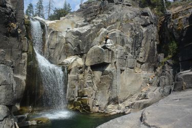
Upper Heath Falls - 40' jump from a small platform LDC, into a very deep pool.
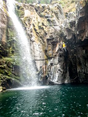
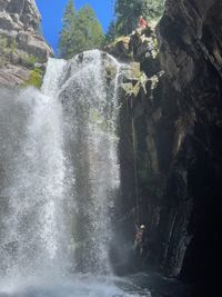
Lower Heath Falls - ~60' rappel from a single bolt LDC just out of the main flow. As this anchor will get pounded during spring snowmelt, future parties may wish to double this up with a second bolt. You can also scramble down to a lower ledge, for a very clean, but ~45' high jump. This rappel goes into a large circular pool with a small exit on the RDC side. There is a possible exit LDC here before the rappel, if the flow looks too dangerous. A person jumping this drop is the cover photo of this page.
The current pushes you into a little alcove on LDC, where it is possible to get out of the water by scrambling up on slippery ramp. This is a good spot to pull the rope and pack it. Getting out of the alcove may be a challenge in higher flows, but at the flows at the time of the first documented descent (FDD) in 8/13/2017, using a ferry angle while traversing the wall made this possible with the use of defensive swimming techniques only. From here, the pool feeds into a narrow channel, to a pour over with a boulder protruding ~1' above the water. At the time of the FDD, the current here was minimal, but in higher flows, this pour over may also present a danger.
Heath Falls Pool Exit Jump - 12' off the boulder in the middle of the outflow of the channel leading out from the pool below Lower Heath Falls, into another long, deep pool between high rock walls. Jump as far out as you can to clear the whitewater. Once you're down, this is a great spot to take some photos back upstream.
The river soon turns a bend and enters a sunny, playful, gorgeous boulder section, still between high vertical walls along most of the way. Swim, hop, downclimb, etc for a while. A few more features of note are spread out along the way.
Ledge bypass - A small drop is bypassed by climbing a ledge LDC over a strainer that looks like it could suck you in under a boulder. Don't fall.
Heath Springs - Mineral rich water trickles in from springs above the canyon on RDC, forming brilliant red colors on the rocks and puddles. In one section the spring water collects into a sizable rust colored pool forming a stark contrast with the neon green water from the North Fork.
Short rap - Rappel past a 15' drop from a knot chock RDC. Due to the shape of the terrain here, this cannot be safely jumped or slid, but skilled downclimbers can make it down. Alternatively, you can scramble around the drop by staying high on the rock wall.
Fun Slide - A 30' long and very clean slide that you can do over and over. From here on, you may encounter other people playing around in the pools, as the canyon can be entered from a trail LDC a bit farther downstream.
Chockstone Jump - In the final corridor before the bridge over the river (and the exit) is a 25' running jump off a chockstone in the middle of the canyon. In low flow, getting on top of this rock is straight forward, but in higher flows, the LDC would form a serious sieve, while the RDC would have significant current as it carries most of the flow. Evaluate the current carefully before approaching this spill over. The canyon can be escaped by backtracking a bit and climbing up RDC.
At the pool at the bottom of the chockstone, the water hits the canyon right wall and creates a strong current flowing left, pushing you (and any thrown packs) left into an alcove that requires strong swimming to get out of. In high flow, it may be impossible to get out. If you do the jump, try to get as far as you can, and swim quickly forward and to the right to avoid getting sucked into the alcove. If throwing packs, similarly throwing packs beyond the current is necessary to avoid getting the pack stuck in this alcove.
Rainbow Cave - If flows are sufficiently low, one can swim across the current to go back underneath the boulder and visit what is essentially a 12' diameter room enclosed on all sides except for the front.
Ramp Jump - Just before the bridge, climb out of the water course on RDC and downclimb 4' to a large ledge system, follow it until the end, and jump back into the pool, maybe 15'.
The bridge here is part of your exit, but don't get out yet, as there is one more amazing feature immediately downstream...
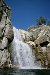
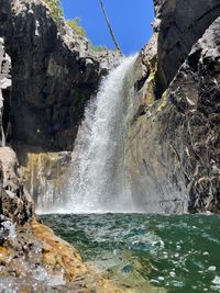
Palisade Falls - Climb down a slot on LDC, and traverse up and over ledges to reach a small platform. Jump 35' into a very deep pool surrounded by high rock walls. You may have an audience here, as this is a popular camping spot. After the jump, you can do additional jumps to your heart's content from the opposite side of the pool (still LDC), at practically any height from 3' to 30', and opportunities up to ~50'. This is a great spot to hang out for a while, and wait for cooler temperatures for the exit hike.
Note: You can continue down river, in the Lower Royal Gorge. In this case, the alternate approach makes more sense.
Or, just go down and do the the Lower Curtain Falls area (which is quite nice) and come back up.
Exit[edit]
Follow the trail back to the bridge, and back up to your car.
Red tape[edit]
There has been dispute over the land ownership of the areas surrounding the upper end of the royal gorge.
The body of water is designated the North Fork Wild and Scenic River area, extending from 0.3 miles above Heath Falls, to >30 miles down river, and is managed by the National Forest Service. National Wild and Scenic Rivers System, BLM. The North Fork Association, which owns a resort community a few miles East of Heath Falls called The Cedars, allegedly claims their property extends to past Heath Falls, and down to Heath Springs below.
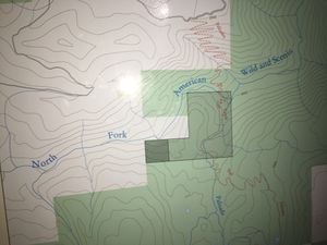
The trail from Palisade Creek trail to Heath Falls crosses the section that straddles these two areas. Many private property signs are posted, and also a few "national forest" signs, all pointing in different directions. Much of the trail is covered in a shaded area on the map at the trail head which indicates limits on camping (light shaded = 1 night).
Beta sites[edit]
Trip reports and media[edit]
- Trip Report from Kayaking Descent
- Article describing the kayaking route, with excellent photos of the main obstacles under extreme flows.
- Cliff Jumping video recorded at Palisade Falls
Background[edit]
The North Fork Blog has a lot of interesting historical and geological information about this area.
First kayaking descent was done by Scott Lindgren in the late 90s. Since then it has seen a number of descents, and is considered one of the best class V-V+ runs in California. Kayaker's refer to Palisade Falls as Rattlesnake Falls, so one can descriptions and photos of this waterfall attributed to either name.
